Moreton Pound to Whitstone

p1070979
Looking west towards Bude

After a fabulous breakfast at a B&B in Bude (trying saying that out loud) we picked up where we had left off at Moreton Pound. Today would involve a long swing towards the sea to loop around the area around Bridgerule on the west bank of the river which should be Cornwall but is actually Devon. At Hackthorne near the wonderfully-named Budd’s Titson, the border is only about 3 miles from the sea.

This, coupled with the lack of north-south paths would drive us as far west as Marhamchurch. We had considered cutting off the bulge by walking the B3254 but one look at the road convinced us not to.

p1070980
Looking south to Tintagel

The blackberries were no worse than the day before and we made good progress along lanes to West Leigh where we were to turn left onto the so-called Planekeepers’ Path. Here we hit a snag in the form of deep puddle of slurry completely blocking the track. Some lateral thinking took us through the farmyard of Leigh Farm walking past a ‘Private’ sign unnoticed, and back onto the track across the valley to Cross Lanes.

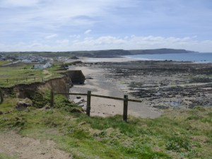
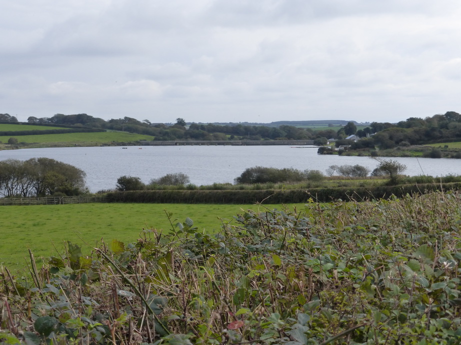
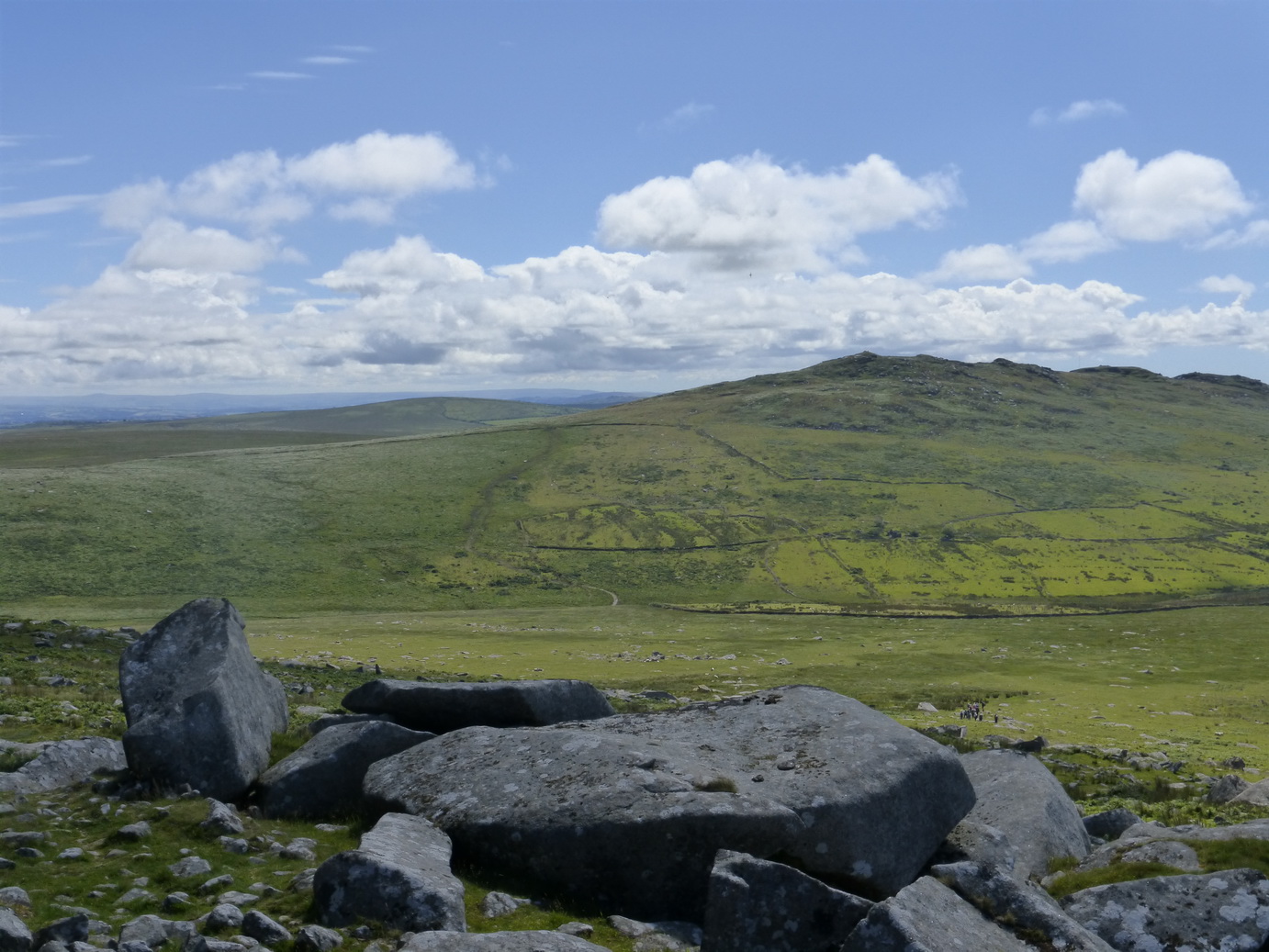
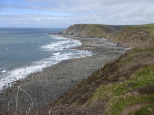
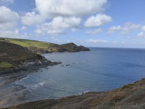
Leaving Cross Lanes, we had a view of the wonderful panorama of the coast, stretching from Tintagel to the domes of GCHQ north of Bude as we crossed open fields.

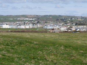
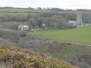
Two churches beckoned us on: Week St Mary on a hill far ahead and Stratton about a mile away to our right. This was a reminder of how prosperous or densely populated this area was in the C15 for seeing two or three church towers  at the same time is a rarity further west. We were headed for Launcells Church which was marked as being 600 yards away but was invisible. Stratton kept beckoning.

p1080007
Launcells church and Barton

Then, quite suddenly, we were summoned by bells: Launcells was in the dell in front of us.

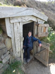
Fearful that a service was about to start (it was a Sunday), we hastened on to arrive at the door of the church at 5 minutes to 11. Thankfully the service was not due until quarter past and we were able to enjoy this glorious church which Simon Jenkins includes as *** in his book of Thousand Best Churches in England. It was well worth the effort as the church is lovely.

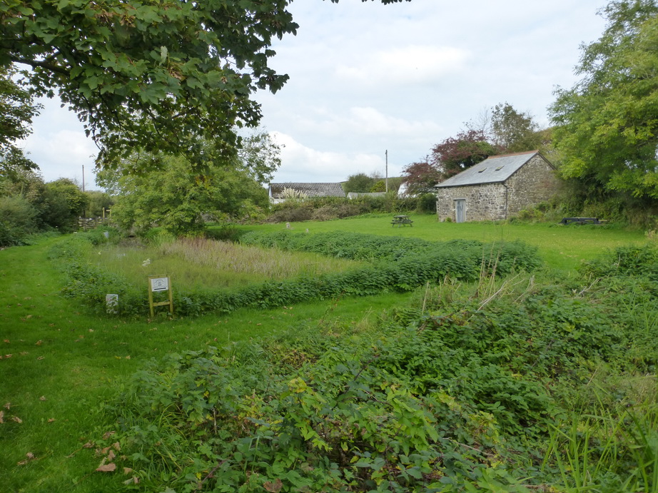
Alongside the church is Launcells Barton, a fine C18-fronted house which would suit George Warleggan’s aspirations.

p1080010
A typical road

Had we had confidence, we would have followed the Planekeepers’ Path from Launcells up to Hobbacott Down but our map did not show a connecting footpath and we opted for a road route to Lower Cann Orchard. Here we found the other end of the path from Hobbacott and so, if you try the route, have courage and take the path.

Our route now lay along a single rolling road through Budd’s Titson to Whitstone. It was another quiet road with tall hedges on either side. Something called Hooper’s rule dates hedges by the number of woody species in a thirty-yard distance with one species per 110 years. Dr Hooper clearly never lived in verdant Cornwall. Here it must be half that for the hedges were a riot of blackthorn, sycamore, oak, as well as the ubiquitous brambles.

Cornwall was experiencing its characteristic ‘second Spring’ for the campion was out in places, alongside garden-escapes of michaelmas daisies.

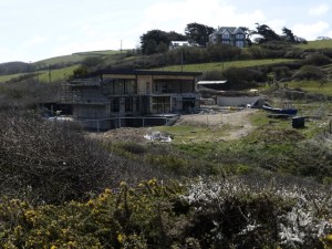
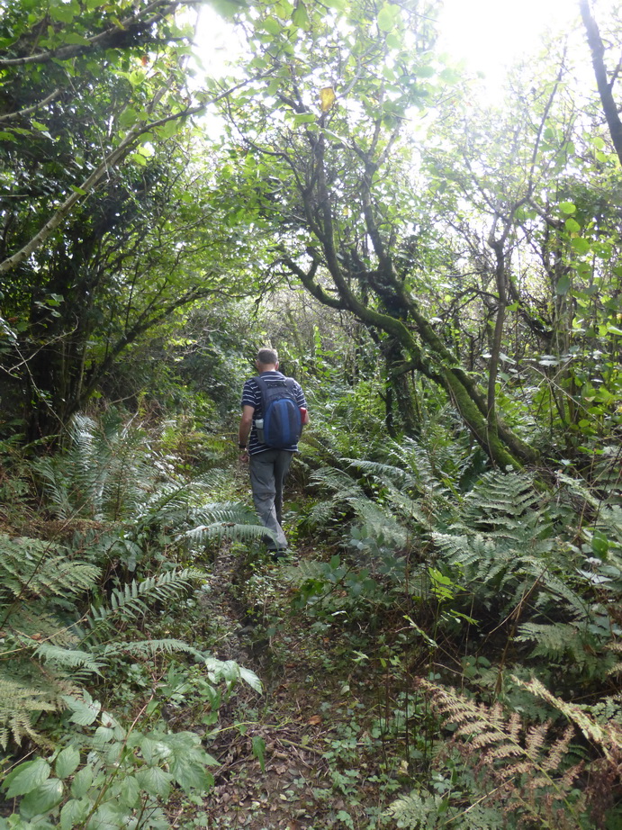
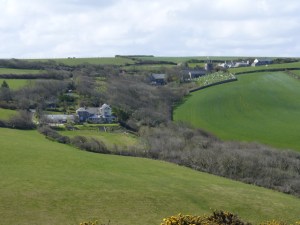
Hilton Wood closed in on us near the end of our walk: a tangled mass of ancient-looking forest, the rampart of a settlement or iron age castle peeking through the trees. Sadly some ‘leisure lodges’ could also be seen. Agricultural diversification has its price.

p1080014
Looking seaward from Whitstone hill

All the streams we had seen so far had been flowing to our right, towards the sea, showing that we had not yet crossed the watershed into the Tamar valley which we probably left around West Leigh. The final steady climb of around 100m up to Whitstone convinced us that things were about to change.

Reaching the top, the views became better and better and there was a real feeling that we were climbing an escarpment. Sure enough, there ahead of us was the low valley of the Tamar while behind us stretched the coast from Tintagel to GCHQ. Our end-point had been well-chosen.

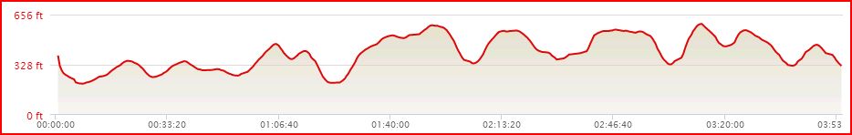
We had walked just over 9 miles in 3hrs 45 minutes and could have done more but Whitstone church awaited us. We had not seen the Tamar all day but we had walked around part of ‘Devon in Cornwall’ and crossed back into the Tamar valley.

Gooseham Mill to Moreton Pound

p1070941
Marsland Water

A bright October day took us back up to the furthest north of the duchy to start our serious attack on the Cornwall/Devon border and river Tamar walk. When we had reached the county border at Marsland Mouth on our coast path walk, we turned inland for a mile or so, ending in the nature reserve and wooded valley at Gooseham Mill. It was here that we started our walk, turning south for Plymouth.

The Marsland Water valley was lovely. On a narrow woodland path, we made our way along the Devon bank before crossing back into Cornwall and climbing up a hill towards Woolley where we joined a country lane. This led us across the busy A39 past a long barrow which is one of the few in Cornwall. This stands at a road junction, satisfyingly suggesting that one or more of the tracks must have an ancient origin.

p1070946
… or is this the source?

From here it was a short step to the source of the Tamar on Woolley Moor.  This must be the least sign-posted river source we have yet found (although the real source of the Nile is just as bad). A scrubby enclosure at the top of Woolley Wood was impenetrable unless armed with waders and several large brush-cutters. According to the map this contains ‘spr’. We had to be satisfied with some standing water which was a little way from the site of the ‘spr’ but which we took to be the beginning of the stream.

Crossing into Devon, we followed a country road to a junction where another stream crossed our path. Trentworthy Water looked rather larger than the meagre stream we had seen at the source and we momentarily questioned whether the geographers had got the right answer on the Tamar.

p1070948
Tamar at Youlstone Ham Bridge

A little way further on we were reassured for, as we crossed the Tamar at Youlstone Ham Bridge we could see that the river was now a respectable ‘small river’. We were back in Cornwall.

We were struck by the landscape of the area. We could not see or feel the sea: there was no soft salt-filled air to cool our cheeks. Around us was a landscape of low rolling hills dotted with green fields and small farmsteads. Fields contained cows or grass. The horizon was large with 360 degree views, dotted with wind turbines.

This felt very different from western, southern or coastal Cornwall. Walking was easy, though, with familiar country roads hedged with blackthorn, sycamore, holly and brambles. We did not want for sustenance for the blackberries were still around in abundance and we could snack as we walked along.

p1070950
Deep in the undergrowth

When I say ‘walking was easy’ this was only the general case. At one point our path deteriorated into one of those ancient paths so familiar from the wetter areas of Cornwall where you are not sure whether you are on a path or simply following the bed of a stream. Thankfully, the ground was moderately dry but the brambles and undergrowth more than made up for it. Machetes would have been helpful.

As we emerged from the covering of trees, we hoped for better but there was still a swampy patch to cross which would be distinctly unpleasant in wet weather, the rushes indicating that the water was not far below the surface.

We approached the Upper Tamar Lake at a distance before making our way down to the junction with the Lower Lake which is a nature reserve and reservoir for drinking water. Here we found a convenient bench for our picnic, watching grebes and a cormorant diving for their lunches.

Bude aqueduct

Crossing into Devon at the dam, we followed the old Bude aqueduct for a delightful but sinuous walk  which reminded us of walking the levadas of Madeira except that the canal had long since ceased to flow and was being re-colonised by scrub. The ripples of the Tamar could be heard in the valley below us.

At Virworthy wharf we reached the head of navigation of the old canal. Here an exhibition in a small hut told the story of the C19 construction of the aqueduct. A series of short sections and inclined planes had allowed sand to be taken from Bude up into the hinterland to improve the drainage and acidity of the soils. It must have taken many, many loads to make much difference to a single field.

p1070956
Virworthy Wharf

We had long given up trying to guess which direction in which we were walking when we found ourselves crossing a road near Puckland. We reluctantly left the canal/aqueduct and walked the short distance to Moreton Pound, crossing the Tamar back into Cornwall once again at Moreton Mill. By now she was a really respectable river and we itched to collect our canoes for the 100m length of decent water we could see.

We had walked 12 miles in just under five hours. It was strange to be back on roads and smooth paths without the ups and downs of coast path but it certainly made the going smoother.

The story continues …

Around Launceston

kensey-bridge
Packhorse bridge over the Kensey

Having a few hours spare, we walked around Launceston, visiting three churches: St Mary Magdalene, St Stephen and St Thomas. None was open with only one offering an explanation.

Our walk took us along part of the planned route down the Tamar valley to Polson bridge which is one of the three major waypoints on our route. Just around the corner from this, close to a less-than-salubrious water treatment plant, was a charming little packhorse bridge over the Kensey river which is not marked on the map.


Gunnislake to Horsebridge

Gunnislake 04
Tamar: the Tamar Trail sign

We have at last found time to start the final stretch of our round-Cornwall trip. Rather than pick up where we left off at Gooseham Mill in the north, we started at the southern end, seeing the condition of the lower Tamar which we hope to canoe in due course.

We parked at New Bridge, Gunnislake, just upstream from the weir which marks the border between the tidal and non-tidal sections of the river. Here a lovely early C16 bridge with triangular cutwaters spans the narrow valley.

Our route took us north along the Tamar Valley Discovery Trail which is marked by a rather jolly apple symbol. It makes a change from an acorn, cross or cockleshell, familiar from our other Cornish walks.

Gunnislake 01
Tamar: a rocky weir

The path emerged alongside the bank of the river in some lovely woodlands. The opposite bank rose steeply above us and was completely covered in a thick forest.

In amongst the trees were occasional lumps of masonry, reminders that this was once a busy mining area. The great bulk of Kit Hill with its familiar chimney was a constant reminder that between here and Tavistock was once an intensively mined and is part of the World Heritage Site.

This stretch of the river is known to canoeists as the rock garden and one could see why from the frequent mini-weirs where the water tumbled over rocks. Being August, the river was not in spate and must have been close to its lowest level.

Gunnislake 03
Tamar: Greenscoombe wood

Before long, the path climbed up a steep hill and delivered us onto a long rather dull road which dropped rapidly to the lovely village of Latchley. This is clearly proud of its heritage for a sign indicated the name of each historic building.

Leaving the village we were once more shrouded in trees in Greenscoombe wood. All the traditional broadleaf trees were here and we lost count of the species as we walked on. A good hack back of some of the undergrowth would have made the going easier but the brambles did provide an occasional ripe and juicy berry.

The river was following us on our right and the occasional sound of water suggested the presence of a rocky weir. We only discovered later that walkers are actively discouraged from getting close to the river as it ‘spooks’ the fish. It seems a shame that we cannot all enjoy such a lovely river.

Eventually, we emerged at the village of Luckett from where the going was much more open, as we followed the edge of fields, the river shadowing us a hundred metres or more away.

Gunnislake 06
Tamar: from Horsebridge

Passing the historic Lower Hampt farm we reached Horsebridge, a C15 bridge which, like that at Gunnislake, had cutwaters. Here the river showed its contrasting characters: smooth waters with an occasional rapid which, at times of peak flow, would probably disappear under water.

We crossed into Devon which we will have to do on and off on our journey along the Tamar valley. A minor road to the right took us up hill, past Lamerhooe cross where a motte and bailey castle once commanded the bend in the river, and on to a car park at the entrance to Grenoven wood.

Gunnislake 08
Tamar: signage in Blanchdown wood

Grenoven and Blanchdown wood are managed by Tamar Trails as a publicly accessible area, a mini-country park. In their midst lie the remains of former mining activity. The roads and equipment lying idle were testament to their modern use for logging.

Although the trails are accessible, we found them incredibly difficult to navigate as signage was almost non-existent and, where there was any, it spoke in shorthand. To make matters worse, two consecutive signs pointed to entirely different places. None of them showed distance or time and there were no helpful maps. It is in the nature of the poor map reader to blame his equipment but we were beginning to count our supplies for fear of ending up like Hansel and Gretel, marooned in the wood for the night.

Eventually, passing further evidence of mining in the form of a mine adit, we emerged at the Tamar Trails Centre itself and escaped back to a road. This lead us steeply downhill back to Gunnislake bridge, Cornwall and our car.

We had covered 5 miles to Horsebridge and 4.5 miles back although our gps was more generous and made it 14.2 miles included the detours. It had taken 3.75 hours. Canoeing this stretch is not going to be possible except when the river is in spate and the fishermen are huddled indoors around their fires, between October and February.

Brown Willy and Rough Tor

Brown Willy 0
Brown Willy

A brilliantly hot and sunny July day tempted us out to walk to Brown Willy and Rough Tor. We used the excellent iWalk Cornwall advice.

They promised us 5.2 miles of moderate-strenuous walking ‘marshy even in summer’. The ground was bone dry but we could certainly see that  much of the ground could be marshy with frequent appearance of marsh grasses.

Brown Willy 6
Rough Tor well

It was glorious. Starting from the end of Roughtor road by Charlotte Dymond’s memorial, one is literally tripping over ancient monuments the whole way up the slope to the top.

We headed for the main patch of reeds where some young horses were eating and drinking, and found the ‘holy well’. This was ‘discovered’ in 1970 and then lost again until 1994. One wonders how one loses a well and whether ‘discovered’ is similar to Speke’s ‘discovery’ of the source of the Nile: it was always there and known by local people.

Brown Willy 5
The Piskie bath

For some reason the Wessex Division has decided to plant a memorial on top of Rough Tor. Our ancient ancestors would have understood the respect for the place but it seemed oddly incongruous and faintly invasive in such a landscape.

Our helpful notes did not mention that there was an excellent Piskie bath by the logan rock at the summit. This even has carefully crafted soap dishes.

Crossing to Showery Tor, we met a group of young lads who were doing their DoE Bronze Award, rather slowly, allowing time for the usual youthful banter. We encountered them again on top of Brown Willy where a cry went up ‘There’s a Pokemon up here’. ‘The government has spent £millions trying to get us to take exercise and all it needed was a fun app like this’, as one of them wisely remarked.

Brown Willy 7
View towards Hensbarrow and the Alps

Another couple of walkers turned up thinking they were on Rough Tor, with no map or equipment, having arrived from Bolventor. Happy as anything, they set off for Rough Tor. It was just as well that it was not a ‘typical’ moorland day.

The views around us were magnificent, reaching as far as Hensbarrow, St Breock Down, Dartmoor and was that St Agnes Beacon we could espy?

From Brown Willy we re-crossed the bridge back to the foot of Rough Tor and made our way along the base of the tor towards the settlements, enjoying the remoteness of a small farmhouse with its own field system which must have been in occupation for many centuries.

Brown Willy 2
Fernacre stone circle towards Brown Willy

There was no discernible path here and we could imagine it being pretty boggy in winter.

Fernacre stone circle was a short step away and we paid it a visit. We counted 50 stones either erect or hidden in the grass and walked the obligatory circuit without any ill or beneficial affects.

The way back around the tor was once again littered with meaningful stones which deserve more careful and detailed study: small hut circles, curb stones and alignments. They are probably all Bronze Age.

It had taken us three hours and we had covered 6.4 miles according to our tracker. It had been more moderate than strenuous but that was on a lovely hot day when the ground was rock hard. Boggy or in Winter would be a different matter.


Bude to Marsland Mouth

P1060159
Bude harbour

The last day of our walk around the Cornish Coastal Path threatened rain and, for the first time on our journey, we started out wearing cagoules.

Although what rain we did get was very light, the cagoules were good protection against the stiff wind. We had been promised 20-25mph winds (Force 5) but up on the cliffs it was more like a Force 6 and, if not a headwind, was generally a stiff beat to windward. Thankfully the wind was on-shore which was reassuring at times.

P1060164
Leaving Bude

Leaving Bude was easy going over some rolling downland and we made good progress towards the first coombe at Sandymouth which has been colonised by a small NT (closed) cafe. On the horizon in front of us was the constant presence of the white domes of GCHQ. It was high tide and the rocky beaches were covered in breaking waves.

Sandymouth set the flavour of the day for  it was a stiff descent and climb on the other side. From here to the border we encountered half a dozen such coombes, some of which had a shale path, some those irritatingly tall steps and some which had the decency to follow the contours on a long zig-zag. From Sandymouth, we noted Duckpool (Coombe), Stanbury Mouth, Tidna Shute, Litter mouth, Westcott and finally Cornakey (see chart below).

P1060180
Tidna shute

Only one of them was really lung-bursting in the manner of Beany cliff, leading you on to a false summit and then presenting you with as much again. We were thankful that we were not doing them at the height of summer and were even grateful for the cooling wind. Do not attempt this if you suffer vertigo, however, as you will find yourself apparently close to the edge at times.

The landscape changed accordingly, with the downs giving way to gorse and rough ground, apparently untouched by farming and tended by occasional horses or sheep.

P1060176
GCHQ

GCHQ was well-protected, not only by wire and large signs warning ‘No photography’ and ‘This is a Prohibited Place’, but also by Coombes. Given the secrecy, we were amused later to see road signs to ‘GCHQ’.

We met few people, just a few individuals, and could enjoy the solitude and environment. The same flora as the previous day prevailed with the addition of what might have been a bee orchid and some candytuft.

We knew we were in for two extra delights on the walk: Hawker’s Hut and Morwenstow church. Had we been braver, we might have searched the cliffs for St Morwenna’s well.

P1060187
Hawker’s Hut

The story of the eccentric Robert Hawker is well known but there is still something wonderful about finding and sitting in his hut, preserved in its lonely location. Is it part of British eccentricity that a place like this can not only exist but survive and be preserved?

He is said to have written some of his poetry in his hut. Not having any with us, we had to think on him and could only declaim it on our return, chosen for its reference to spring and the violets that had accompanied us on the path.

We see them not – we cannot hear
The music of their wing –
Yet know we that they sojourn near,
The Angels of the spring!

P1060213
Morwenstow church

They glide along this lovely ground
When the first violet grows;
Their graceful hands have just unbound
The zone of yonder rose.

I gather it for thy dear breast,
From stain and shadow free:
That which an Angel’s touch hath blest
Is meet, my love, for thee!

We found the grave slab of his wife Charlotte in Morwenstow church which is a couple of fields from the path. It is highly recommended for its Norman remains and a simply lovely ancient font.

P1060218
Marsland Mouth

The end felt within reach but there still three coombes lying in wait for us, thankfully not as testing as some of the earlier ones.

We reached the border after 8 miles (map) or 12 miles (gps) and four hours of walking. We had ‘gained’ 1915ft which explained why people found this a particularly tough section.

The border itself consisted of a small bridge with a dull post each side, one saying ‘Devon’ and the other ‘Cornwall’. Being more conscious of its image, Cornwall had also added a decent ‘Cornwall/Kernow sign’.

We celebrated with some lunch, avoiding pasties and cream teas for fear of having to decide whether we should be crimping them at the side or the top, and exactly where to put the cream and jam.

The ‘other place’ did not look that different from what we had been walking through.

BudeOnward
This was, at the same time, the end of our adventure and the beginning of our next one for we ‘turned right’ and followed the tracks up the small valley and through a nature reserve to Gooseham Mill. We were heading for Plymouth and will be making our way across to the river Tamar and down its length to complete a circuit of Cornwall.


Crackington Haven to Bude

P1060080
Crackington Haven

We had two more sections of the Cornish Coastal path to complete and spotted a gap in our diaries which coincided with a dry spell. So we headed northwards to the outer reaches of the county to pick up where we left off at Crackington Haven.

People spoke in hushed tones when we told them we still had this stretch to walk. The book called it ‘strenuous’.

The rise out of Crackington was long and steady. We soon found ourselves on some soft undulating downland which belied the dire warnings and only reached ‘moderate’ because of the occasional valley.

P1060084
St Gennys churchtown

Passing Castle Point we could see St Gennys church tucked into a fold of the hill. Below us, the sea was relatively calm, turning over gently against the jagged rock formations that run out to sea. This is not an area of sandy beaches. The cliffs were a geologist’s delight with great folds and ridges demonstrating the earth’s power to torture rock into new shapes.

In the previous few weeks, spring had made a real effort and, in the lovely sunshine, we were the beneficiaries. Plants were bursting out all around us. There were great clumps of fragrant wild garlic, bluebells and primroses in the sheltered valleys while the cliff tops were covered in brightly coloured violets, willow and blackthorn blossom, gorse, thrift, and even campion.

P1060087
Lower Tresmorn

We were brought up slightly short at Chipman Point where we found two worried walkers admitting they had ‘wimped out’ of descending some very sheer steps. ‘Lose your footing and you will be dead’ they said as we set off downwards. We had experienced worse but it was good to get to the bottom. If the wild horses could do it then so could we.

The path was not one for people with vertigo but that is true of much of the coastal path in this area. With the views and the vegetation, walking was a joy.

P1060095
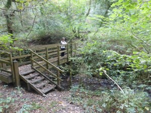
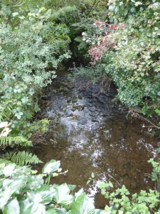
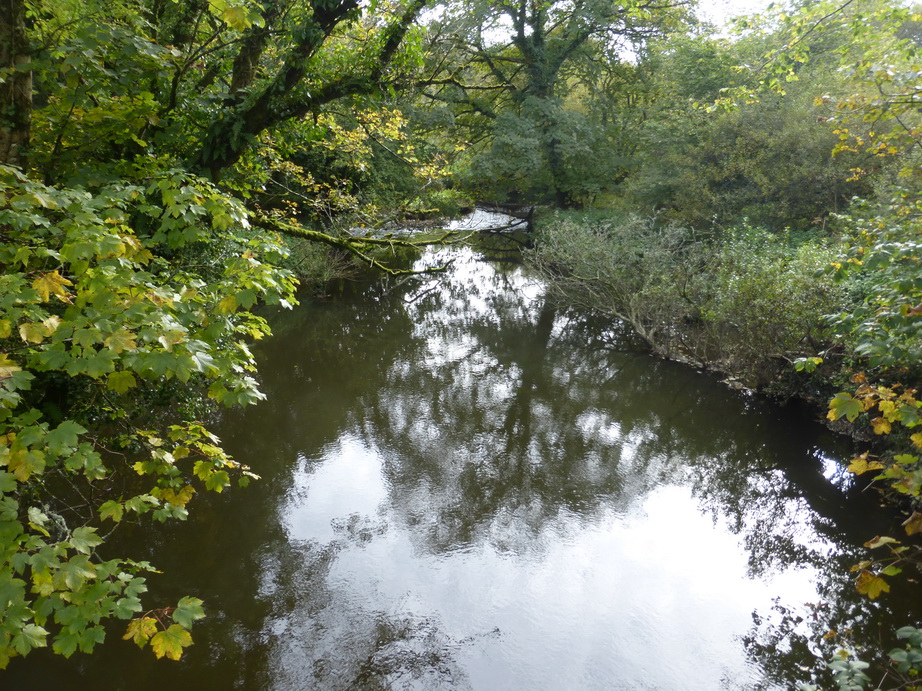
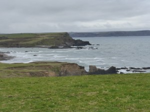
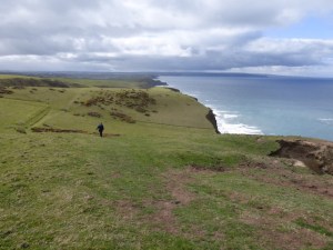
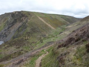
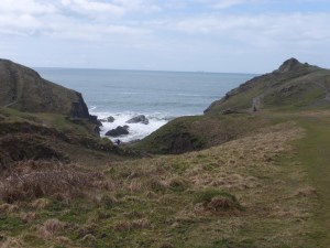
Bynorth mouth looked nasty on the map but turned out to be a lovely wooded valley with the path following the slope up the valley through a small and primrose copse, before taking us across the stream and back up to the heights the other side. This was an exception for the path makers generally seem to prefer a direct down and up route. Zig-zags must be infra dig.

After a restorative cup of coffee, we passed Millook which had a charm of its own, and rose once again to Penhair cliff with little problem.

P1060098
Wanson mouth

We noted, with distaste one of those nasty planning decisions in a piece of building work going on in Great Wanson. A modern building was being constructed four-square in the valley, selfishly dominating the sea view.

Onwards to Widemouth bay which was a completely different prospect from the solitude we had experienced over the last hours. On a Sunday, the beach was covered with people: rugby tots, lifeguards, kite flyers, packs of dogs and simple walkers enjoying the sunshine.

P1060099
Widemouth bay

We eventually settled on a prounciation of ‘Widmuth’ in contrast to ‘Bid-e-ford’ or ‘Wade-bridge’ – such Anglo Saxon names – but were unimpressed by the sprawling cheap architecture which clusters around the small patch of sand, the first that we had seen for some time. It is not surprising that we had crossed the boundary of the AONB as we entered the beach.

From here, and after some lunch, the going was very easy all the way into Bude, along rolling sandy cliffs. The book describes this as ‘easy’.

P1060101
Bude

Bude is tucked behind a protective headland and appears as a sprawling mass on houses. We walked along the headland and admired the expanse of sandy beach exposed at low tide, overlooked by a C19 Storm Tower designed to like the temple of the four winds.

A short distance over the canal lock and past the sea pool took us to Crooklets beach and a welcome reward of an ice cream.

We had walked 10 miles according to the map, 11.4 according to the gps, with a gain of 1367ft in exactly 4 hours. One more stretch to go.

Elevation

There was something vaguely familiar about Bude where we spent the night. Then we saw John Betjeman’s description of it as ‘an East Anglian resort facing the wrong way’. The houses were the same period; there was a game of cricket taking place; the golf course was in the middle of the town; there were bathing huts and polite ice cream shops and cafes; people were walking in the same aimless way, sheltering from the wind; and the houses were late Victorian/Edwardian with wide spaces between them. This was Cornwall’s Aldeburgh, developed at a time when the railways, now long gone in both cases, had brought tourists to the new seaside holiday spots.

The thing Aldeburgh had not experienced was the handiwork of a local builder in creating quite the most bizarre-looking Methodist church.


The Lizard link

P1050930
The missing link

The Lizard village is a confusing place. All roads converge on a large car park from which the signs suggest that the coast path can be reached by three out of the four compass points. When we left the Lizard heading north, we left by that road. When we left heading east, we left by another path. All of which adds up to a ‘minor navigational error’ which meant that we had not walked a distance of about quarter of a mile: the missing link.

A sunny spring day encouraged us out to complete the missing section so that our arrival at the Devon border could genuinely signify the end of the walk. We did not want a short section to be hanging over us.

P1050933
Towards Kynance Cove

This was not our longest walk but it certainly blew the cobwebs away and it was good to be back on the tough Lizard cliffs and within reach of the sea. On the other hand, falling during the Easter holidays, it was busy with people every few yards: very different from the remote northern cliffs we have been walking recently. It was almost standing room only by the NT shop.

We ignored the crowds and walked on to Housel Bay so that we could feel justified in having walked rather further than the mandatory minimum. We passed a helpful sign (see gallery) which suggested that our feelings about the Lizard village were well-grounded.

Satisfied, we headed off to re-visit Mullion and St Keverne churches.

A journey through the landscape and history of Cornwall