A lovely sunny bank holiday took us on a four mile walk around the Rough Tor area, expertly guided by iWalk Cornwall. Visiting three different stone circles, numerous hut circles, ring cairns and an early medieval cross on one walk was quite something.
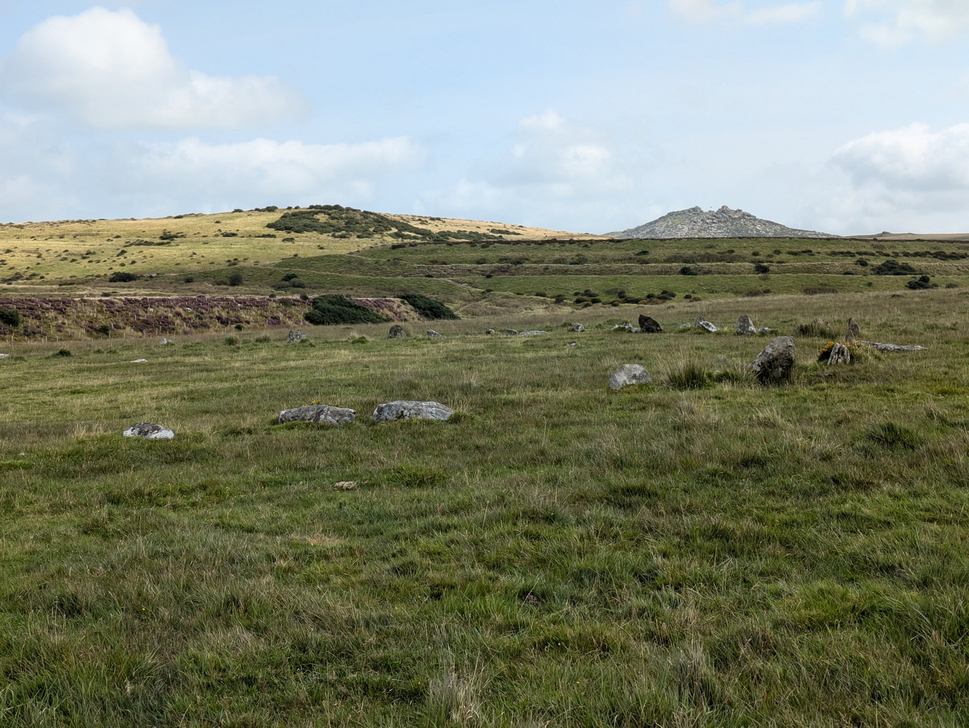
Stannon stone circle
The first delight was Stannon stone circle which consists of 39 standing stones and about another 40 recumbent, according to Craig Weatherhill, out of a probable total of 82. There were various alignments with Rough Tor, Brown Willy and the gap between which we could not test on a sunny day.
The effect of its isolation is rather ruined by the large, obviously man-made hill alongside: the remains of former china clay mining which has resulted in the large Stannon reservoir.
On a bright Spring day at the end of April, we set off from Sancreed Beacon following an excellent route provided by iWalk Cornwall. This had it all: ancient monuments, a splendid church, a holy well, and a fogou (than which there is nothing better).
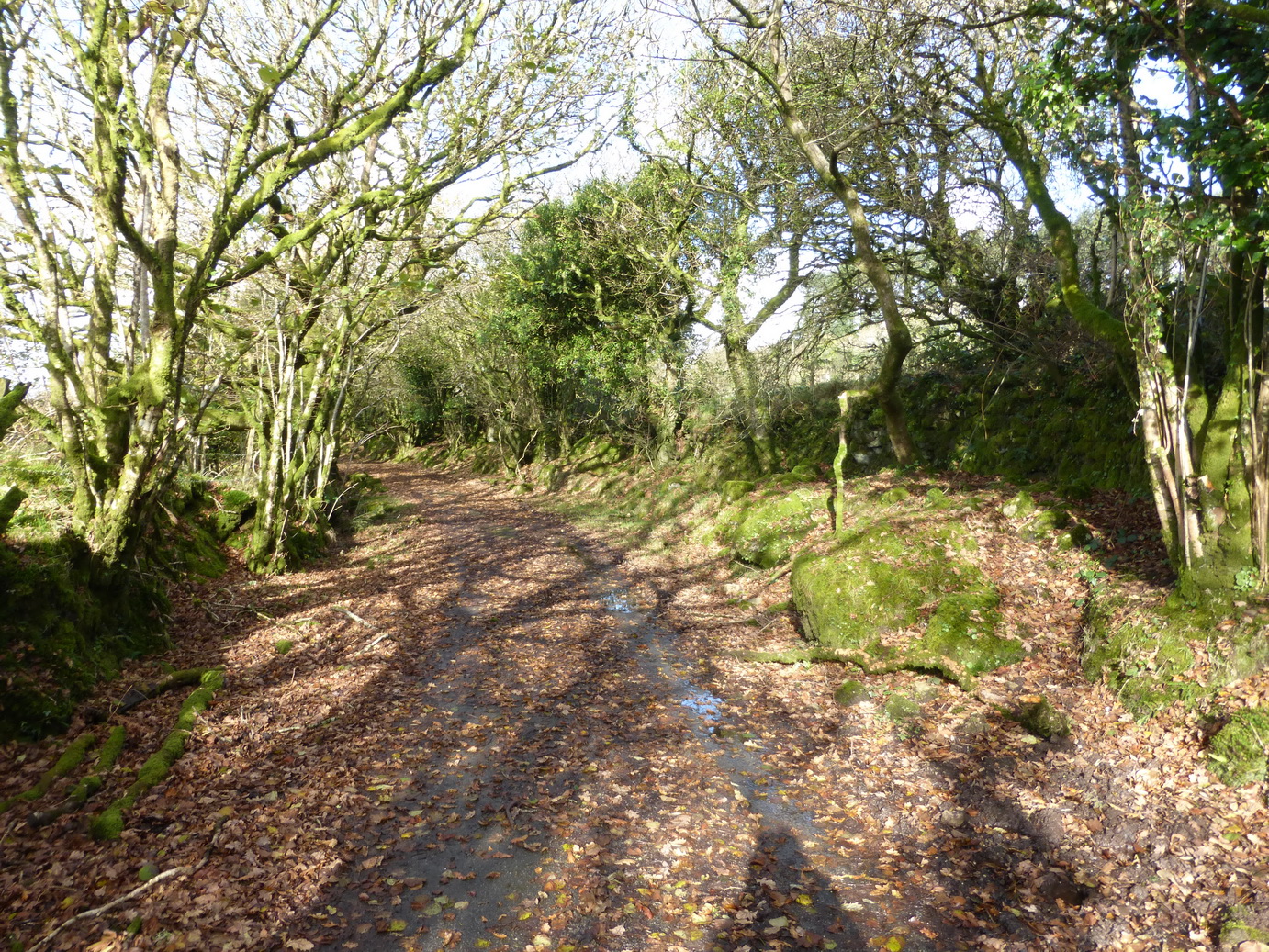
The route took us off to look at the end of the Drift reservoir before returning us to Sancreed itself, passing through some lovely green lanes, resplendent with bluebells, white leek and that soft green of spring, eventually emerging by Sancreed church.
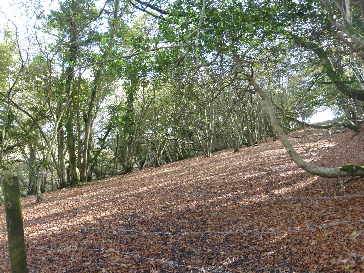
Autumn was doing its very best and the countryside was covered with the rich browns of fallen beech leaves, the trees bare against the pale sky illuminated by a bright low sun. It was a fresh November day which threatened an occasional light shower.
We were back on the Copper Trail again, at last.
We rejoined the route at St Neot, where we left of, heading north towards Hilltown Farm before dropping down to the lovely Loveny river.
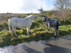
Colliford residents
The way took us on a cart track up over Penkestle Moor. The path here was muddy despite the lack of recent rain and we were soon jumping from tussock to tussock to ensure dry boots. A short sharp hail shower was the only actual rain we saw all day and not enough to slow us up.
Emerging at the bottom of Colliford Lake dam, we met some of the local residents before turning west towards Carburrow tor which was prominent for some time.
Although part of the Trail covers quite a bit of road, much of the stretches are short and very empty of traffic. This gives it a degree of variety and, in wet weather, the hard roads are almost welcome.
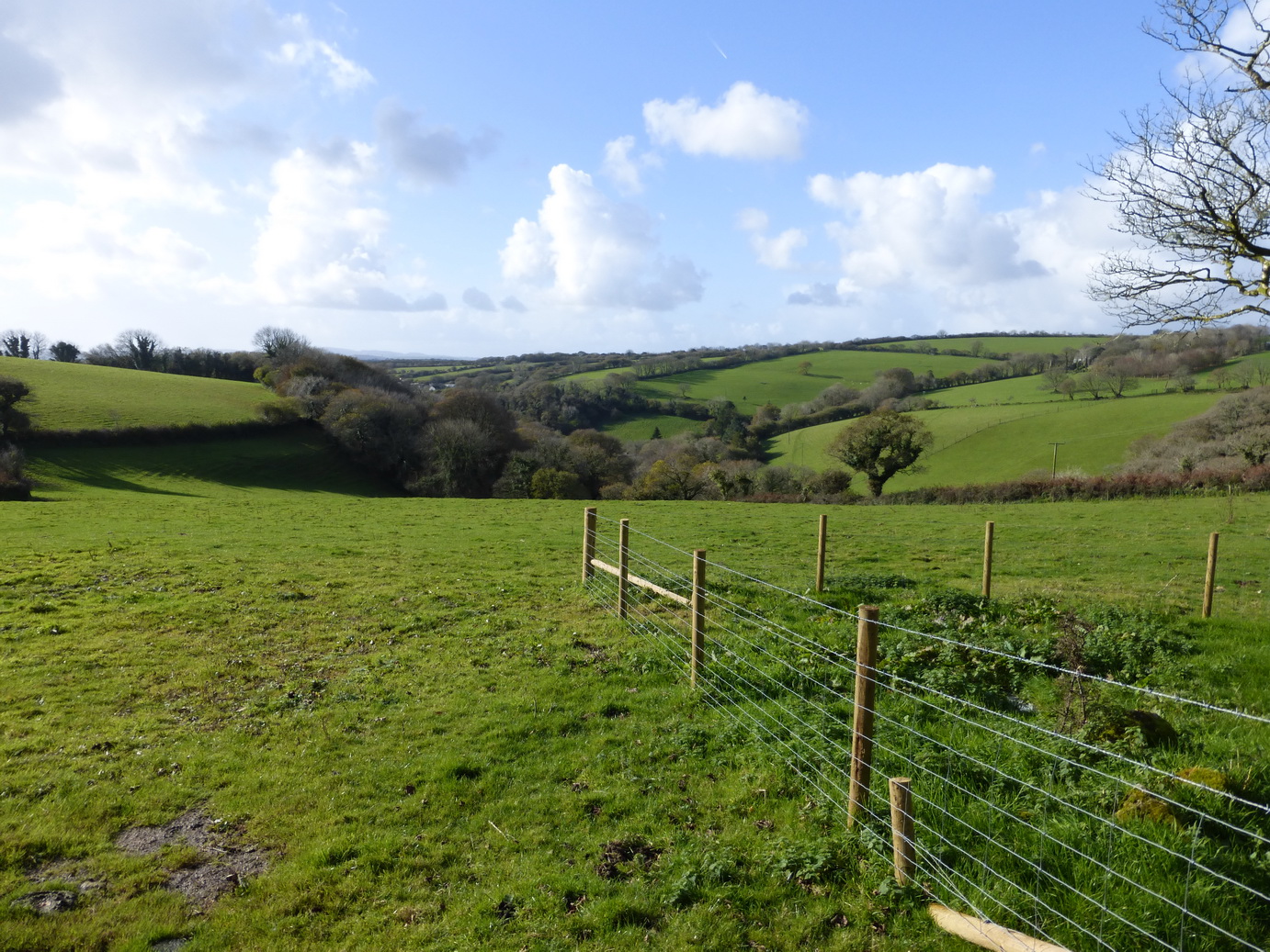
Above Treveddoe valley
Although all part of Bodmin Moor, the area consists of very green fields, wooded valleys and large patches of rough open moorland. much of it covered in scattered stones and remains of former settlements.
Carburrow tor is an archaeologist’s jigsaw puzzle of settlements with long house, cairns, and the remains of many round huts.
We drank a welcome cup of coffee at the foot of the tor before crossing Warleggan down and descending a road to to Treveddoe, a beautifully-situated house at the head of a wooded valley.
Wheal whisper – the ‘dry’
The path dropped down the field and past the remains of Wheal Whisper tin mine. Some small buildings, a landscaped quarry and some well-dressed walls are all that remain of a once-flourishing concern. There was more jumping over tussocks here.
We emerged onto a road and into the village of Mount.
Just outside Mount there was a wonderful signpost, very typical of the ones around Warleggan (‘twinned with Narnia’): great white slabs of wood on elegant posts. This one was held in place by an iron bracket and helpfully offered Bodmin as a destination on two of its three arms.
The inscribed crosses
The road passed the small Treslea Down cross and then two inscribed stones above Welltown. The latter were high up on the top of a Cornish wall at a crossroads and had surely been moved there in the past. Ancient stones continue to provide their usual purpose as waymarkers.
Crossing the unusually tidy greens at Little Downs, we headed towards the remains of Cardinham castle. Sadly, there is very little to be seen from the road. The route squeezes down a muddy track – a narrow ‘bridle path’ – past the old mill before rising up towards the village of Cardinham, the church tower very visible on the hill ahead. This must have been the main route from castle to church.
Cardinham church has some wonderful churchyard crosses and is well worth a detour.
After a bite of lunch, we set off for Cardinham woods. The excellent Copper Trail guide does like the word ‘eventually’ as in ‘follow the track which eventually comes out …’ It encourages confidence that the future will come true.
We ‘eventually’ reached a sign which confirmed that we were entering the woods themselves. We were warned to expect joggers, walkers, dogs and horses. We were not warned to expect a bunch of men wrapped up in leather jackets and goggles, driving open cars on a treasure hunt and beaming from ear to ear. There was no sign of any horses.
The neglected Callywith crosses
The final stretch up through Deviock wood was a long haul. By now the sun had lost its strength and we were walking in shadow. ‘Eventually’ we emerged onto a track said to be much frequented by rabbits – we saw none – the sound of the A30 a dull roar in the distance. A short way across a field, one of those really muddy gateways and a soggy track and we were back onto a tarmac road past Callybarrett Farm and a waiting car.
A final joy was hidden under a hedge at the edge of a bramble patch, below a modern embanked road: two of the saddest-looking wheel-headed crosses we have yet come across. They stand side by side, apparently neglected. Leaving crosses in situ is clearly a preferred strategy but it seems sad that these two have not been given a more decent prospect than looking out at brambles and listening to the road of the A30 fifty metres away.
After 5 hours we had walked 11 miles (Google), 16.5 miles (our gps) and returned for a well-deserved hot bath. The Copper Trail is proving to be a well-thought out and enjoyable route.
Cornwall Council does have a sense of humour after all!
A bright sunny day after a few days of heavy rain tempted us out to start the Copper Trail which had been on our agenda for some time. We decided to start at the beginning at Minions where we discovered that Cornwall Council does have a sense of humour after all.
On the roadside opposite the road sign stood the tall Long Tom wheel-headed wayside cross which may well be an original menhir.
This section of the trail was full of interest and variety, ranging from ancient monuments churches and holy wells, to C19 mining natural delights.
The Hurlers
The real start of our walk was at the Hurlers and Pipers. The Hurlers consists of three Bronze Age stone circles close to each other: a rare formation but no help in understanding how and why stone circles were used.
The trail proper starts by following a disused railway/tramway south from Minions. Lumps of granite are marked with holes where the rails were originally connected. A short distance ahead, the track descends the former Gonamena incline, emerging eventually at Crow’s Nest. To the east, the remains of the South Caradon mine bespatter the side of Caradon Hill with its enormous television transmitter.
Trevethy Quoit
Our next monument was Scillonian portal tomb of Trevethy Quoit, possibly Cornwall’s oldest structure: an enormous neolithic dolmen. Sadly a row of houses rather encroaches on its setting but on a fine day, there can be few better sights.
The purpose of the hole in the capstone is unknown.
In the distance, the tower of St Cleer was visible above the trees and we took an overgrown bridleway which would never have accommodated a horse, down the hill to Trecarne (where the houses all seemed to have ‘Carne’ in their names). Here, we left the trail to take a detour to visit St Cleer with its holy well and church.
St Cleer holy well
The holy well, dedicated to St Clare of the order of Poor Clare’s – St Francis’ friend – is an elaborate structure which successive restorations has rather hemmed in with an inelegant wall. Its waters, we are reliably informed, will cure insanity but they are sadly inaccessible, which may explain a lot.
Alongside stands a C15 Latin cross.
We rejoined the main trail near South Trekeive. It would have been a short step to the C8 King Doniert’s Stone – or stones – with its inscription and lovely Celtic knotwork but we had already visited them on the way to Minions.
At South Trekeive we passed our third water treatment works of the day – always a delight – before crossing Bulland Downs and emerging at Draynes Bridge.
Golitha falls on the River Fowey
A short detour through some lovely woodland – a nature reserve – is highly recommended to view Golitha Falls. Here we found various people wandering around asking ‘are these the falls?‘ in the manner of someone expecting Victoria Falls on a charming Cornish river.
We can recommend the reserve for dog walking, adventures and picnics.
Back to the road and a steep climb up to the hamlet of Draynes before an equally steep decline to the converted Methodist chapel at Lower Trenant. From here, the track took us into the lovely Periock Wood, following a stream up a muddy path towards Lower Bowden. Here the farmer had helpfully cut a track across an unharvested hay field to indicate the ‘right route’.
St Neot holy well
We emerged close to the almost invisible Berry Castle and cut across some open moorland before descending towards St Neot, hidden in the valley below. A quick detour to the hopelessly Victorian holy well brought us eventually to St Neot’s wonderful church with its incredible windows.
Here we ended the first stage of the Copper Trail. Our gps said we had walked over 12 miles in about 4.75 hours although Google Maps stubbornly suggests nearer 9 miles.
If the later sections of the trail are as full of interest as this section then we are in for a treat.
Cornwall Council does have a sense of humour
The Hurlers
The Hurlers
The Pipers
The old railway track
Gonamena incline
South Caradon Mine
South Caradon Mine
St Cleer church from Trevethy Quoit
Trevethy Quoit
King Doniert’s stone(s)
St Cleer holy well
St Cleer holy well
St Cleer Latin cross
Golitha falls
Golitha falls
Periock wood
Flower of the walk: the foxglove
Hilltown Latin cross
St Neot holy well
St Neot holy well
A journey through the landscape and history of Cornwall