King Arthur’s Hall – spoiler alert, it has nothing to do with King Arthur – is one of the most enigmatic monuments in Cornwall and a source of years of argument and speculation.
It consists of a 48m long and 21m wide rectangular enclosure formed by a 2m tall bank with a series of over 50 stones on the inside face. The central area is boggy and pretty much a no-go area for much of the year. Oriented roughly N-S, there is an entrance way at the SW corner. To the north east stands the unmistakeable outline of Rough Tor and Brown Willy, so it lies in the area of Bodmin moor which was covered with Neolithic and Bronze Age remains.
A foraging expedition on a bright sunny day took us back to Cape Cornwall, surely one of the loveliest coastal spots in the Duchy. From there we made our way to the familiar Tregeseal stone circle.
Set on the edge of an area of high moorland covered in the bright colours of flowering heather, Tregeseal is the first ancient monument you meet as you follow the Tinners’ Way from St Just.
A lovely sunny bank holiday took us on a four mile walk around the Rough Tor area, expertly guided by iWalk Cornwall. Visiting three different stone circles, numerous hut circles, ring cairns and an early medieval cross on one walk was quite something.
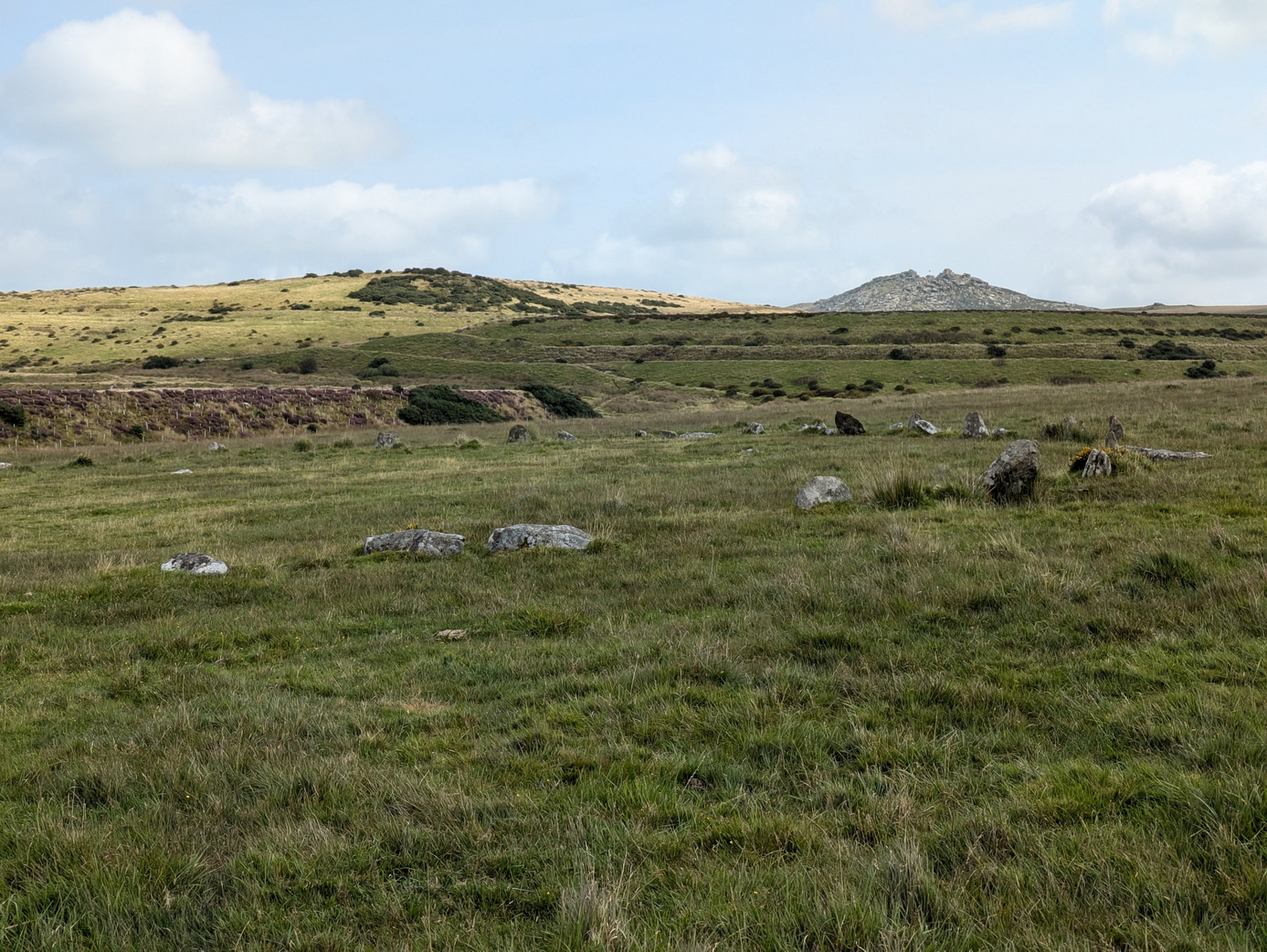
Stannon stone circle
The first delight was Stannon stone circle which consists of 39 standing stones and about another 40 recumbent, according to Craig Weatherhill, out of a probable total of 82. There were various alignments with Rough Tor, Brown Willy and the gap between which we could not test on a sunny day.
The effect of its isolation is rather ruined by the large, obviously man-made hill alongside: the remains of former china clay mining which has resulted in the large Stannon reservoir.
A chance conversation led to the discovery of two natural seawater rock pools which we have not seen mentioned anywhere else.
Rinsey Head is a familiar landmark with its house apparently perched on the edge of the cliff. What many people miss is that there is a small cove at the base of the cliff – Porthcew – which has sand at low tide and has several tempting-looking rock pools.
We visited Perranporth at spring low tide on a bright May day to find the rock-cut swimming pool on Chapel Rock. It turned out to be very easy to find in a wonderful location.
Perranporth pool
We could not miss Chapel Rock which dominates the centre of the immense Perranporth beach, its St Piran flag flying proudly straight out in the stiff wind. A hazy sandstorm was blowing from the direction of the Watering Hole.
On a bright Spring day at the end of April, we set off from Sancreed Beacon following an excellent route provided by iWalk Cornwall. This had it all: ancient monuments, a splendid church, a holy well, and a fogou (than which there is nothing better).
The route took us off to look at the end of the Drift reservoir before returning us to Sancreed itself, passing through some lovely green lanes, resplendent with bluebells, white leek and that soft green of spring, eventually emerging by Sancreed church.
There is something very romantic about things emerging from under the waters: think the Lady of the Lake brandishing Excalibur, or a sunken town. Places such as the fabled Atlantis, Port Royal in Jamaica, Heracleon in Egypt, and storm-tossed Dunwich, generate stories of sunken church bells and ghostly apparitions. Some monuments escaped inundations: Abu Simnel was moved to avoid the rising waters of the Aswan dam while the architects of Rutland Water chose to protect Normanton church with a bund. As things stand, Venice will one day be faced with similar decisions if St Mark’s Square is not to slip below the Mediterranean waves.
The loss of Port Royal was instant and catastrophic; Dunwich took longer as the erosion of the coastline took centuries. For others it was the actions of man: the planned flooding of a river valley to create a reservoir.
On our return from Bosporthennis, it was irresistible to stop at the Moomaid in the Field kiosk for some delicious home-made ice cream. But first, we needed to earn it. Zennor quoit lay on the ridge, somewhere just out of sight.
Cornwall Council does have a sense of humour after all!
A bright sunny day after a few days of heavy rain tempted us out to start the Copper Trail which had been on our agenda for some time. We decided to start at the beginning at Minions where we discovered that Cornwall Council does have a sense of humour after all.
On the roadside opposite the road sign stood the tall Long Tom wheel-headed wayside cross which may well be an original menhir.
This section of the trail was full of interest and variety, ranging from ancient monuments churches and holy wells, to C19 mining natural delights.
The Hurlers
The real start of our walk was at the Hurlers and Pipers. The Hurlers consists of three Bronze Age stone circles close to each other: a rare formation but no help in understanding how and why stone circles were used.
The trail proper starts by following a disused railway/tramway south from Minions. Lumps of granite are marked with holes where the rails were originally connected. A short distance ahead, the track descends the former Gonamena incline, emerging eventually at Crow’s Nest. To the east, the remains of the South Caradon mine bespatter the side of Caradon Hill with its enormous television transmitter.
Trevethy Quoit
Our next monument was Scillonian portal tomb of Trevethy Quoit, possibly Cornwall’s oldest structure: an enormous neolithic dolmen. Sadly a row of houses rather encroaches on its setting but on a fine day, there can be few better sights.
The purpose of the hole in the capstone is unknown.
In the distance, the tower of St Cleer was visible above the trees and we took an overgrown bridleway which would never have accommodated a horse, down the hill to Trecarne (where the houses all seemed to have ‘Carne’ in their names). Here, we left the trail to take a detour to visit St Cleer with its holy well and church.
St Cleer holy well
The holy well, dedicated to St Clare of the order of Poor Clare’s – St Francis’ friend – is an elaborate structure which successive restorations has rather hemmed in with an inelegant wall. Its waters, we are reliably informed, will cure insanity but they are sadly inaccessible, which may explain a lot.
Alongside stands a C15 Latin cross.
We rejoined the main trail near South Trekeive. It would have been a short step to the C8 King Doniert’s Stone – or stones – with its inscription and lovely Celtic knotwork but we had already visited them on the way to Minions.
At South Trekeive we passed our third water treatment works of the day – always a delight – before crossing Bulland Downs and emerging at Draynes Bridge.
Golitha falls on the River Fowey
A short detour through some lovely woodland – a nature reserve – is highly recommended to view Golitha Falls. Here we found various people wandering around asking ‘are these the falls?‘ in the manner of someone expecting Victoria Falls on a charming Cornish river.
We can recommend the reserve for dog walking, adventures and picnics.
Back to the road and a steep climb up to the hamlet of Draynes before an equally steep decline to the converted Methodist chapel at Lower Trenant. From here, the track took us into the lovely Periock Wood, following a stream up a muddy path towards Lower Bowden. Here the farmer had helpfully cut a track across an unharvested hay field to indicate the ‘right route’.
St Neot holy well
We emerged close to the almost invisible Berry Castle and cut across some open moorland before descending towards St Neot, hidden in the valley below. A quick detour to the hopelessly Victorian holy well brought us eventually to St Neot’s wonderful church with its incredible windows.
Here we ended the first stage of the Copper Trail. Our gps said we had walked over 12 miles in about 4.75 hours although Google Maps stubbornly suggests nearer 9 miles.
If the later sections of the trail are as full of interest as this section then we are in for a treat.
A brilliantly hot and sunny July day tempted us out to walk to Brown Willy and Rough Tor. We used the excellent iWalk Cornwall advice.
They promised us 5.2 miles of moderate-strenuous walking ‘marshy even in summer’. The ground was bone dry but we could certainly see that much of the ground could be marshy with frequent appearance of marsh grasses.
Rough Tor well
It was glorious. Starting from the end of Roughtor road by Charlotte Dymond’s memorial, one is literally tripping over ancient monuments the whole way up the slope to the top.
We headed for the main patch of reeds where some young horses were eating and drinking, and found the ‘holy well’. This was ‘discovered’ in 1970 and then lost again until 1994. One wonders how one loses a well and whether ‘discovered’ is similar to Speke’s ‘discovery’ of the source of the Nile: it was always there and known by local people.
The Piskie bath
For some reason the Wessex Division has decided to plant a memorial on top of Rough Tor. Our ancient ancestors would have understood the respect for the place but it seemed oddly incongruous and faintly invasive in such a landscape.
Our helpful notes did not mention that there was an excellent Piskie bath by the logan rock at the summit. This even has carefully crafted soap dishes.
Crossing to Showery Tor, we met a group of young lads who were doing their DoE Bronze Award, rather slowly, allowing time for the usual youthful banter. We encountered them again on top of Brown Willy where a cry went up ‘There’s a Pokemon up here’. ‘The government has spent £millions trying to get us to take exercise and all it needed was a fun app like this’, as one of them wisely remarked.
View towards Hensbarrow and the Alps
Another couple of walkers turned up thinking they were on Rough Tor, with no map or equipment, having arrived from Bolventor. Happy as anything, they set off for Rough Tor. It was just as well that it was not a ‘typical’ moorland day.
The views around us were magnificent, reaching as far as Hensbarrow, St Breock Down, Dartmoor and was that St Agnes Beacon we could espy?
From Brown Willy we re-crossed the bridge back to the foot of Rough Tor and made our way along the base of the tor towards the settlements, enjoying the remoteness of a small farmhouse with its own field system which must have been in occupation for many centuries.
Fernacre stone circle towards Brown Willy
There was no discernible path here and we could imagine it being pretty boggy in winter.
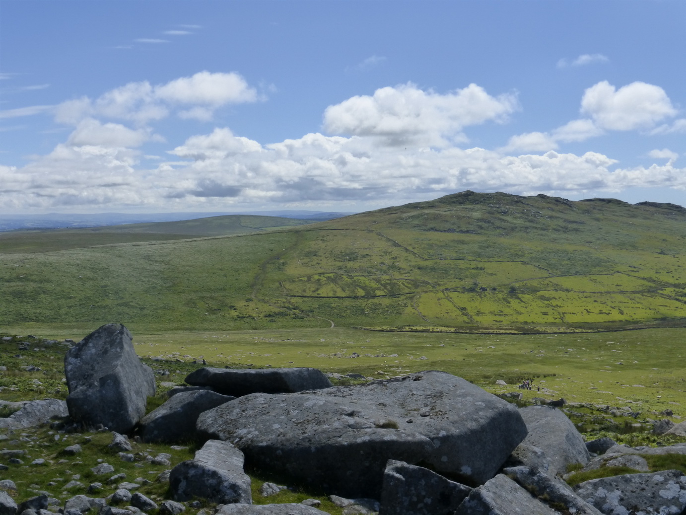
Fernacre stone circle was a short step away and we paid it a visit. We counted 50 stones either erect or hidden in the grass and walked the obligatory circuit without any ill or beneficial affects.
The way back around the tor was once again littered with meaningful stones which deserve more careful and detailed study: small hut circles, curb stones and alignments. They are probably all Bronze Age.
It had taken us three hours and we had covered 6.4 miles according to our tracker. It had been more moderate than strenuous but that was on a lovely hot day when the ground was rock hard. Boggy or in Winter would be a different matter.
Bronze Age hut
Rough Tor well
Piskie bath
Towards Hensbarrow
Brown Willy
Fernacre stone circle and Rough Tor
Fernacre stone circle and Brown Willy
Charlotte Dymond’s memorial
A journey through the landscape and history of Cornwall