St Neot to Callywith

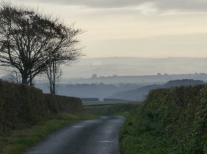
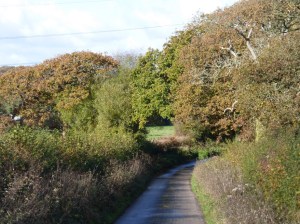
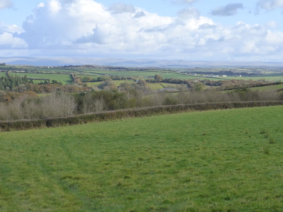
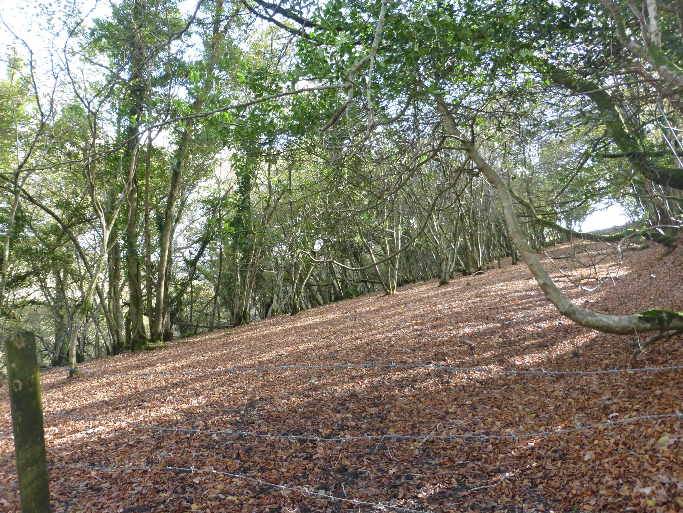
Autumn was doing its very best and the countryside was covered with the rich browns of fallen beech leaves, the trees bare against the pale sky illuminated by a bright low sun. It was a fresh November day which threatened an occasional light shower.

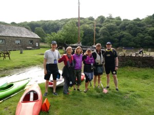
We were back on the Copper Trail again, at last.

We rejoined the route at St Neot, where we left of, heading north towards Hilltown Farm before dropping down to the lovely Loveny river.

Colliford residents

The way took us on a cart track up over Penkestle Moor. The path here was muddy despite the lack of recent rain and we were soon jumping from tussock to tussock to ensure dry boots. A short sharp hail shower was the only actual rain we saw all day and not enough to slow us up.

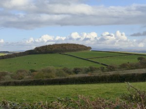
Emerging at the bottom of Colliford Lake dam, we met some of the local residents before turning west towards Carburrow tor which was prominent for some time.

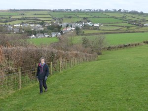
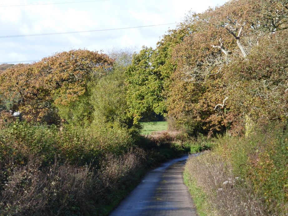
Although part of the Trail covers quite a bit of road, much of the stretches are short and very empty of traffic. This gives it a degree of variety and, in wet weather, the hard roads are almost welcome.

Above Treveddoe valley

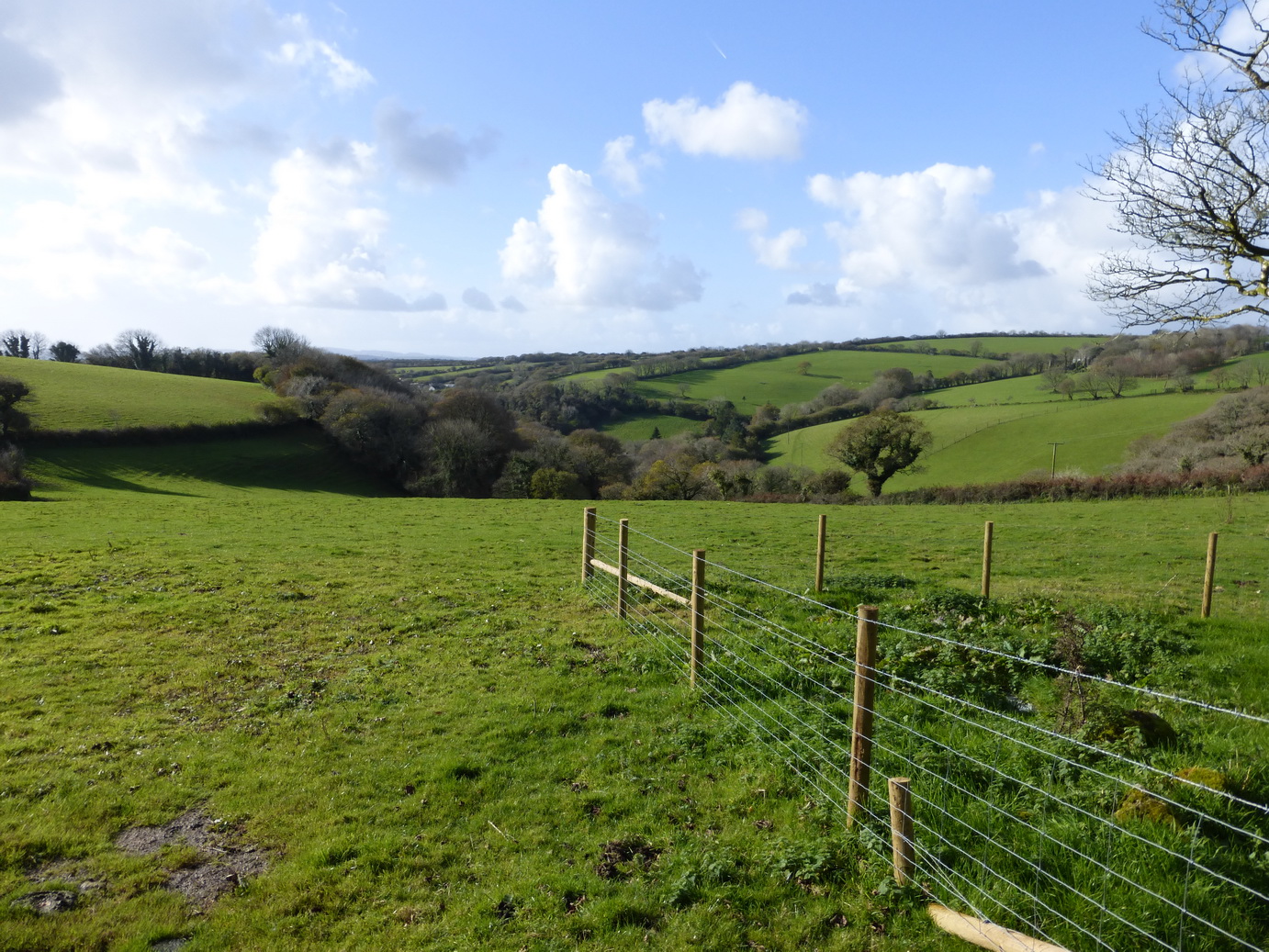
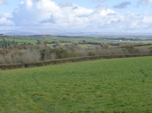
Although all part of Bodmin Moor, the area consists of very green fields, wooded valleys and large patches of rough open moorland. much of it covered in scattered stones and remains of former settlements.

Carburrow tor is an archaeologist’s jigsaw puzzle of settlements with long house, cairns, and the remains of many round huts.

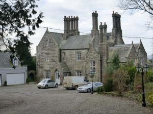
We drank a welcome cup of coffee at the foot of the tor before crossing Warleggan down and descending a road to to Treveddoe, a beautifully-situated house at the head of a wooded valley.

Wheal whisper – the ‘dry’

The path dropped down the field and past the remains of Wheal Whisper tin mine. Some small buildings, a landscaped quarry and some well-dressed walls are all that remain of a once-flourishing concern. There was more jumping over tussocks here.

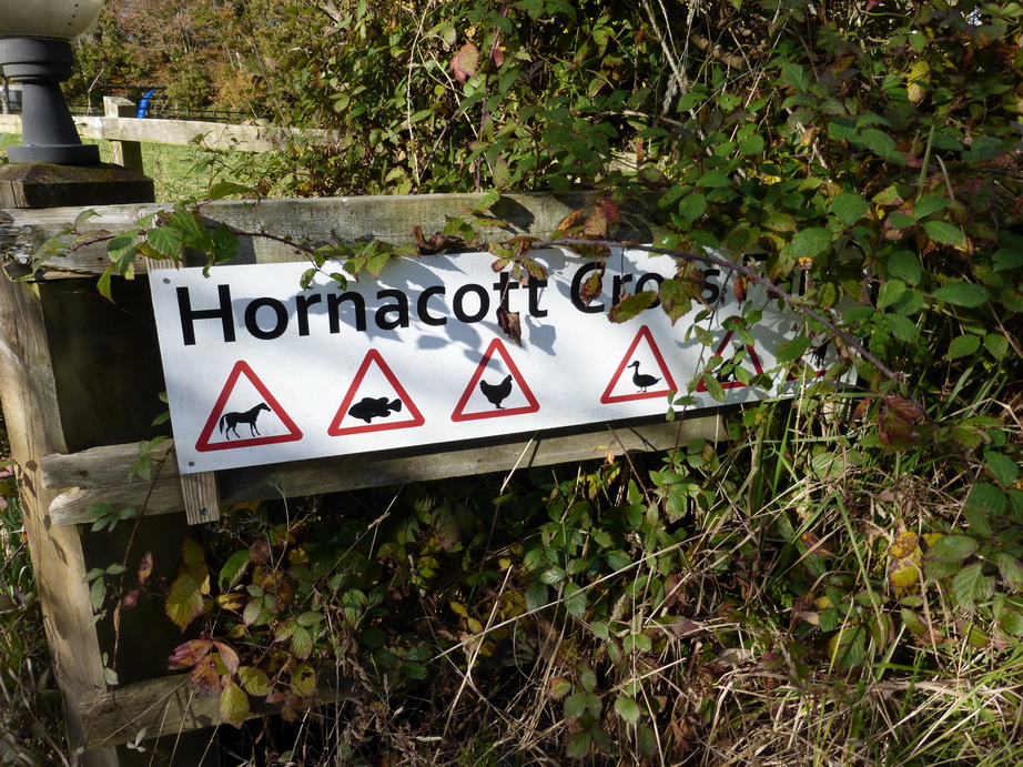
We emerged onto a road and into the village of Mount.

Just outside Mount there was a wonderful signpost, very typical of the ones around Warleggan (‘twinned with Narnia’): great white slabs of wood on elegant posts. This one was held in place by an iron bracket and helpfully offered Bodmin as a destination on two of its three arms.

The inscribed crosses

The road passed the small Treslea Down cross and then two inscribed stones above Welltown. The latter were high up on the top of a Cornish wall at a crossroads and had surely been moved there in the past. Ancient stones continue to provide their usual purpose as waymarkers.

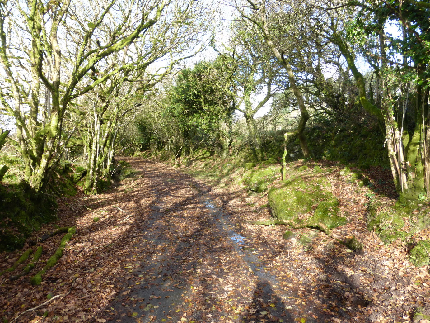
Crossing the unusually tidy greens at Little Downs, we headed towards the remains of Cardinham castle. Sadly, there is very little to be seen from the road. The route squeezes down a muddy track – a narrow ‘bridle path’ – past the old mill before rising up towards the village of Cardinham, the church tower very visible on the hill ahead. This must have been the main route from castle to church.

Cardinham church has some wonderful churchyard crosses and is well worth a detour.

After a bite of lunch, we set off for Cardinham woods. The excellent Copper Trail guide does like the word ‘eventually’ as in ‘follow the track which eventually comes out …’ It encourages confidence that the future will come true.

We ‘eventually’ reached a sign which confirmed that we were entering the woods themselves. We were warned to expect joggers, walkers, dogs and horses. We were not warned to expect a bunch of men wrapped up in leather jackets and goggles, driving open cars on a treasure hunt and beaming from ear to ear. There was no sign of any horses.

The neglected Callywith crosses

The final stretch up through Deviock wood was a long haul. By now the sun had lost its strength and we were walking in shadow. ‘Eventually’ we emerged onto a track said to be much frequented by rabbits – we saw none – the sound of the A30 a dull roar in the distance. A short way across a field, one of those really muddy gateways and a soggy track and we were back onto a tarmac  road past Callybarrett Farm and a waiting car.

A final joy was hidden under a hedge at the edge of a bramble patch, below a modern embanked road: two of the saddest-looking wheel-headed crosses we have yet come across. They stand side by side, apparently neglected. Leaving crosses in situ is clearly a preferred strategy but it seems sad that these two have not been given a more decent prospect than looking out at brambles and listening to the road of the A30 fifty metres away.

After 5 hours we had walked 11 miles (Google), 16.5 miles (our gps) and returned for a well-deserved hot bath. The Copper Trail is proving to be a well-thought out and enjoyable route.

Minions to St Neot

Cornwall Council does have a sense of humour after all!

A bright sunny day after a few days of heavy rain tempted us out to start the Copper Trail which had been on our agenda for some time. We decided to start at the beginning at Minions where we discovered that Cornwall Council does have a sense of humour after all.

On the roadside opposite the road sign stood the tall Long Tom wheel-headed wayside cross which may well be an original menhir.

This section of the trail was full of interest and variety, ranging from ancient monuments churches and holy wells, to C19 mining natural delights. 

The Hurlers

The real start of our walk was at the Hurlers and Pipers. The Hurlers consists of three Bronze Age stone circles close to each other: a rare formation but no help in understanding how and why stone circles were used.

The trail proper starts by following a disused railway/tramway south from Minions. Lumps of granite are marked with holes where the rails were originally connected. A short distance ahead, the track descends the former Gonamena incline, emerging eventually at Crow’s Nest. To the east, the remains of the South Caradon mine bespatter the side of Caradon Hill with its enormous television transmitter.

Trevethy Quoit

Our next monument was Scillonian portal tomb of Trevethy Quoit, possibly Cornwall’s oldest structure: an enormous neolithic dolmen. Sadly a row of houses rather encroaches on its setting but on a fine day, there can be few better sights.

The purpose of the hole in the capstone is unknown.

In the distance, the tower of St Cleer was visible above the trees and we took an overgrown bridleway which would never have accommodated a horse, down the hill to Trecarne (where the houses all seemed to have ‘Carne’ in their names). Here, we left the trail to take a detour to visit St Cleer with its holy well and church.

St Cleer holy well

The holy well, dedicated to St Clare of the order of Poor Clare’s – St Francis’ friend – is an elaborate structure which successive restorations has rather hemmed in with an inelegant wall. Its waters, we are reliably informed, will cure insanity but they are sadly inaccessible, which may explain a lot.

Alongside stands a C15 Latin cross.

We rejoined the main trail near South Trekeive. It would have been a short step to the C8 King Doniert’s Stone – or stones – with its inscription and lovely Celtic knotwork but we had already visited them on the way to Minions.

At South Trekeive we passed our third water treatment works of the day – always a delight – before crossing Bulland Downs and emerging at Draynes Bridge.

Golitha falls on the River Fowey

A short detour through some lovely woodland – a nature reserve – is highly recommended to view Golitha Falls. Here we found various people wandering around asking ‘are these the falls?‘ in the manner of someone expecting Victoria Falls on a charming Cornish river.

We can recommend the reserve for dog walking, adventures and picnics.

Back to the road and a steep climb up to the hamlet of Draynes  before an equally steep decline to the converted Methodist chapel at Lower Trenant. From here, the track took us into the lovely Periock Wood, following a stream up a muddy path towards Lower Bowden. Here the farmer had helpfully cut a track across an unharvested hay field to indicate the ‘right route’.

St Neot holy well

We emerged close to the almost invisible Berry Castle and cut across some open moorland before descending towards St Neot, hidden in the valley below. A quick detour to the hopelessly Victorian holy well brought us eventually to St Neot’s wonderful church with its incredible windows.

Here we ended the first stage of the Copper Trail. Our gps said we had walked over 12 miles in about 4.75 hours although Google Maps stubbornly suggests nearer 9 miles.

If the later sections of the trail are as full of interest as this section then we are in for a treat.


Cotehele to Cremyll Ferry

20170528_085801
Leaving Cotehele

We left our exploration of the Tamar valley somewhat hanging in the air after our walk to Cotehele. We had found somewhere to launch our canoes. It was all a question of waiting for the right tide and a gap in diaries.

The aim of this expedition was to canoe the tidal Tamar to Cremyll Ferry and thus to complete our circum-navigation/walk around Cornwall. Unusually, we had invited friends to join us as part of our joint exploration of Cornwall’s rivers.

Continue reading Cotehele to Cremyll Ferry

Restormel to Lanhydrock

P1090397

Walking the Saints’ Way, as we were last weekend, makes one think more about the geography of the Bodmin-Lostwithiel corridor.

We are so influenced by modern communications that the two towns seem to live in their own bubbles. Bodmin hugs the A30 and is generally approached along it. Lostwithiel hugs the other major road in the area, the A390, which distributes traffic east and west.

Continue reading Restormel to Lanhydrock

The Saints’ Way 4

P1090347
Lanlivery church

It has been a wonderful spring with three weeks of dry sunny weather during April. The camelias, bluebells, azaleas and blossom seem to have gone on for ever and it is only now that they are beginning to look as though their flowering is drawing to a close.

At the beginning of May we took the chance to complete ‘the other leg’ of the Saints’ Way.

The Saints’ way splits at Helman Tor with the westerly route going through Luxulyan, St Blazey and Tywardreath to enter Fowey across the Menabilly headland. The easterly route heads for Lanlivery and follows the river to Golant, entering Fowey from the north. When we previously walked the Saints’ Way we had used the westerly route.

P1090348
Polyntor standing stone

We started at Lanlivery, having previously walked the Helman Tor to Lanlivery section on a warm summer’s day after a pub lunch at the (excellent) Crown Inn.

The way crossed a small valley, past a curious shrine to Humpty Dumpty, complete with lighting effects, to where a large standing stone stood, sited unusually on the side of a hill but within view of the church tower. This would have been a good waymarker for a passing saint.

There was another waymarker over the next hill where we encountered a wayside cross, set next to the busy A390 at a place charmingly called No Man’s Land.

After a short distance walking alongside this road, the way dived right and we took a steep lane down a field towards Milltown.

P1090353
St Winnow church

Passing a vain goose admiring her image in a greenhouse, we emerged on a small road running parallel to the river. All around, the vegetation was red, white and blue against a background of the fresh green of spring: campion, wild garlic and bluebells were doing their bit and the air smelled strongly of fresh garlic.

This was a lovely section and very easy going. In the distance, across the river, the sight of St Winnow church in its waterside setting just added to the delights.

The path turned off halfway up a hill and crossed a large ploughed field, heading for Golant. We stopped here to visit St Sampson church which gets a single star from Simon Jenkins. This is well worth a visit, if only for its hillside setting and putative links with the story of Tristan and Iseult.

P1090384Leaving Golant, the way then became a narrow path and quite the loveliest section of the day. The vegetation continued to be quite splendid: sadly our camera cannot do it justice. There is something about the colours of bluebells that modern cameras simply do not like. They also cannot capture the smell of fresh vegetation or the noises of the birds enjoying a sunny day.

We emerged at a small quay and followed the valley up through a wood to a small waterfall where we ate a sandwich, surrounded by the smell of garlic.

Across another hill – and past the inevitable water treatment works – and we descended a hill towards the Bodinnick ferry. Around us were the signs of the former railway station and its accompanying infrastructure. The station itself being converted into ‘apartments’. We hope they like views of a car park.

We walked through the narrow streets of Fowey – it was almost mandatory to wear Joules and SeaSalt – and arrived at the church formally to end our walk. It had been an easy 7.5 mile (9 mile on our gps) walk in 3 and a quarter hours.


Gunnislake to Cotehele

p1080555
Morwell wood

The final stages of our Tamar walk were a bit disjointed thanks to our discovery that launching canoes at Gunnislake did not appear to be on the cards (except at dead of night when the gamekeepers were not watching). We were faced with a series of short links instead of one long stretch.

To link Gunnislake to our new get-in spot of Cotehele Quay needed one of these short walks on a sunny January day. There was not a leaf left on the trees but the snowdrops, crocuses and daffodils were beginning to  appear from among the leaf-litter.

We started where we had left off, just south of Gunnislake, and walked on easy roads up the landmark of Calstock church. In the gorge below us the Tamar, now a mighty river, was winding its way past Morwell Woods and showing increasing signs of being tidal.

Calstock church was delightful and set, unexpectedly, on the site of a former Roman fort. We noted a ledger stone in the porch to a Griffin – an echo of entering Mylor church.

We shadowed the single-track railway as it twists and turns its way around the valley side, before dropping down past OkelTor Mine, holding our noses as we reached the river and its reedy bank close to the sewage works.

calstock
Calstock viaduct

By now the Calstock viaduct (1904) was very visible in all its elegance, the town clutching the hillside on the north bank. It is something of a surprise that this little line – from Plymouth to Gunnislake – has survived successive railway closures but the winding river and lack of bridges means that communities like Calstock and Bere Alston are actually  rather cut off with few major roads.

Calstock appeared an attractive small town with come good quality houses. Others looked sadly neglected.

cotehele
Cotehele house

As a light rain began to fall, we followed the road along the river’s edge to the sharp Cotehele turn where we took to the woods and made our way up to the house. Cotehele (NT) is a fine Tudor mansion of a very domestic scale with wonderful views down to the river and viaduct below.

We wandered around the gardens and up to the folly on the hilltop. Built in the C18, this triangular tower sits on the top of the hill and was designed to look like a church tower from afar. The NT has thoughtfully provided a stair to allow one to reach the top.

shamrock
Cotehele Quay: Shamrock

Our walk took us down to Cotehele Quay on the river bank below. Here the Shamrock (1899), a Tamar barge, sits looking slightly disconsolate in winter, surrounded by glutinous mud. An NT cafe provided sustenance and shelter from the passing light drizzle.

Our return route took us past the little Edgcumbe chapel, built on the cliff edge close to where Sir Richard, a supporter of the future Henry VII, hid in the undergrowth to avoid his pursuers in ca 1483. He dived into the river to escape them. His pursuers, seeing his cap floating away, presumed him drowned and gave up the chase, allowing him to escape to Brittany. A charming story and a reminder of the perils of backing the ‘wrong’ side, as the Cornish gentry so often did.

A more direct route took us back up the hill and back to our car, the sun providing an entertainment of rainbows pointing at Kit Hill which really does need climbing one day.

Our Tamar walk is thus effectively complete: about 60 miles. The remainder of our ‘circumnavigation’ of the borderlands will be by boat (and reported here).

This circular walk of about 6 miles had taken us 3 hours of walking. We rewarded ourselves by visiting St Ive church on the way home.

Around Gunnislake

p1080468
Welcome to Gunnislake

We had planned to walk to Gunnislake and complete our journey down the tidal Tamar by canoe. A recce around Gunnislake soon disabused us of this idea. It is hard to imagine a more unnecessarily unwelcoming area than the banks of the river at Gunnislake.

We had previously run into bossy riparian owners a short distance up the river. It seems the same attitude prevailed here as the banks were littered with signs banning any activity at all.

The walk along the Tamar from the bridge passes through some woods filled with the remains of old industrial buildings being reclaimed by nature.

p1080469
Gunnislake weir

The remnants of the old canal and lock also become apparent as one reaches the weir which is the head of tidal navigation.

In the distance, as the river turns southwards towards the Morwelham bend, an attractive looking gorge appears, under Sheepridge wood.

It is a shame that one cannot access this area easily by boat and it is hard not to resent the prohibitions which are so uncharacteristic on a tidal river. We wondered what anyone would do if we had paddled upstream down the middle of the river.

We will have to walk on and launch further downstream.

Milton Abbot to Horsebridge

p1080463Having reached Milton Abbot, our route planning became a little uncertain. We had a mere 4 miles gap linking our last destination at Milton Abbot with Horsebridge which we had reached from the other direction. We kicked ourselves for not having stretched ourselves on some of the earlier, easy walks.

To fill in the gap, we started at Horsebridge and did a circular walk to Milton Abbot and back. The preferred route is along the Tamar Valley Discovery Trail which takes you through Sydenham Damerel although there is a straighter route through Leigh Cross which we used on the return journey. The Sydenham route had the advantage of going off-road for a stretch after the village but was otherwise unremarkable; except for a rather jolly penny halfpenny gate.

p1080464
Milton Abbot Old Vicarage

This was not a walk filled with incident or particular delights. The distant profile of Bodmin Moor and the familiar shapes of Rough Tor and Brown Willy were constant companions, as was Kit Hill to the south west. As usual, we wished we could walk closer to the river itself.

Milton Abbot, which we only seem to visit on grey days, is clustered around its church (St Constantine) and contains some good looking small buildings. The Old Vicarage, however, is a candidate for any horror film and reminds one of the status of a Victorian vicar.

p1080465
Leaving Milton Abbot

There was another stretch of off-road walking out of the village before we headed back to Horsebridge by the more direct route.

Newbridge to Milton Abbot

p1080221
Early morning

We picked up our journey where we left off, at a junction near Newbridge. A light rain – ‘heavy dew’ –  was falling as we stepped out.

It was early which is always a wonderful time to be walking. Ahead of us the mist was lifting from the valleys creating a magical, almost artistic effect.

Ahead, the roads were initially much the same as the previous day but as we dropped down to Bridgetown, the character changed. While we had been away the river had grown up a bit and had established its own mini flood plain.

p1080226
River Ottery

The stretch through Crossgate, close to Druxton Bridge was a joy. The road followed the edge of the higher ground. It was instantly more prosperous. The simple open pastoral fields we had experienced further north gave way to arable fields and paddocks. The landscape was tidier too.

Near Werrington, the significant river Inney joined the Tamar, adding considerably to the volume of water in the river.

A short stretch on the A388 took us through a garden centre and onto a footpath for the first time in many miles. We were soon back on a road again, re-tracing some former steps towards Polson bridge.

p1080230
St Leonard’s packhorse bridge

By now we had joined the Tamar Valley Discovery Trail with its apple symbols. If you follow this then be warned: the apple symbols are often overgrown with ivy and it has a habit of deserting you at critical moments.

The St Leonard’s water treatment works was as delightful as ever while close by polite children were passing their Sunday mornings exercising their mounts walking around a dressage ring. Hidden away was the tiny packhorse bridge over the river Kensey which we had spotted before, now covered in a spectacular carpet of orange leaves.

p1080256
Greystone bridge

We crossed over the A30, the usual dividing line between the ‘tougher’ landscape of north and ‘softer’ south Cornwall, and made our way to Lawhitton where we visited the unusual church.

We were back on very narrow lanes again, which we followed down a steep hill to Greystone bridge.

There were frantic warning signs about ‘uneven road surface’, ’10mph maximum’ and ‘danger of skidding’. No driver can keep to this sort of speed on empty roads. The road was so narrow that no driver could speed and any skidding would only damage the car as each side consisted of a Cornish bank. Perhaps there should be a sign at Polson bridge saying ‘Drivers use all roads in Cornwall at their own risk’. It would be cheaper.

p1080259
Felldownhead cider barn

At Greystone (the bridge dates from 1439) the Tamar enters a small gorge which stretches beyond Gunnislake.

What the books had not mentioned was the steep 1 mile 20% climb up the other side but it was cheering to see a drinking trough at the bottom of the hill and a cider barn at the top.

We sat to eat our picnic beside a kaleidoscope of apples waiting to be processed, their sweet smell reminding us of the abundant harvest.

From here, it was a short distance to Milton Abbot where, with the clouds looking distinctly threatening, we hastened down a non-existent path across some fields and up to the church where our car awaited us.

We had walked about 13 miles in five hours, leaving ourselves a ridiculously short distance to reach our target of Gunnislake where we will start the next stage of our odyssey.


Whitstone to (near) Newbridge

p1080164

We returned to the Tamar valley over a weekend which promised to be fine, if cold, picking up where we had left off at Whitstone.

On our last walk we did a big detour, about 3 miles from the river, to avoid walking down the B3254 super-highway or crossing the border into Devon for too great a distance. On this walk we were faced with another detour in the other direction, as much as anything because of the lack of roads following the river.

As our last posting said, the upper reaches of the river are characterised by low rolling hills with few villages, scattered farmsteads, plenty of clay soils and cattle standing around in green fields. The roads join up these farmsteads. The B3254 is the main artery and, during its 18 mile length from Launceston to Kilkhampton, passes through no town worthy of the name. This is a wild area of open landscape where farms have been in families for generations.

p1080191
Dartmoor in the distance

Leaving Whitstone, we followed a footpath across a field which was boggy even though it had not rained significantly in recent days. This was our only foray off road for the whole day.

The rest of the time we followed lanes which came in two flavours: ‘very narrow’, which could accommodate a single car and a walker squashed into a Cornish hedge and which generally had grass down its middle; and ‘narrow’ which left rather more room for the walker unless the vehicle was a particularly large tractor driven at speed by someone who looked about 16 years of age.

p1080206

It was a day of sounds and colours and bright sunshine rather than notable sites. In the distance, in front of us, the tors of Dartmoor pointed skyward while, to our right, the familiar shapes of Bodmin moor gave us some familiar landmarks.

It has been a ‘good’ autumn with the golden leaves falling straight down and gathering at the roadsides and on woodland floors, not scattered to dark corners. In places, we were walking on a golden carpet, beech producing much the best colours.

The susurration of the trees above us in the occasional wintery gusts sent a shower of dying leaves into our path and we held our hands in front of us, determined to catch falling leaves for luck.

p1080163
Tamar at Crowford bridge

We noted the appearance of starlings, a bird which is rare further west  in Cornwall. Great murmurations were chattering away to each other, discussing the unfamiliar walkers below them.

Because of the detour, we had not seen the Tamar for some time and it was good to re-acquaint ourselves with her at Crowford bridge.

A car overtook us as we approached the ridge, drove up to it, seemed to look at Devon,  turned around and headed back into Cornwall. We understood and were respectful as we crossed the county boundary.

p1080167
North Tamerton

A mile or so later we crossed back into Cornwall, the border not being marked, and headed for Tamerton bridge where an elegant house, a former post office, kept guard on the crossing. By now, the river was looking quite grown up. A short distance away was North Tamerton church which we had to visit.

We suspect that not much happens in North Tamerton; at least judging by the sign there.

Our way lay southwards on a single road and we stretched our legs to reach Boyton for a late lunch. Here was another church in a small village on a gentle hill above the river, the shape of the valley being unmistakable.

p1080189
Beware of the fish

At Hornacott drivers are faced with a perplexing sign. Avoiding horses and dogs is relatively easy. Cats, chickens and geese are more of a problem but are generally avoidable. However, the Highway Code is strangely silent about the correct diversionary manoeuvre when fish pop up in the road. As walkers, we were thankful not to be faced with this danger.

We left Boyton as the temperature was beginning to drop and walked on a mile or so to collect our car for the end of day one of a two day expedition.

We had walked 11.5 miles in four hours, almost all of it on what passes as roads in the borderland.

A journey through the landscape and history of Cornwall