Category Archives: Walks

Boskenna to Porthcurno

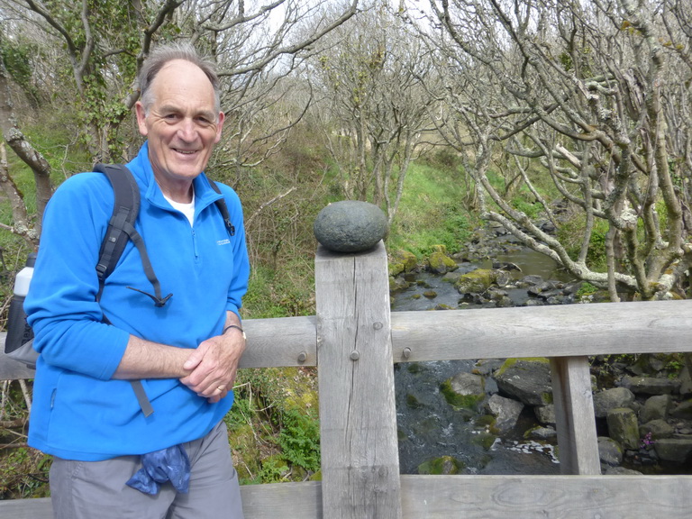
There are some sections of the coast path that are so familiar that it is like walking home: each step brings more memories, more delights. This walk was one of those.

We walked it again in September 2016 and some additional notes relate to that visit.

St Loy 02
St Loy’s well

We had ‘reached’ St Loy Cove beneath Boskenna in an earlier walk and simply needed to fill in the missing piece to Porthcurno: a short stretch of about 3 miles. The books advise a half day trip from Porthcurno to Lamorna but doing a circular walk made a single car possible.

You have to enjoy steep ups and downs on this walk. The book says ‘Strenuous’.

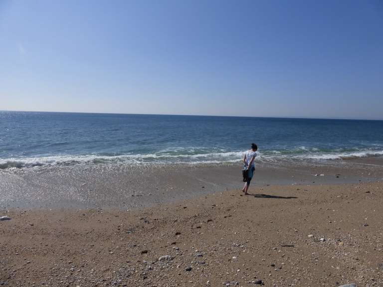
St Loy Cove is a gem: wooded and with mature gardens running down to the sea of the sort you might expect on a river bank further east. It is probably a very different prospect in a winter storm but today it was a delight. There was a small well alongside the path which we christened St Loy’s well since all wells are named after Cornish saints and thus holy.

p1070906
Bolders in St Loy’s cove

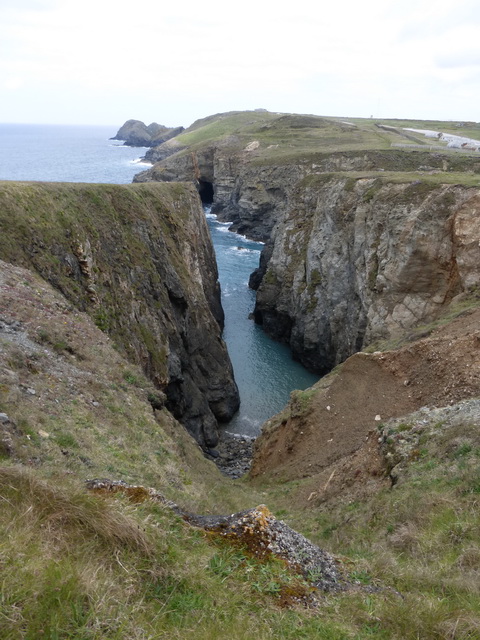
St Loy’s is very unusual cove as it consists of very large rounded boulders, scattered across the ‘beach’. there are two sorts: plain ones and others made of the usual golden stone of Penwith, familiar from Laura Knight’s pictures. How were they formed? Is this a particularly stormy beach where the stones have been rolled around and smoothed over the years? If so, how is it that the houses that cluster around the cove edge, directly facing the prevailing winds, have the most wonderful green gardens which have a luxuriance seen nowhere else along this stretch of coast? [Sept 2016]

Porthcurno 05Reaching the top of Merthen point we were delighted to see the wit of a local farmer who had erected a standing stone which reminded us of a monkey: perhaps a Japanese macaque or proboscis. [Sept 2016]

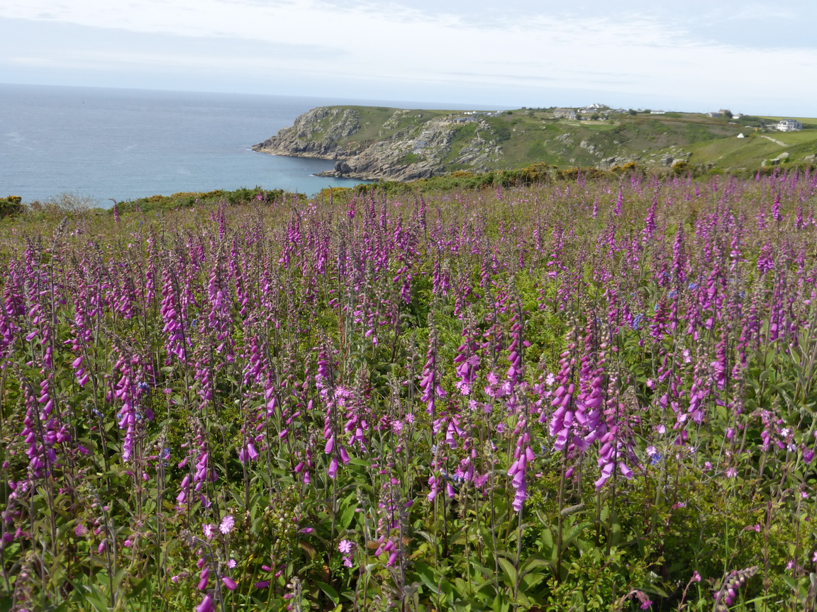
Walking on the cliff tops was easy and a sheer delight for the range of flowers. The bluebells were well past their best but the vegetation was turning to pinks and red. Thrift was joined by white, pink and blood-red campion. The foxgloves were in full flower and in places the dodder covered the top of the gorse like mat of red spiders’ webs.

Walking up to the cliff tops was another matter for the coves of Porthguarnon (especially) and Penberth had steps to test the fittest of legs.

Penberth
Penberth

Penberth is a delight, perhaps verging on National Trust ‘Model A – A Cornish fishing cove (with signs)’. It, and Porthgwarra further west, are the most evocative of the small fishing coves that must once have dotted this coast. Thankfully this one is still working with four cove boats drawn up on the slipway.

By now we had spotted that the colour of the water over the sand had changed to that clear azure which is completely transluscent and invites searches for glimpses of passing mermaids.

Logan rock
The Logan rock (on the right)

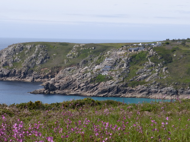
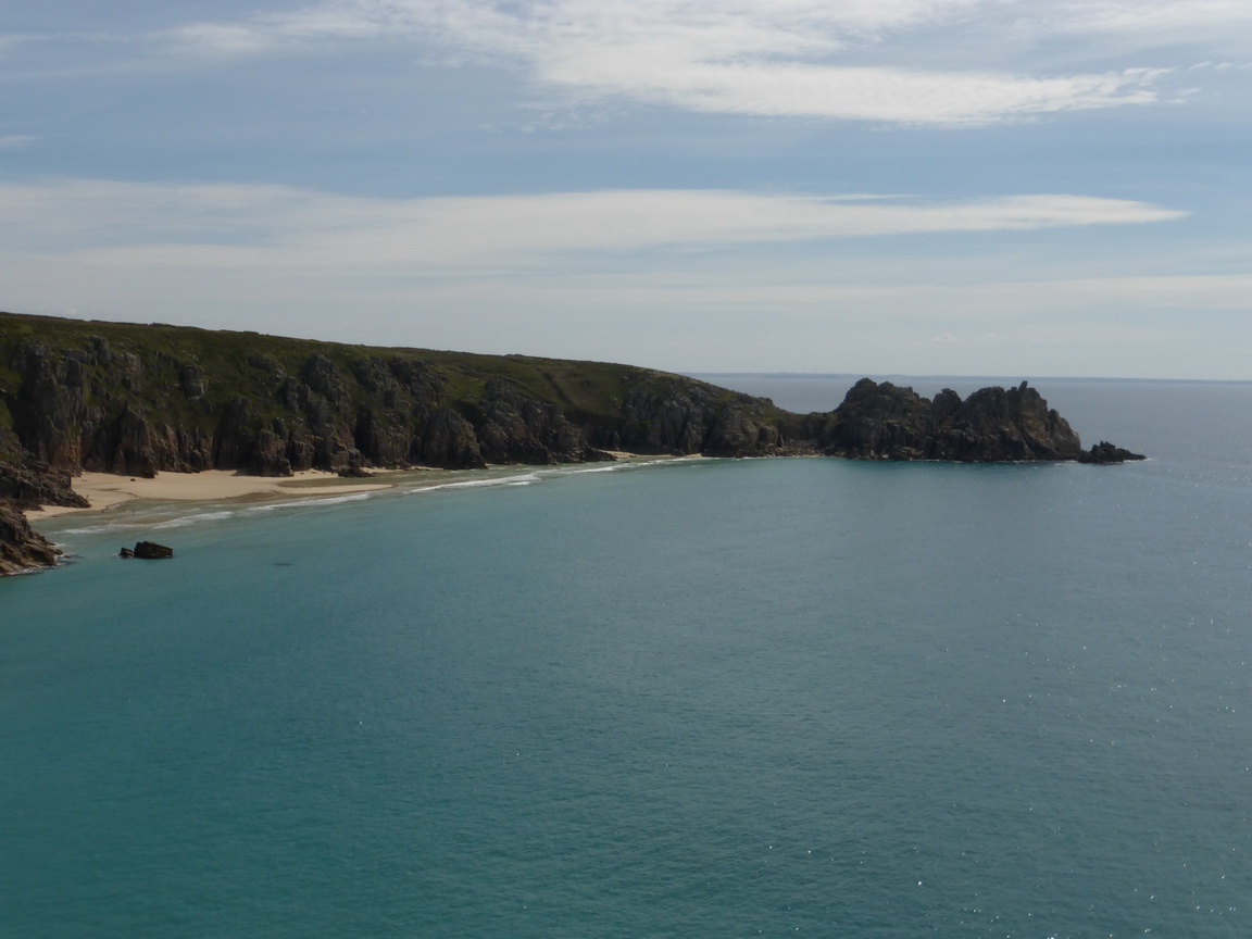
Climbing Cribba Head we came to the great C3 BC Iron Age fortress of Treryn Dinas and its famous Logan rock. The fortifications stood out clearly showing that it must once have been a mighty fortress indeed.

Very tame and proprietorial ponies were grazing the vegetation as we made our way to the rock itself. We eschewed the opportunity to set it rocking – it has never been the same since it was replaced in 1825 – and ate our picnics watching others attempting the feat.

Porthcurno 06
The Minack Theatre

In the distance the next great landmark was twinkling at us beneath a darkening sky: the wonderful Minack Theatre. Each step invited another glance and another photograph of Rowena Cade’s incredible creation which appears to sprawl down the cliff towards the great rock which gives it its name.

The beach below was uncharacteristically empty. Now one of the most famous and popular beaches of the peninsular, it is loved by all. In the distant past it was shunned by the local who knew all too well that the sewage outfall for the valley was on the right hand side of the beach, encouraging good fishing but making the water less enjoyable for swimming. How times change.

Porthcurno 14
The Porthcurno beach house

We passed the little shed where the trans-Atlantic telegraph cables come ashore: a wonderfully prosaic little shed for such an important task. The romantic names pinned up on small signs are all that hint at its importance.

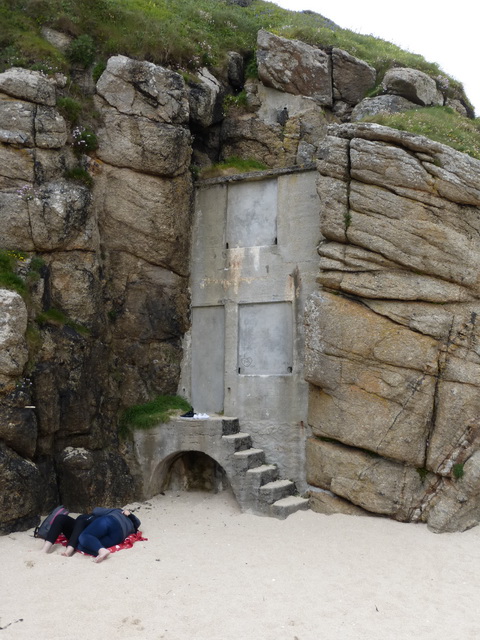
The little beach house, also constructed by Rowena Cade, and one of the few follies of Cornwall, is sadly neglected and cemented up. It was once open and damp like a deserted pillbox and a wonderful playground for children.

The steep steps up to the theatre provide one of the greatest coastal views anywhere: the Logan rock, an azure sea – no basking sharks today – and the clear clean bright sand of Porthcurno and Pedn Vounder beaches.

Porthcurno 01And finally, because it is always impossible to refuse, we added a few yards to our trip by wandering through the theatre itself where a performance was in rehearsal. ‘Behold the head of a traitor!’, ‘We are such stuff as dreams are made on …’ Echoes of past performances came flooding back. A home-coming indeed.

We walked about 7 miles in four hours and re-visited St Levan and St Buryan churches, the Merry Maidens stone circle and Boskenna cross on the way home.

Lamorna to Perranuthnoe

Mount 01
The Mount from Penzer point

This is surely one of the flattest walks on the whole cliff path for much of the curve of Mount’s Bay from Mousehole to Marazion is reclaimed land. It also contains a great deal of man-made surfaces: tarmac, concrete and then gravel.

There are not many walks on the coast path where you can pretty much see where you started when you get to the end. This is (almost) one.

It is spectacular scenery and we would very much recommend doing it west to east. In some ways it was as if one was attached to a gigantic bungy cord with St Michael’s Mount at its centre. It pulls you round the bay from the first sighting after rounding Carn-du, until, with the bungy at full stretch, it flings you around Maen-du and releases you into Perranuthnoe.

Lamorna
Lamorna cove

We parked at Lamorna, close to the Wink pub. The valley was greener than any valley could possible deserve to be, the light fresh greens of spring dappled by sunlight. The Open Studio scheme was on and Lamorna is clearly still full of artists. We were pleased to note Birch Cottage where Lamorna no doubt once worked. The rocks had the warm golden colour made famous by Laura Knight’s work.

The stretch of path between Lamorna and Mousehole was traditional cliff path stuff: winding, and over some high boulder steps. It was obviously Rosamunde Pilcher time for we met several Germans walking in the opposite direction.

Mousehole
Mousehole

Mousehole was as charming as ever although over-full of visitors over the half term. From here to beyond Penzance the surface is on tarmac or concrete.

We stopped for coffee overlooking the oldest pier in Newlyn, watching the fishing boats unloading their catches. Less consciously pretty than its neighbour, Newlyn contains some lovely traditional granite buildings. A very short detour into the Fradgen behind the fish market is highly recommended, especially if you enjoy the works of the Newlyn artists.

The promenade between Newlyn and Penzance was in the final stages of repair after the winter storms over a year ago. We passed the Queen’s Hotel and re-enacted ‘The Rain it Raineth Every Day’ (from memory) to show that it did not, then on past the Jubilee Pool Lido which is also still being restored.

Penzance 02
Penzance restoration

Every town has its ups and downs and we have plotted Penzance’s over the years. The number of people and developments around the waterside car park made it hard to believe that it was not heading upwards once again. Some of the restoration has even been quite sympathetic.

The walk around the railway station was hardly inspiring but it did remind us just how much money the Victorians had ploughed into the construction of the railway system we take for granted. The station is carved out the cliff and all the old marshalling yards – now mostly given over to light industry housed in depressingly cheap modern buildings – lie on reclaimed land, protected from a stormy sea. The engineering works to construct the station alone would be regarded as a large investment today but this was just the start of something which was going to stretch all the way to London.

Passing Long Rock we could see three church towers – Penzance, Gulval and Ludgvan and almost Paul – which is relatively unusual in a Cornish landscape. We could also see three large supermarkets which is rather more typical. At this point the going changes to gravel and the marshes open up on the left. The Mount gets ever closer.

Mount 03Marazion was even fuller of tourists than Mousehole. Being high tide, the Mount boats were shuttling back and forward as fast as they could, fetching and delivering people across the short stretch of water. We lunched where we could watch them before escaping back to the cliff path.

Eventually leaving Marazion, the path turns back into a ‘proper’ path and winds its way eastwards around the low headlands. An unusual view of the Mount opened up, with Penzance and Newlyn in the background.

Cudden
Cudden point

Cudden Point started to dominate the view. Long known in the family as the sleeping dragon, its nose was well down in the water, watching for invaders. The sight of very familiar landmarks like Acton Castle drew us on and we rounded the corner into Perranuthnoe and a welcoming cup of coffee after four hours and 11 very easy miles.

We visited Perranuthnoe (where one set of our parents were married) and Paul churches on the way home.

The Gannel to Mawgan Porth

We resumed our walking on a unwisely-chosen day as the mist was down and we could barely see the beaches at the bottom of our cliffs. In some ways this was an advantage for we started in the middle of Newquay, eventually finding the end of the footbridge we had visited on our previous outing. It was hidden away in an anonymous and dull housing estate on the edge of Pentire where parking was positively discouraged.

Newquay is not famous for its architectural splendours. Sadly, many of its buildings are dull, cheap, functional, or have been rendered inelegant by the demands of business. Around its historic core, the town has sprawled with guest houses and businesses essaying a hard-to-believe jollity climbing over each other to attract customers.

The town was a late C19 speculative construct. A slump in usage of the rail line from Par for goods and a switch to passengers, helped the town to develop a tourism industry. Silvanus Trevail then worked out plans for a model resort – plans which were never fulfilled – and business took off. How unlike Portreath which also had a railway of sorts but was not connected to the main line and therefore never made the jump to a railway-borne tourist.

P1020909
Modern housing for surfers which might as easily be in Marbella

Trevail was responsible for the three great hotels which are the landmarks of the Newquay skyline and which would never be allowed today: indeed, in 1933 the CPRE apparently argued for their demolition. They could have put their efforts into spreading the indiscriminant sprawl of the town with its muddled and often low quality architecture.

The decline of the ‘English seaside holiday’ from the end of the 1960s could have been the final straw for Newquay’s 100 year-old tourism industry but the surfing industry has given it a new lease of life. Sadly, this has not brought high quality. In some ways, the result is a reminder of how ineffective our post-War planning laws really are: unable to prevent low quality sprawl and the voracious appetites of red-blooded commercialism.

P1020904Walking through a town like Newquay was never going to be our ideal for a coast path but we were pleasantly surprised at some stretches. The route attempts to follow the coast through the town following a litany of famous beach names: Fistral, Tolcarne, Lusty Glaze and Porth.

In some parts one would not actually know you were in a town at all thanks to the golf course which kept buildings well back from the cliff edge or because the path was below the cliff edge itself. The cliffs and beaches themselves were indeed spectacular, as far as we could see them.

P1020906
The huer’s hut

It was very early in the season but fun and games were clearly starting: coasteering, surfing and setting up for a beach festival of some sort. Whoops of glee came through the mist from the participants.

We were pleased to greet the huer’s hut but were unable to take advantage of its telescope which promised a 10x magnification of the view – of the mist.

These thoughts occupied us as we tramped past restaurants offering Indian, Portuguese, Greek, Turkish and Australian fare. It is 90 minutes of the coast path that have to be endured. Signage through the town was very patchy with stickers on posts being almost the best on offer.

It was a relief to reach the open spaces beyond Porth and Trevelgue Head, noting its mighty Iron Age fort in passing, where the town ends abruptly and the great expanse of Watergate Bay (allegedly thanks to the mist) stretches out northwards.

P1020910A long classic cliff-top stretch follows with the geology gradually changing to a shale or slate.

Passing Watergate Bay hotel we noted the new development of modern chalets crouched into a narrow valley. At least this architect had been prepared to think through the landscaping and materials, covering the roofs in grass. Serried ranks perhaps but preferable to anything we had seen so far.

P1020912
Griffin’s Head fort – the ramparts

The arrival of Griffin Head gave us some satisfaction and we explored the remains of the ramparts of a small Iron Age fort which was not on the same scale as that at Porth.

Mawgan Porth appeared through the mist, its mighty beach empty of water at low tide and we returned to our waiting car.

8.5 miles in about three hours of walking left us wanting more but next time we will do it in bright sunshine.

Visits to St Mawgan and St Columb churches completed our day out.

Perranporth to The Gannel

P1020755You have to love sand for this stretch of the cliff path; and it helps if you do not expect attractive architecture.

Leaving Perranporth is the best way of visiting as you do not have to look at the surfer-dude and concrete block ‘architecture’ for too long. Several of the towns on this north coast seem to have a generous layer of sand throughout their streets which helps to remind one what they are really here for.

P1020757Passing some early-season surf lifesavers practising in the surf and many dogs being walked, we found the path rose up onto the top of the dunes. It was not for long, however, as it soon dropped down onto the beach of Perran or Penhale beach sands and we had a straight walk on the firm sand. This is a lovely stretch provided you can find firm sand to make the going easier.

Being down on the beach, one does not realise how large the dunes are behind the cliffs: about a mile inland of rough grass and sand. It was on this beach that St Piran surfed in on his millstone, climbed the cliffs and established his oratory and chapel. We were too focused on the walk to take a detour and left that visit for another time.

P1020761 P1020763 P1020762Approaching Ligger Point there were signs warning us of a military danger area. A decayed camp appeared on the cliff top, cheek-by-jowl with some lovely ‘smuggler’ caves in Hoblyn’s Cove. A mysterious bunkhouse, said to be part of GCHQ, was accompanied by an almost artistic aerial on Penhale Point.

Holywell Bay continued the sandy theme. It is more compact than Perranporth but a lovely sandy bay with some very dull modern holiday homes in the village. One day there will be a (Cornish) law that such buildings cannot be left in concrete grey but must be white or some other traditional colour. Dull architecture is all very well but why compound the problem by getting the colour wrong?

P1020770This is the point at which one really, really has to love sand for the climb out of Holywell Bay was worthy of an Arabian dune. Eventually, we reached firmer footing on the open cliff top where the thrift was flowering in profusion with a small scabious-like blue flower we could not immediately identify (later suggestion: sea squill or scilla verna).

These accompanied us all the way to Crantock Beach where the path once more crossed some grassy dunes and the way was decided by luck more than signage.

P1020771P1020772
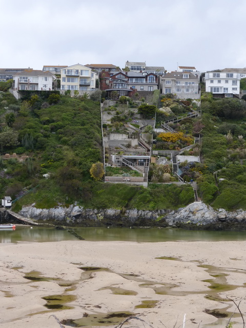
Emerging on the banks of the Gannel, it was clear that we were approaching civilisation for the opposite – Pentire – bank was filled with smart houses whose estates tumbled down the steep cliff. Different solutions were adopted by the owners: meandering paths through vegetation, smart lined lawns to rigid modernity. We pondered on how often they carried food to the ‘sitting areas’ at the bottom of the hill, only to find that they had forgotten the salt, or wanted another drink.

Our path, devoid of modern buildings, led us through a whole field of cowslips where we lunched.

It was a short walk to Penpol creek and a low-tide crossing place . As the tide was out we were able to cross some strangely fluid sand and then cross and re-cross the small footbridge which is under water at high tide. We thus demonstrated that we had reached Newquay which will be a later starting point.

Honour satisfied, we returned to our car, ticking off another 9 miles of the Coast Path (over 10 miles on our gps). On the way home, we stopped off at Crantock and Cubert churches.

Porthleven to Praa

P1020537We were sure that we had walked this stretch of the coast path before but could not quite remember doing it together. So we set out on a day which was meant to be dry but turned out to be wet mist: what is known in Cornwall as claggy.

Leaving Porthleven, it was good to see the Institute at low tide and without the storm surf that appears to engulf it in a good blow. Less good was the large encampment on the fields leading down to the cliff path: a festival had been happening the night before and there was a large tented village. Occasional grunts could be heard emerging from under the canvas. P1020536

Mind you, the residents of Porthleven had obviously been enjoying a festival of their own for this lady was lying on the slipway. We have known Porthleven for years, from back when most of the buildings around the harbour were derelict. Now they are all in thriving use, crowned by the appearance of a Rick Stein cafe. The town is definitely on an up.

P1020538Just out of town, we passed a cross to all those sailors who had been lost on this coast (see earlier posting about Loe Bar). It was apparently not until 1808 that drowned sailors were guaranteed a burial in consecrated ground. It would be good to think that this was for political correctness – to ensure that Catholics, Muslims or heathens did not find themselves lying in good Protestant ground – but knowing those times, it would probably have been more about who paid the cost of the funeral.

The going was easy and we enjoyed the thrift and other plants which were in flower in profusion. There is no need to go to a wood to see a good display of bluebells for the cliff was covered in them.

P1020542The cliffs here are steep but crumbling. Managed retreat seems to be the order of the day. The beaches below were covered in a multiplicity of differently coloured stone: greenstone, granite and even some unidentified white stone.

P1020548

One wonderful feature is known as the Camel or Bishop. Somehow, we preferred to update it to the meerkat, its paws tucked firmly to its chest, on the look out for any passing ship in peril.

AP1020553pproaching Trewavas Head, we delighted in the engines houses which rival the Crowns at Botallack for their precarious position on the cliff edge. Signs warned us that choughs were nesting here. It is good to know that they are no longer confined to an unspecified, and deeply secret, place on the Lizard, but are spreading to other parts of the Cornish coast. The black birds that we saw were, of course, simply black birds: not a red beak or foot to be seen.

P1020552Moving on, after a little snack, we arrived at the familiar sight of Rinsey. This is surely the craziest siting of a house on this coast. Perhaps they thought that if they built any further back from the edge then someone would build in front of them and steal their view. On the other hand, we speculated, with caves below and in a mining area, perhaps the house has an elevator or staircase straight into the cave below to make smuggling easier. The plot for a re-working of ‘The House of Adventure’ started to develop in our minds …

We reached Praa – not one of Cornwall’s greatest architectural gems – with ease. We had walked a mere 6 miles in two hours and the weather was beginning to close in. We stopped off at Germoe, Breage and Sithney churches on the way home.

Carne to Porthallow

P1020436What was planned as a short walk to ‘fill in’ a gap we had not covered actually turned out to be a rather fuller day than we had planned.

Getting to the start line at Carne on Gillan creek is something of an adventure in itself, involving winding lanes, many with grass down their middles, and several abrupt stops. But it is worth it for Gillan creek with water in it is even lovelier than the Helford river if that were possible. The swans and some shelduck were dabbling about as though they owned it which, of course, they do.

We followed an inland route to Gillan which is an option involving a steep hill climb up a road and probably best avoided. It does take a sharp eye to spot the start of the path at Carne, though, as it is hidden under a large horse chestnut tree.

P1020437Once past Gillan itself, the going was very easy over springy turf towards Nare Point where there is an National Coastwatch Initiative lookout: surely one of their more remote, even by their standards. Gurnards Head perhaps rivals it and has less shipping to watch.

This is an area of confusions for this side of the water is a St Anthony in Meneage, a Flushing and a Nare Point. Across the bay and just visible are St Anthony in Roseland, Nare Head and, just hidden behind Falmouth, the original Flushing itself.

P1020440During WWII, Nare Point was the site of a dummy village complete with lights turning on and off to try and confuse any enemy bomber into thinking it was Falmouth, an easy mistake to make in the days before pinpoint navigation. In earlier times, the point was even considered for another Henrician castle to match those at Pendennis and St Mawes, no doubt protecting the entrance to the Helford. Perhaps it was dropped for it would be a bold captain who attempted to bring a large ship into the Helford, unless, that is, he was a Frenchman on his way to Frenchman’s Creek.

P1020442From Nare Head the going to Porthallow was easy, along a very typical cliffside path, the destroyed side of Pol Lawrence cliff and the Cornish Sea Salt factory visible in the distance.

It was a simple matter to drop down into the cove where we rewarded ourselves with a cup of coffee, admiring the determination of the ‘Pralla-ians’ to keep things as they are. The reference to the Mohegan and Bay of Panama relates to two famous wrecks on the Manacles a few miles south, involving much loss of life. Many of the survivors were brought into Porthallow cove.

P1020435About 3.6 miles in just over an hour did not seem like fair game and so we extended the day with a cross-country return and a visit to the beautifully sited St Anthony in Meneage church, making a day’s walk of just over a respectable 10 miles. We liked the idea of speeding swans but never did find out what bender the cignets (sic) were on.

Lizard to Gunwalloe

P1020304The continuation of the bright weather tempted us out again to link up our recent walk to Gunwalloe to one we had done earlier from the Lizard. The sun was shining brightly and the light wind came at us across the land from the east.

This was a really lovely walk along some pretty remote stretches of coast where we saw few people. The going was easy: fresh bouncy turf with heathland on our landwardKynance 1020305 side. The sea was calm and as clear and blue as one could wish.

The first delight was Kynance Cove: little more than a narrow spit of sandy beach linking a large rock to the mainland. Balanced precariously at the bottom of the cliff is a small and popular cafe. It is hardly surprising that the cove is so popular when it can look as beautiful as it did for us. Kynance 1020306

We could not dally to enjoy the sight and headed onward across the cliff and down a steep drop to Soap cove. This is a long narrow inlet where the tide was turning over in a desultory fashion and we could easily imagine a small boat running contraband ashore. Or had we been watching too much Poldark again?

Climbing up the other side deserved a reward and we sat down, to admire the Predannickstunning view, wondering why we should bother to carry on. But we did.

Predannack airfield was to our right and we found ourselves sharing the peace and solitude with a helicopter which was doing circuits and bumps over the airfield, or possibly keeping a watchful eye over us should we be contemplating some illicit activities.

In the distance loomed a distinctly un-Cornish sight. We are more accustomed to cows, barns and the occasional farm. The vegetation, accustomed to the prevailing salt-laden winds, could raise itself only a few feet above the land. Windyridge Farm, perched just back from the cliff seemed aptly-named.P1020312

Rounding Predannack Head, we came upon Mullion island which provides some slight protection to the little harbour. This led to a discussion as to when a rock becomes an island. If it involves the ability to live on it then Mullion island certainly qualifies although it would be a brave soul who chose to do so.

P1020308The going, by now, had the air of a National Trust-cared for estate with stepping stones and helpful advice on signs. We were clearly approaching civilisation again.

The drop down into the cove was steep but the charm of the cove is considerable and we sat eating our lunch, admiring the recent repair of the harbour wall, watching visitors walking to the end, looking over and re-tracing their steps. It would be good to say that the building work being done to the cottages was as historically acceptable. Sadly, we felt that they might be being altered to the detriment of the natural charm of the little cove. It remains to be seen.

The climb out of Mullion cove was steep and took us up to a large white building which, inevitably, was a hotel: the Mullion Cove hotel. Large blocks such as this were built all along the coast in the days before planning conditions which would not allow them today.

P1020317This was a tough part of the walk, involving several descents – which are the easy part – and then steep ups. The first one was the descent below the ‘large white’ Polurrian hotel, down a set of steps which became spine-shuddering as much as anything because of the large drop entailed with each one. We walked them in the opposite direction later in the day and quietly cursed their creator who clearly had longer legs than us.

Throughout the walk we had been enjoying the wonderful flowers which were shining with all their might. The thrift was in luxuriant flower, creating great carpets of bouncy vegetation which invited relaxation.

MarconiAs we approached the top of Angrouse hill, we could see a large monument on its crest. This was Poldhu where Marconi carried out his famous experiments which culminated in the message to America and then to the South Atlantic. A humble field alongside the path was where the aerial had been erected. I looked at the mobile phone in my pocket which seemed a far cry from those early days, just over 100 years ago, when he achieved so much pioneering work from this remote Cornish cliff.

In front of us was another large white building, presumably once a hotel but now converted into a care home: another home for old people to look at an empty sea in an inaccessible place.

Crossing Poldhu cove was easier on the legs and we soon found ourselves looking down on our destination: the much photographed little church of Gunwalloe which we had visited a few weeks before. Touching the church closed the loop and meant that we could claim to have completed the Lizard to Porthleven stretch. It deserved an ice cream before we set out to find our car.

We had walked  over 8 miles in a just under 4 hours.

Gunwalloe church P1020315

Godrevy to Hell’s Mouth

The problem was that we could remember leaving Portreath on foot, but could not remember arriving at Hell’s Mouth up behind Godrevy point. There was no alternative, and on a sunny but windy day we set off from Portreath again to see if it jogged any memories.

P1020298The climb out of Portreath was steep but, once up on the top, the going was wide open and flat. This was an area under agriculture right up to the edge of the cliff: easy going.

Fairly soon we came to the horse which we first identified as looking more like a cat. This is just one of the many collapsed pieces of cliff on this section: great chunks of green appear to have been broken off by a giant. More likely, they have been undermined by the great storm seas of winter.

P1020301A couple of nasty downies and uppies tested our muscles and endurance but if a Jack Russell and Labrador could do it then so could we.

We missed Crane castle – finding cliff castles is not easy when the gorse is thick – and marched on across Reskajeage downs which were fairly featureless, the views east and west making up for the dullness of the cliff top vegetation. The path was flat and dry, and easy to follow with no surprises.

Just as we were getting into our stride, we found ourselves at the Hell’s Mouth car park where our car was waiting for us. On the way, we had found where we originally turned off on a circular walk through Tehidy Woods. Importantly, however, we could now say that we had covered the stretch from St Agnes to Godrevy without any sense of cheating.

P1020299 P1020300

Porthleven to Gunwalloe

P1020130There is no better time to be on this stretch of the Coast Path than on a bright sunny day. The walking is easy and the proximity to the sea makes it a joy.

What one forgets is that this coast was feared by sailors of tall ships. The prevailing wind is from the South West and a large sailing vessel could easily find themselves unable to sail to windward, out of Mount’s Bay. If so, then they stood little chance of survival in a storm. The wind would drive them straight onto the lee shore: the long expanse of sand known as Loe Bar.

P1020126It was the wreck of HMS Anson which moved Henry Trengrouse to invent the ship-to-shore rocket carrying a light line as a precursor to a rope. This technique, so simple in concept, eventually led to the saving of many lives.

Loe Bar itself was once connected to the sea and was the entrance to the harbour of Helston. The harbour silted up and the Bar formed, leaving a fresh-water lake behind it. The remnant of the original river is now a boating pool near the old cattle market beside the A394 in Helston.

The two miles from Porthleven to Gunwalloe fishing cove is a single beach of sand, still famous for its steep shelving undertow which has taken lives even recently. At its end, a small open space pretends to be a cove which still retains some vestiges of its fishing past.

Beyond the fishing cove, the land rises over Halzephron cliffs.

P1020127

What a lovely word is Halzephron. According to the equally lovely pub, it is derived from the Cornish words for strong wind: hardly surprising given that it is face-on into the prevailing wind and that wind has crossed the Atlantic, undisturbed.

Over the headland, it was a short walk to the objective of our walk: the glorious church of Gunwalloe, surely one of the most televisual of churches in the county having featured in series from Wycliffe to Poldark.

P1020132

Apparently tucked into the back of a sand dune and with a beach on either side, it looks as though it might be overwhelmed during any storm. Its separate tower is all that holds back the sand.

A tour of the church was essential before heading for the pub for lunch. Then the return journey which included the mandatory paddle on the very edge of the sea on the Bar, the soft sand crunching beneath our toes.

P1020145

One answer to the problems of shelter on this coast was the creation of the tiny Porthleven harbour: somewhere a ship could tie up in safety. It would be a brave captain who attempted to take his ship in through the long arms of the entrance in anything other than a calm sea for it is far too narrow and dog-legged.

Really good walks contain a pub and church but this time we went one better: ours ended with an ice cream on the Porthleven harbourside. What a day.

P1020147

Lizard to Dean Quarry

A sunny Sunday tempted us onto the South West Coast Path once again. As we are trying to link up a number of short walks, we had planned a stiff walk from the Lizard up to Dean, or Porthoustock, quarry.

The journey started by the exquisite St Wynwallow at Church Cove, surely the most southerly church in Cornwall, with its calm interior and serpentine lectern.

Leaving the cawing rooks, we headed onto the lovely cliff path which wound its way northwards.

It was a lovely time of year with the vegetation emerging in yellows, whites and blues. The blackthorn was in full blossom, the wild garlic a profusion of white; the gorse and primroses in yellow and the bluebells out. In places, the red campion was starting to appear.

P1020389The route was a delight: high cliffs and a calm sea hundreds of feet below. Once we had cleared the area of the Lizard we were fairly solitary and could walk along the cliff’s shoulder on a dry path.

Small cove after inaccessible small cove hinted at the opportunities for landing contraband late at night. It would be a steep climb with brandy for the parson on one’s back. Or had we been watching too much Poldark?

P1020394Our first sign of population was at Cadgwith, surely the most photogenic and famous fishing cove, tucked into a corner facing east: everyone’s idea of a Cornish fishing village from generations of calendars and chocolate boxes.

The reality of life is very different of course but on a sunny day it is hard not to enjoy the illusion of tranquility.

P1020396Shortly afterwards, we passed the tiny Poltesco cove, once the centre of the serpentine industry but now a calm ruin close to the beach. The National Trust has tidied the place up and add a charming bridge, bench and the obligatory explanatory panel.

A long trek on a south-facing cliff followed, relieved only by the existence of the large sandy beach of Kennack Sands where large Britons did what Britons do on a beach: sit on picnic chairs and wrap themselves up in rugs or behind windbreaks.

P1020401Close by was one of the less welcome eyesores of this part of the coast: a staggeringly unimaginative holiday camp. Seen from a distance it looks like a serried rank of simple ‘units’, each of which has its own balcony: to keep the occupants in or other guests out being unclear.

From the air, the true horror is revealed.

It was something of a relief when someone pointed out a basking shark out in the bay as it turned our attention from the land.Kennack

The stretch to Black Head was the most remote of the walk. We saw few people and enjoyed the proximity of the gorse-laden heathland that spreads northwards towards Goonhilly. A tiny valley garden was an unexpected bonus with camellias, azaleas and even clematis in flower, protected form the gales in a fold of the land.

P1020404
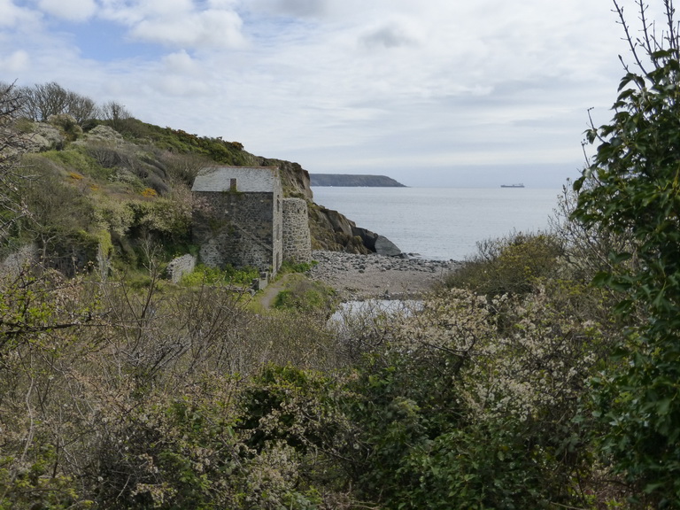
Approaching Chynalls point we could see yet another large white ‘former hotel’ now converted to some other use, probably a care home. This promoted us to wonder at the way we put our old people in remote places with empty views of the sea when it might well be company and activity that they really desire.

P1020405Coverack is no Cadgwith and is something sub St Mawes in style but the houses were immaculate in the heart of the village and most managed to retain a genuine Cornish architectural style. The words ‘second homes’ and ‘holiday homes’ were on our lips.

Leaving Coverack, we headed onwards around the aptly named Lowland Point. Here, the landscape changed dramatically with the path no more than a few metres above the beach on a wide area of raised beach covered with large rounded boulders. This was not an attractive area of the path and we recalled the walk from the other direction, past quarries and destroyed landscape.

Just before the quarry, we found a familiar path and headed up around the excavations and back to our car.

We had covered 12.2 miles in 4.5 hours.

P1020392
The devil’s frying pan close to Cadgwith
P1020400
An imaginative bench at Poltesco
It is impossible to pass Cadgwith without taking a photo
It is impossible to pass Cadgwith without taking a photo and so here it is

P1020407

P1020406
Coverack

P1020398