Category Archives: Walks

Freathy to Cremyll ferry

151010 Freathy to Cremyll 02Being a two day walk, we stayed in the area. This allowed us to make an early start which was lovely. The cool morning mist was still clearing, the sun breaking through the clouds and the clear early morning area filled our lungs as we set off from Freathy on our last leg of the south Cornish coast.

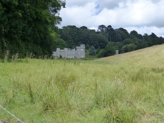
Trying to get a meal in a pub the night before we had been turned away from several pubs because ‘the wedding’. We never did discover whose but it was good to know that business was still brisk in October.

151010 Freathy to Cremyll 03
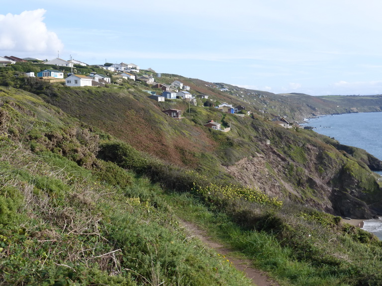
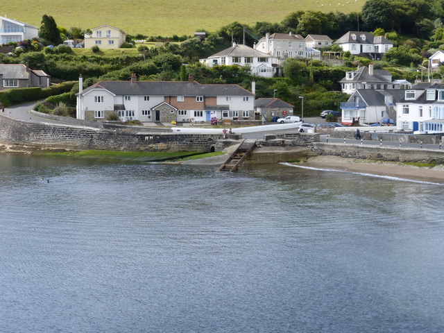
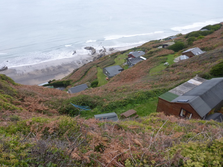
The shack-land continued as we walked along the cliff beyond Freathy, the military road our constant companion, following the contours.  The open-air nature of these, with their little patch of green seemed so much more appealing and genuinely ‘green’ than the rows of houses at Looe, Millendreath, or Downderry. It was as though the planners were refusing brick and stone; well done them.

151010 Freathy to Cremyll 07
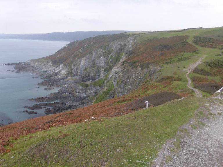
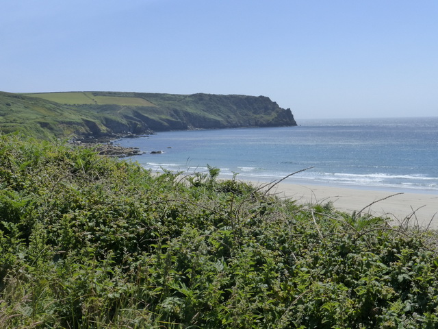
In the distance loomed Rame Head and, tucked underneath it Polhawn Fort, scene of the big wedding. In no time, we were crossing the Iron Age ramparts and climbing the slopes up to the little chapel of St Michael on the headland. Here, the remains of a very exposed WWII anti-aircraft battery sat alongside a possibly Norman chapel within an Iron Age fort.

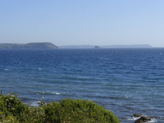
In the distance, the shadowy shape of another place – we think it must be Devon – stretched into the distance. Somewhere out there were Start and Prawle points, scenes of childhood memories for some.

151010 Freathy to Cremyll 11Shortly after the Head, we turned inland for a brief detour to admire lonely Rame church with its little spire and restrained woodwork.

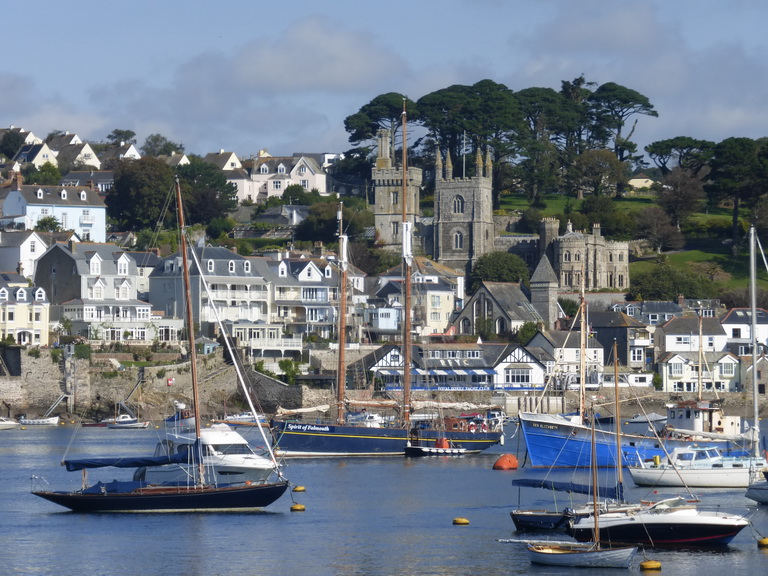
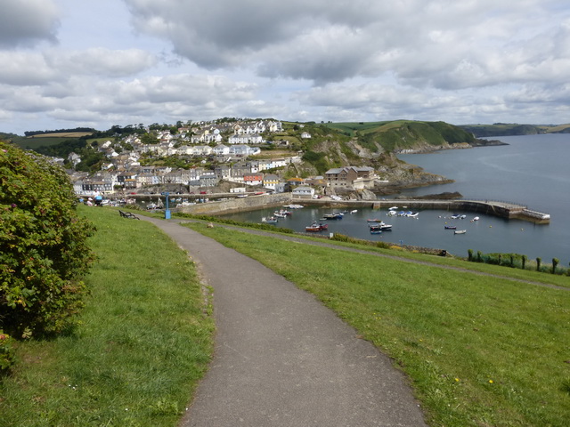
Onwards, around Penlee point and the twin villages of Cawsand/Kingsand hove into view. Cawsand is dominated by the mighty bulk of a former fort, now converted to flats, which hovers like a spaceship over the tiny harbour.

151010 Freathy to Cremyll 15On the harbourside we admired the institute building, a smaller twin of that at Porthleven, which was almost undermined in the great storms of February 2014. From here it was a step to the former boundary (until 1844) between Cornwall and Devon at Devon-Corn house.

By now, we were all too aware that the colour of the geology had changed again. The familiar red sandstone of Devon was everywhere and  it was understandable why Devon once thought that this areas should be theirs. Despite the close-packed houses and narrow lanes, this no longer felt like Cornwall and the view of bits of the city in the distance hinted at the real loyalties of the area.

151010 Freathy to Cremyll 27An easy walk along low cliffs brought us to the last large fort at Picklecombe, which has been converted into flats and apartments in a way which betrays its original shape and feel.

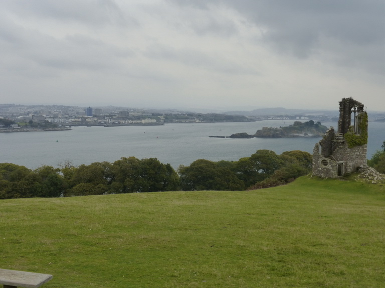
Around the corner was the first sight of the city across the water as we entered the enormous Mount Edgcumbe park. The contrast between the close-packed houses, tower blocks and defences of Plymouth and the rural nature of the landscape through which we were passing, was very marked.

151010 Freathy to Cremyll 29We passed a succession of small ruins and follies and made another brief detour around the back of the less-than attractive red stone house before descending though incongruous and distinctly un-Cornish formal gardens.

From here it was a step out of the park to the Cremyll ferry where we rewarded ourselves with some lunch and well-deserved refreshment at the Edgcumbe Arms. We had walked about 9.5 miles in 3.75 hours of easy walking.

151010 Freathy to Cremyll 35And so we had reached the end of the beginning, or was it the beginning of the end? We had completed the south coast of Cornwall – but for one tiny bit of about 500m which remained on our consciences. Our attention will now turn once more to the unwalked sections of north coast which is said to be rather more in the ‘challenging’ category.

Looe to Freathy

151009 Looe 01
Looe from the east

Another series of social engagements and guests prevented us from making the most of some lovely September weather but we managed to get out for two consecutive days to complete the south coast.

We had left off our story looking at a loo in Looe and this is where we re-started our journey. It was October and we were not expecting scalding heat, a suntan or azure blue seas.

We had not altogether  taken to West Looe which appeared to straggle with little character. East Looe had a heart clustered around some narrow streets worthy of Mevagissey or Mousehole.

151009 Looe 05
Millendreath holiday village

Once we found our way out of town, we followed another straggly ribbon of houses along the cliff to Millendreath. This small beach was not an architectural gem having been colonised by a soulless holiday village of cheap houses.

A diversion – an unsafe cliff – took us through a narrow shelter belt of trees cunningly disguised to be woodland path and a short bit of road before we were once more on the cliff top, passing the monkey sanctuary.

151009 Looe 04
Looe island from Millendreath

The vegetation had changed since we had last walked. Now the dry brown leaves of oak, sycamore and beech were beneath our feet. The blackberries which had not been eaten by passing walkers, were coming to an end. The sloes were ripe on the bare wood of the blackthorn. Near houses, Michaelmas daisies were in full flower but the hydrangeas were coming to an end.

There was a distinct feeling that autumn was approaching. A weak sun shone all day: perfect conditions for walking.

151009 Looe 13
Rame Head

The sweep of Whitsand Bay to Rame Head would be our companion all day. It was one of those walks where you can see your start and finish points throughout the day. The underlying rock was slate which had created black and grey beaches rather than the golden sand we expected.

Our next stop was Seaton where we took the opportunity to sit on a seat and have our late morning coffee. Like Millendreath, it was not going to win many prizes for architecture.

151009 Looe 16
Portwrinkle

A long and glorious stretch took us to Portwrinkle. We had heard that it did not live up to its charming name but we found otherwise. The houses clustered around the tiny harbour seemed thoroughly traditional and well-cared for and good enough to excuse the straggle beyond. The hotel and golf course … well, there has to be a hotel somewhere.

Cresting a rise, we had our first view of distant Plymouth, a complete contrast to the rural landscape through which we were walking.

Before long we were being warned that we were entering a danger area. Approaching the Rame peninsular proper, one is constantly reminded how this area has been in the vanguard of defending Plymouth with a string of fortifications, batteries and forts from Palmerston’s time (1850s and 1860s) to World War II.

151009 Looe 21
Tregantle fort

The first and largest of these on this walk would be Tregantle. The cliff edge below this has been converted into a series of firing ranges. Thankfully, we were able to walk in front of the fort for there was to be no firing today.

Only a few mysterious and very much C21 semi-camouflaged objects suggested that this was a military site. They were gone by the following day.

151009 Looe 23
Freathy

It was only a step from here to our car, parked free at Freathy despite Cornwall Council’s conviction that we might want to spend vast sums in their car park.

Here there was a complete contrast to the straggle of Looe: a series of sheds or shacks clung to the cliffside at the top of a steep cliff, with some gentle waves breaking on golden beach below.

There was something simple and appropriate about these shacks which were almost universally in wood or look-alike wood. They felt like holiday cottages should, where life could be lived inside and outside with gorse and bracken as the garden wall.

We had walked 11 miles in 4.5 hours and felt good. Described as ‘strenuous, moderate in places’ in the guide we had felt it nearer ‘moderate’.

We headed off to find some churches: Hessenford and St Martin by Looe.

Polruan to Looe

P1040321
Fowey

After an August off enjoying the company of guests we were feeling in need of a good walk and chose a wonderful sunny September day to re-start our journey.

We started in Polruan with a last look across the water at Fowey with Place and St Fimbarrus looking peaceful in the warm sun. We set our faces eastwards and rounded the headland, away from civilisation.

The book had assured us that this would be ‘strenuous … a connoisseur’s section: it is quiet and remote; it is scenic, with beautiful large sandy bays and smaller coves plus impressive headlands … it is quite hard work …’ We agree with all of that and underline the last bit. A friend had warned us of some ‘killer coombes’. Put simply: you have to like steps.

P1040323
Lantic bay

For the first part of the walk, the view westward was familiar: the striped landmark on Gribbin Head and the stretch of St Austell Bay to Black Head and the Nare had been with us for many miles. Ahead of us was Lantic Bay which lay with its two little beaches completely peaceful at the base of Pencarrow Head.

We braced ourselves as we approached West Coombe, expecting the worst but simply found the delights of Palace Cove and Parson’s Cove, muttering ‘smugglers’ under our breaths. Lansallos church winked at us behind some trees but the extra 1km there and back early on what was to be a long walk seemed too much to bear.

P1040326It was lovely walking though: ‘country’ rather than ‘bush’ and with some delicious ripe blackberries. Below us the sea was a millpond and the characteristic clear blue of a sunny Cornish day.

At East Coombe, we began to learn what the path could do. Steps down and up again stretched in front of us. It was a long and slow climb up the steps on the other side, past a large landmark indicating an offshore rock. The bell buoy in the distance tolled ominously as we ascended the staircase.

The going became a bit easier thereafter but with regular stretches of lung-busting steps. As the path began to turn the corner, we expected Polperro to begin to appear. The only hint was the occasional fishing boat packed with tourists which seemed to disappear into the cliffs. A small white marker on a distant rock suggested that something might be hidden away.

P1040329
Polperro

The entry into Polperro was splendid: sudden and surprising. One moment there was nothing other than a gradually widening path, the next the full glory of a quintessential white Cornish fishing village appeared in front of us.

Like many such places, it is mandatory to take the same photograph as everyone else from the same vantage point. None of them can capture the sounds: the screech of the seagulls demanding food and attention, drowning out the call of the boatman, gathering their flocks of tourists.

Polperro thinks of itself as the former capital of smuggling thanks to the history of Zephaniah Job, the so-called Smugglers’ Banker. His story has been told, re-told, embellished and swallowed by many an eager – or gullible – journalist or presenter, usually in return for some liquid refreshment. We did not add ourselves to the list but simply enjoyed the sun.

After a break for lunch we headed eastwards once again, thankful to be leaving some of our fellow human beings, some of whom we suspected would have found the going well beyond their capabilities.

P1040347
Talland bay

Almost immediately we found ourselves on a diversion away from the cliff route. The ‘elves’ had arrived before us, declared the cliff unsafe and had created a diversion around a smart and exclusive-looking house onto an immensely dull, straight and steep metalled road which we followed down into the behind Talland beach. The air was blue with imprecations at the presumed selfishness of the owners and the lack of initiative being shown by the authorities in restoring the original route.

A short diversion to Talland church was well worth the effort. It is only a field beyond the path and had much of interest, not least a tower which appeared to be half buried in the hillside.

P1040349
Looe or St George’s island

Rounding the corner, Looe or St George’s island came into view: once the home of Benedictine monks and one of the fabled arrival sites of Jesus and Joseph of Arimathea.

In the distance the ghostly outline of Rame Head reminded us how close we were to the end of our south coast journey. This bay will be our companion for the rest of our trip.

It would be good to say that the entrance into Looe was as much of a surprise and delight as that to Polperro but sadly not. Marine Drive through Hannafore stretches like a white housing estate transplanted from Surbiton with sadly modern houses, smart lawns and the inevitable tennis, bowls and boules club which invited blazers and smart dresses.

P1040352
West Looe as seen by ‘Nelson’, a former resident of the harbour

East Looe as seen by ‘Nelson’We tolerated, rather than enjoyed it, especially as the pavement was littered with sun-worshippers in deck chairs, who had spilled a few yards out of their cars, removed clothing and turned too much bare flesh to the afternoon sun like so many beached walruses.

The twin towns of West and East Looe are not in the same league as Polperro and are strangely modern. We sat discussing architectural mistakes as we drank a restorative coffee on the west side of the bridge, pleased at the distance covered and the evidence that we had not lost the use of our legs over the last four weeks.

We had covered 12.1 miles in 4:45 hours for a height gain of 1515ft. On the way home we visited Lanteglos by Fowey, hidden away on the side of a hill outside Polruan: a Simon Jenkins ** church.

Charlestown to Fowey

P1030971A bright sunny day between two storms encouraged us out to complete the walk around the lovely sweep of St Austell Bay.

Things had been deteriorating since the lovely open landscape of Nare Head and Gorran Haven. The switchback after Mevagissey had exhausted us and we had gritted our teeth through the closed environment of Duporth. Thankfully, this walk had ended in the joy of Charlestown where we started this day’s walk.

Exclusivity continued as we passed the Wisteria Lane look-alike of the Carlyon Bay estate. This disgorged onto the side of a golf course where we were regaled with signs warning us to beware of flying golf balls and warning about the danger of tripping over rabbit droppings and the like. These were tame dangers compared with the crumbling cliffs we would see later.

P1030968
Carlyon Bay beach

The Carlyon Bay beach was fenced and surrounded by ‘Information Points’ to convince us that it was our dearest wish to see a large building constructed on the beach itself. Even if access across the golf course were possible, we doubted that the beach would ever be the same again if the development were go ahead. For now, rusty metal and an empty beach is all you get.

Mind you, the golf course did not look the most interesting we had seen, barely boasting a tree beside its fairways and having a rough only an inch deeper than the mown grass.

P1030969
Par docks

In the distance was the delight of Par Docks and Factory, looking like something out of the Cornish space programme and blighting the view for some time. This is surely the worst eyesore we have yet seen on this glorious coast.

The path turned a sharp left and we followed a narrow fenced path around the inland side of the Docks. It felt like a path auditioning for a role in a Quentin Tarantino movie: something between a prison exercise yard and the stuff of nightmares.

P1030973
Par beach

The village of Par was not one of the architectural delights but we managed to find a way through it, despite the poor signage, and onto the wide expanse of beach where locals were beginning to gather to make the most of the sun. The local judo club was even engaged in summer barbecue, set against the backdrop of the docks.

Normal cliff conditions soon returned as we strode out past Polmear, crossing the Saint’s Way that we had walked early this year, and so down to Polkerris cove for coffee.

P1030975
Polkerris

Polkerris is a gem. Another Rashleigh C19 construction, like Charlestown, it contains little more than a decayed C18 pilchard cellar which looks like a small fort, and a pub. The arm of the breakwater curled around the beach and small boats like the paw of a cat protecting its kittens.

The beach filled up rapidly with local young enjoying the bright sparkling water.

P1030978From here the going was easy all the way to Gribbin Head with its large red and white day mark.

At least we were walking along tall cliffs, the rocks below peeking up like dragon’s teeth above a translucent blue sea.

Turning the headland, we headed down a steep downy hill and switched into du Maurier mode as we approached the wonders of Polridmouth bay, the setting for the key scenes from Rebecca.

P1030984
‘The boathouse’ Polridmouth cove

It was not hard to imagine Max sinking the boat containing his first wife’s body in the clear sheltered waters of the cove. The stunning cottage with its little lake – no doubt rentable for a small fortune – was clearly recognisable as ‘the boathouse’ in the novel.

It was only a step onwards to St Catherine’s Castle, an English Heritage Henrician fort designed to protect the Fowey estuary from Catholic Europe. The remains of an earlier blockhouse stood at the foot of Polruan.

P1030986
The Fowey river

We had been trying to ignore Polruan, a rather obtrusive village on the opposite headland. The uniformity of the houses their layout sadly diminishes what might have been a bearable development.

Our eyes turned instead the lovely view up river, to the the historic bulk of St Saviour’s chapel on the headland and Punche’s cross marooned on its rock.

It is a lovely river, enhanced on this day by the number of boats rushing to and fro in the bright wind.

We completed our walk with a stroll into town, beyond the Polruan ferry landing as we really felt that the day deserved a small celebration.

P1040005Having started the walk with one style of exclusivity, we ended it with another as we passed smart cars with personalised number plates: ABC1 was parked next door to 1ABC, next to L1ZYS. Braying voices emanated from a terrace above us.

We had walked over 10 miles in 3 and half hours. The height gain had been a mere 750ft compared with the last walk’s 1320, qualifying this as easy.

On the way home we (re-)visited Fowey and Tywardreath churches to capture some new photographs.

Gorran Haven to Charlestown

P1030897
Gorran Haven

We returned to the coast path after a week showing a friend St Agnes beacon (and avoiding some horrid weather). It promised to be a lovely day and we set off from Gorran Haven in bright sun with the sea absolutely flat and translucently blue.

We had rather taken to Gorran Haven which, although cramped at the water’s edge, seemed a friendly place.

The books told us that the walk was going to be ‘Moderate’, followed by ‘Strenuous’ and finally ‘Easy’. The path certainly started ‘Moderate’ and we enjoyed the walk towards Turbot Point, walking on rolling cliffs and thinking how lucky we were. This is sometimes a mistake.

P1030908
Chapel Point

The first delight was the little complex of houses on Chapel Point. Completed in 1935-38 by architect John Campbell in an Arts and Crafts style, they were intended as the first of a small development which was interrupted by WWII. He was about to get planning permission for more when he tragically died and the development halted.

The three houses with their accompanying trees appear to have their own private beaches (not so, apparently) and fill the view for some time.

Before long we were dropping down into Portmellon, now effectively a suburb of Mevagissey but actually a lovely little cove of its own.

P1030904
Port Mellon: Percy Mitchell’s boat shed and launching ramp

Local boatbuilder, Percy Mitchell, had his yard here and the shed and slipway are still visible. The latter was installed to stop him lifting boats over the harbour wall, a form of launching which had unfortunately consequences for it was not unknown for a boat to be brought rapidly back into the boatyard immediately after its launching.

We spotted Porthgwarra cottage in Portmellon and wondered whether there was a Portmellon Cottage in Porthgwarra (we did not remember one) and hoped that the postman was not dyslexic.

P1030905
Mevagissey

Around the point and Mevagissey itself appeared to view. It is something of a mini St Ives and we tried hard not to think how many of the houses were second homes. Some were in need of a bit of TLC but others wore their recent coats of paint with pride, their parking places carefully guarded by chains, ropes and bossy notices.

The streets are painfully narrow – certainly too narrow for many of the 4x4s that were trying to wind they ways through and we were just thankful that we had not visited at peak season.

Leaving Meva, we noted the interesting rock formation on Penare Point which is similar to the ‘on end’ slate floors in some of the churches we have been visiting. Before we could enjoy it to its fullest extent, we saw Pentewan in front of us. Oh dear.

P1030911
Pentewan

The low land behind a lovely wide sandy beach has been  colonised by a large campsite of tents and touring caravans. This is one of those places on the coast path where it is clear that the local landowners dislike walkers for the path has to skirt the inland side of the campsite, threatened by noisy notices about the site, and thus the beach, being for ‘residents only’.

The little village of Pentewan itself lies just beyond the campsite and is actually rather charming, if you ignore the inevitable attempts to attract campers with signs saying ‘bucket of chips all day’ and the like.

P1030915
The Terrace, Pentewan

Built in the early years of the C19, at much the same time as Charlestown, this was another attempt to create a small harbour. Sadly, it continued to silt up and was finally abandoned in 1945.

A particular joy was an ancient sign which said ‘Car FREE Park’. Now where has anyone seen one of those in Cornwall in recent years?

The path leads up the hill past a small terrace which looks suspiciously earlier than its 1820 date. At one end of this stands All Saints church. Thankfully – confirmed by a resident – some trees block the view over the campsite.

P1030918We had faced a few nasty ups and downs but thought the worst was over. We were wrong. Despite the fact that Black Head, our chosen lunch stop, was getting close, we did not factor in two or three steep coombes which had thoughtfully been provided with steps to make even the strong-hearted go weak at the knees.

We made our way onward, however, noting the lovely little cottage at Hallane which is a useful stand-in if the Hammick one is not available. It had a tiny stream through its garden and beach pretty much of its own.

Eventually, we reached Black  Head in time to collapse for some lunch. The wind was getting up and the earlier clear skies had been replaced with cloud and its was beginning to get close.

P1030927
Black Head fortifications

The fortifications of the Iron Age fort were very visible, as were some later pieces of iron which will need further investigation.

We delighted in the tasteful and well-designed 8ft monument to A L Rowse, aware that we were entering his part of the county.

Our pains were not over, however, for the ups and downs continued along the north-south coast to the extent that we were beginning to wonder where the ‘Easy’ bit was due to start.

P1030930In the distance, we could see the pyramid of the Austell Pharaoh who had been watching over us for much of our walk.

Eventually we emerged on Porthpean sands which was familiar territory. The British were doing what they do on beaches: playing with balls, hesitantly going near the water, using canoes and sleeping in what remained of the sun.

The path had more delights in store for we reached the top of the first hill to find a sign saying ‘Footpath closed. Dangerous tree. Here is a detour of 1.5 miles.’ They did not mention that it was all on roads.

P1030933As it happened, the tree was right in front of us and some previous walkers had thoughtfully tramped a way through and so we ignored the signs (which were not replicated on the far side). Our suspicions were aroused for the path alongside the houses above Du Porth has been a matter of dispute in the past. We did not like the houses which had that selective air which is so foreign to the Cornish landscape. We were not much impressed by their gardens either: dull lawns mowed to look like golf course greens and unimaginatively-placed brash hydrangeas.

Passing Rashleigh’s small coastal battery, in an overgrown copse, the path dropped down in Charlestown itself. We tried not to think too hard of the Ondein Line, Poldark (both versions) and almost every Rosamunde Pilcher film that was ever made. But it is undeniably scenic.

The tide was out and we walked across the small lock bridge, saving ourselves the tramp up to the end and back, and set off uphill to our waiting car.

P1030935Fate had two last joys in store. The first was some original pilchard pressing points in the side of a building. Pieces of timber would be slotted into these, a barrel filled with pilchards set under it and a weight hung on the far end to press the pilchards down.

The other was the locked and barred public toilets, not the first that we had seen on the walk. Remember this if you do this walk. Cornwall Council prefers you to cross your legs, grit your teeth and smile: or use a bush.

We had walked just over ten miles in about four and half miles and had ‘gained’ over 1300ft. Parts were definitely ‘strenuous’.

We looked in on Gorran and Gorran Haven churches on the way home.

Nare Head to Gorran Haven

P1030724The rapidity of the windscreen wipers did not bode well when we set out and our nerve almost went. We went ahead, prepared to get wet, and had a wonderful walk on a sunny day.

The books had used the term ‘strenuous’ and this proved sound as it was probably the most consistently ‘up and down’ stretch that we have yet done. Some of the steep sections were stepped but most were simple paths.

P1030728
Portloe

We soon reached Portloe which is a lovely keyhole-sized haven which boasts a small fishing fleet as well as the Lugger hotel.

The books also used the word ‘remote’ and we were often reminded of this. There are small communities every couple of miles but nothing in the nature of a large village after Portloe.

West and East Portholland appeared lovely places for secluded holidays. The latter included the first of the Caerhays estate houses which are recognisable by their sludge-yellow windows and woodwork. Having an estate colour is all very well, but please not cattle-cake yellow.

P1030735
Caerhays: there was once a hill here

Caerhays itself is completely bonkers, of course. It has been the cause of more bankruptcies than most large houses and what on earth possessed Nash, or the owners, to build such an un-Cornish looking house in a spot like this? They even ‘moved’ – more like ‘removed’ – a hill so that they could have a view of the sea; all in the interests of providing work during a recession.

The gatehouse looked more suitable for a railway station (or Pendeen church).

The going changed as we left Caerhays: much easier once we had climbed up some steps through a copse to the hilltop.

P1030746As well as liking sludge yellow, the Caerhays estate appears not to like SW Coast path signs and so we had to trust to our instincts and the map.

We also noted a stile to add to our collection of ‘really effective gates’.

Hemmick beach looked lovely, enhanced by a small secluded cottage set among the reeds. We made a mental note to rent it if we wanted to escape.

P1030744
High point

By now a wonderfully craggy point, probably High Point, was beckoning us on towards Dodman with its Cross visible on the summit. One last hill and we could sit down and enjoy a well-earned lunch out of the wind. In the distance we could make out the white sails of yachts enjoying the fresh breeze.

The going changed again on the east side of the Dodman, a very ‘Daphne du Maurier’ house standing proud above the extensive and popular Vault beach. It could have stood in for Menabilly.

From here it was simple step to Gorran Haven and a refreshing ice cream. We had covered ten miles in four hours. Two churches needed visiting: St Michael’s Caerhays and Veryan.

Bohortha to Nare Head

150629 Walk 02
Nare Head, Gull rock and the Dodman

Having finished filling some missing stretches of the coast path, we turned our attention to extending eastwards, picking up where we had left off on the south coast.

A bright sun and wonderful south easterly sailing wind greeted us as we headed down to the bottom of the Roseland at Bohortha. It really is untrodden ways down there. As usual, Froe Creek was a delight with its little half tide dam.

150629 Walk 01
Towan beach

We picked up our previous trail at Porthbeor beach and headed around Porthmellin Head from where we could see our objective for the day: Nare Head and its accompanying pyramidal Gull rock, the Dodman hovering in the background.

After our walks in Penwith and on the North coast the going seemed almost tame. The path was easy going and largely on the level. The landscape rolled but there were none of the towering cliffs to which we were accustomed. Beaches were extensive and had sand in abundance, interspersed with rocky outcrops. 150629 Walk 03

Alongside us fields of winter wheat were ripening; grass was standing tall unaware that the harvesters would soon be on their way; and the surface of a great field of oats rippled like waves, creating the illusion of  a magic-eye picture. Later we would pass an equally large field of fresh-green bracken. The long days of summer did not feel far off.

Portscatho appeared very suddenly as we rounded a corner, heralded by a wonderfully planned and kept garden. It is a smart village, remarkably similar in conformation to Coverack and a mini version of St Mawes. Its houses, no doubt largely holiday cottages, were well-painted: almost painfully white in the bright sun thanks to Mr Dulux’s excellent products.

150629 Walk 06We were slightly surprised to find a memorial to the Burma Star Association with which we have a family association. We have yet to find a link between the Association and the village, but here the memorial stands on the edge of a Cornish sea.

We walked on, past the Hidden Hut at the end of Porthcurnick beach which was predictably popular, and towards Pendower beach which beckoned us on, two windsurfers making the most of the conditions. An occasional distant rumble suggested that the Navy was ‘conducting exercises’ over the horizon: no doubt rattling sabres to reassure us that they would protect us from lone terrorists.

150629 Walk 11
‘I cannot see the sea let alone any ships’

On these walks we have often remarked on the placing of some of the benches, especially those which commemorate someone special. Despite the National Trust’s generally excellent work keeping the paths in order and the vegetation cut back, not all these benches are intelligently maintained. We came across two wonderful examples of benches which gave a detailed view of a blackthorn hedge instead of the intended sea view.

We had a slight loss of charity about the unnecessary small detour around the Pendower Hotel. It would have cost them nothing to allow us to cross the 100 yards or so of frontage. It was a reminder of some of the diversions along Carbis Bay.

I am sorry to say that we took it out on the Nare Hotel a little further on and marched through their garden ‘confused’ by the conflicting messages alongside saying ‘Non-residents welcome’ and ‘Residents only’.

A ruined cafe on Pendower beach was a stark contrast to the buzz of Porthcurnick beach with the Hidden Hut. Here, the cafe had gone and the beach was strewn with rubbish and broken glass. A real lost opportunity.

150629 Walk 15
Nare Head

The sandy stretch of Carne beach is glorious and was filled with walkers and dogs. Nare Head looked close enough to touch.

The guidebook had said that this stretch was going to be ‘Strenuous’ but we had seen nothing that was not ‘Easy’ or at best ‘Moderate’. There were dark warnings about the climb to Nare Head but this turned out to be mild compared with the area around Zennor. It was helped by being a simple path without unevenly-spaced and high steps which require an added umph to raise the aching body.

150629 Walk 20
Gull rock

Breathless, we flung ourselves onto the top of the Head and nibbled some sandwiches admiring Gull Rock which had changed shape since we had last seen it.

Behind us were some weird green tubes which we recognised as the entrance to a nuclear bunker. Unless it had been permanently manned, it would have taken its team some time to reach such a remote spot. Like some of the wartime pill boxes around the coast, one could think of worse views to spend the hours waiting for disaster to strike.

It was a short step from here to our car. We had covered 8 miles in under three hours.

There were more treats in store for us because we then visited the churches at Gerrans, St Anthony in Roseland and St Just in Roseland with its holy well: the last two churches being each given one star by Simon Jenkins. We also dropped in on Tregony church to capture some missing photographs.

Lower Boscaswell to Zennor

P1030522Another lovely sunny day for a glorious stretch of coast, starting from where we left off last time, checking on Boscaswell fogou.

We were glad to leave the ruined landscape of Geevor behind and quickly found ourselves on a classic cliff path, walking just outside the margin of cultivation with an ancient granite boulder wall to our right and a vertiginous cliff and a turquoise sea to our left.

Rounding Pendeen Watch with its smart lighthouse, whose windows were being cleaned from a cherry-picker, we sighted Gurnard’s Head which was a pretty constant companion on this walk. It was also a reluctant one for it seemed never to get any closer and occasionally hid behind another head, fooling us into thinking it might suddenly pop out and ‘Boo’ us.

We resisted the temptation to turn inland to Borlase’s house to inspect Pendeen fogou, remembering the need for serious welly boots to wade through the slurry.

P1030523Portheras cove below Pendeen was unexpected: a lovely sandy beach with a small boat cove hidden behind the Kenidjack rocks, no doubt thrown here from the carn by a friendly giant.

As civilisation fell away, the path became sublime: easy walking on a firm surface. The flowers, provided a degree of delight and we added blue sheepsbit scabious to our collection as well as something that looked like an orchid but has, so far, defied better description.

P1030529The National Trust has done some good work repairing the path and creating bridges. We particularly enjoyed one which had a lintel which was large enough to grace Stonehenge and which had been elegantly provided with a handrail.

Porthmeor cove was another surprise. Although largely rocky, it offered a landing beach for a small boat. Close inspection of the headlands alongside showed they were populated by climbers attempting to find a way up. We simply used the path.

We took a break for lunch overlooking Gurnard’s Head, which was almost teeming with other walkers. It seemed strange to be looking at another Trereen Dinas close to Treen, much as we had done a few weeks ago on the south coast.

P1030537We almost tripped over Chapel Jane about which we can find nothing other than the mark on the map.

Treen Cove lay below. Here stood a house which must vie for one the greatest houses on the coast path, rivalling the Rinsey House and an unnamed one we found deep on the Lizard. Isolated on its little promontory, it seemed to have its own private beach and rocks, plus the picturesque ruins of a mine. How different it would have been when those mines were working.

A short distance onwards took us to the foot of Zennor for be warned, despite appearances, Zennor is actually at the top of a steep climb from whichever direction you approach it.

P1030538
Never was a sign so welcome as on a hot sultry day

A stiff uphill stretch and we linked up with our previous walk and so completed Penwith and almost everything from Mawgan Porth to St Anthony’s Head. ‘Almost’ meaning a couple of half kilometre stretches which we will complete at some point.

We had taken 3 and half hours to cover 7.5 miles.

We looked in on Morvah, Madron and Gulval churches on the way home, avoiding the competing delights of Porthmeor fogou, the Men and Tol, Lanyon Quoit, Madron well … all of which we had visited before. The area is so rich in evidence of the past.

Sennen Cove to Lower Boscaswell

P1030424
We were not the only ones taking flight

Being a bright sunny June day, we set off from Sennen Cove, heading northwards towards Pendeen.

We had a gap to fill in, one to which we had been looking forward as we knew and loved the area.

Whitesand bay was glorious with surfers enjoying some good waves under the watchful eye of the lifeguards. Gwynver beach looked the better, and less populous, option.

P1030433The stretch from Tregiffian Vean cliff to Gribba Point was classic cliff path: an occasional scramble but mostly walking through low scrub. There was a strange zigzag at one point and then a small detour up the Cot valley for some reason but otherwise the going was easy and the route obvious.

Most of the Spring flowers were faded by now and the great carpets we had seen in recent weeks were gone. The foxgloves were in bold flower but little else was fresh. In places a red mat of dodder covered the top of the gorse. We quickly identified the flower of the day which we think is English stonecrop, a sparkly succulent, which covered many of the rocks. The general smell was of fresh bracken.

P1030435
Cape Cornwall

Below us, the sea was its usual turquoise but you would expect nothing less on a sunny Cornish day.

Emerging from the Cot valley, we skirted Ballowall (Carn Gloose) barrow without stopping, having visited it in the past. Although apparently terribly important archaeologically, this is surely one of the most confusing monuments for the amateur to disentangle. Our ancestors certainly picked a wonderful site for whatever it was they were trying to create.

A short distance further on was Cape Cornwall, so much better than Land’s End and reputedly better known by our ancestors. The little harbour, with its small tidal swimming pool looked calm and sheltered although it probably took the full force of the storms a couple of winters ago.

P1030437
St Helen’s Oratory

We had not come across the little medieval St Helen’s Oratory before. Perched on the saddle approaching Cape Cornwall, it has been rescued from its former use as a cowshed and turned back into something more evocative.

It is not hard to imagine that many such oratories once existed in Cornwall. Some must lie under our churches, others, like that at Madron or further up the coast beyond Zennor, have been almost recaptured by nature.

Porth Ledden lies on the north side of Cape Cornwall and is a natural harbour which has been described as ‘the best-defended early harbour in Cornwall’ with a cliff castle on both sides. We had visited this when we walked the Tinner’s Way a year or so ago. Today it was just as appealing even though the tide was out.

P1030441The landscape changes markedly from Cape Cornwall onwards. We were approaching St Just and there was evidence of past industrial activity and disused mines – with as many warning notices – everywhere.

Round the corner from Cape Cornwall was the Crowns Mine of Botallack. It is almost a law that you have to take far too many photographs of it and we did, eating our lunch looking down on its amazing engine houses.

Behind us, the ghostly sounds of the folk music of Brenda Wooton and John the Fish seemed to waft to us from the Count House where they used to sing.

P1030447Passing the Levant mine (NT) we came all too quickly to the immense denuded landscape and buildings of Geevor mine. Mining and arsenic production has so damaged the surface that little will grow here.

We had one last treat however. We had parked in Lower Boscaswell on purpose and the path to our car passed what remains of Boscaswell fogou. This was almost completely destroyed by a farmer in the past but a short section still exists, hidden away behind some long grass in the a wonderful wide, above ground Iron Age wall.

The walk had taken us three and half hours. The book says we had covered about 8 miles, Google thinks it was about 7.5 miles.

On the way home we visited Pendeen, St Just in Penwith and Sennen churches.

Hellesveor cliffs to Godrevy

P1030173This walk had many similarities to our recent ones and not just because it was along a cliff. It included cliff, hills and flat; tarmac, path and sand-walking; a clear objective – Godrevy lighthouse – which could be seen almost from the beginning of the walk which ‘simply’ needed reeling in. ‘Reeling in’ does not mean that one always walks towards the objective. To the lighthouse!

Parking outside St Ives – high parking fees are not an alluring attraction – we followed a lovely bit of cliff path before entering the charming delights of St Ives.

P1030188It is difficult to believe that two such contrasting towns as St Ives and Newquay can be so physically close and yet so different. St Ives is, of course, filled with alluring signs to artists’ studios and aquamarine and turquoise gift shops, but its architecture is generally of a good quality, granite and robust.

It is impossible to understand the light in St Ives. Like Scilly, it is simply different: clearer and more translucent. Listing the possible constituents does not point to an obvious solution. Cornwall generally benefits from clean, clear air, scrubbed and salted by the Atlantic. Other places have golden sand allowing the sea to take on its azure clarity. Other places have sheltered shallow waters. None of these is unique and so it has to be a combination of them: the protected east-facing bay of shallow sandy-filled water may just help to reflect the light back up into the sky to give St Ives its special soft light.

P1030174
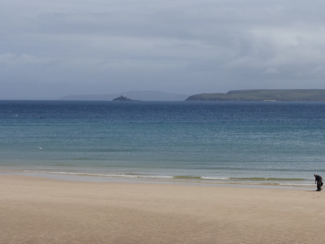
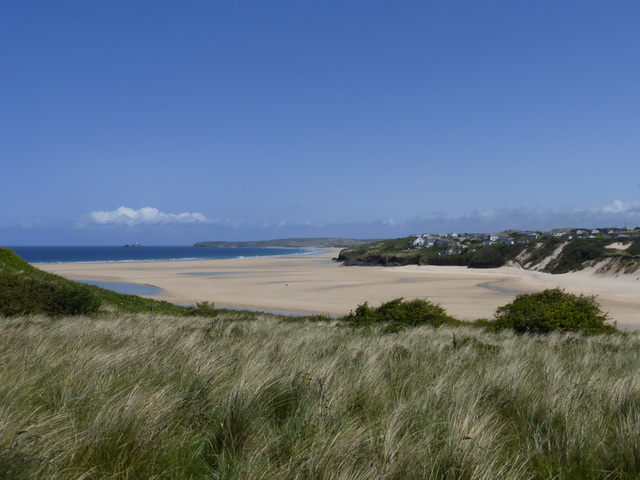
Whatever the cause, walking into St Ives can sometimes feel like walking into a painting. Quite apart from the bright sun and acres of golden sand, it is hard not to be impressed by St Ives, in or out of season.

The visitors – or tourists – ambling along the quayside, wondering how to ‘use’ the town now that they have arrived, wondering whether to give into the blandishments of the ‘boat trip to see the seals’. It is undoubtedly a tourist trap but thankfully only a few shops let the side down and hint at the slippery slope towards Newquay.

A visit to St Ia’s church was essential, a gentle smell of incense filling our nostrils as we made our way southwards towards Porthminster beach and Carbis Bay, Godrevy lighthouse beckoning us on.

P1030193The path here was a mix of dried mud and rough lane, thankfully relieved of any further tarmac, as we made our way through lush greenery. On one side we had a variety of ‘more exclusive houses’ bordering the sea, and the railway line, surely one of the most scenic short journeys in the country. The views were constantly amazing.

Passing Carbis Bay, the sands of Porth Kidney stretched out, seemingly continuous with Hayle Sands. Only a small blue line seemed to separate the two.

P1030196The St Michael’s Way joined us as we approached Lelant golf course where the managers had erected various bossy notices about their right to bombard us with random golf balls, warning us to keep firmly to the path as though this might protect us. The thought of the important St Uny church drawing us onwards.

There are moments when one wishes for some stepping stones or a small ferry. This was one of them for the next couple of miles were eminently forgettable. Lelant turned out to have some lovely granite C18 and C19 houses reflecting its former importance as a small port on this now-silted up estuary.

P1030218
Approaching Hayle

The tramp, for tramp it was, around the saltings was pretty uninspiring, tarmac, traffic and a decayed landscape contrasting to the views we had been experiencing so far. The nadir was the entrance into Hayle itself, along a clinker-covered path towards an ultra-modern supermarket replacing the former Harvey’s factory at the centre of the town.

Escaping Hayle, we started the long sandy path through the Towans, the distant view of St Uny cheering us and reminding us of the missing stepping stones.

P1030217
St Uny church

The Towans, a great expanse of grassy sand dunes, has been populated by holiday shacks of all sorts and sizes. Where these are unique they have a certain charm but sadly great estates of them have emerged which are less acceptable.

Signage is essential here and has been well done with standing stone monoliths indicating the way in a landscape which looks positively extra-terrestrial. We had plenty of time to speculate as to how Mexico or Upton Towans got their names.

P1030222Our only minor complaint was that the marked distances were distinctly Cornish. Initially signed as being 4 miles, it was still 4 miles about half an hour later and adding in the value on the reverse made the total distance around 5.5 miles. Maybe they were as lost as we were.

We did enjoy the wildlife, though. The flower species of the walk was undoubtedly valerian, available in its white, red and strong red versions. Above us birds sang and a kestrel went hunting, undisturbed by the distant kite-surfers.

By now Godrevy light appeared within reach, clear in the azure sea. We eventually emerged from this sand-waste to discover Gwithian car park from where it was an easy step, with the tide still out, onto the beach and along the strand to the NT car park.

We had covered a distance of about 12.5 miles – although the gps said it was further – in five hours of fairly steady walking and felt we needed a rest. We had also visited two churches: St Ives and St Uny and planned to pop into Gwithian on the way home. The memories of the blues – ‘improbably blue sea’ (Pevsner) – and golds of the day will stay with us for some time.