A lovely sunny bank holiday took us on a four mile walk around the Rough Tor area, expertly guided by iWalk Cornwall. Visiting three different stone circles, numerous hut circles, ring cairns and an early medieval cross on one walk was quite something.
Stannon stone circle
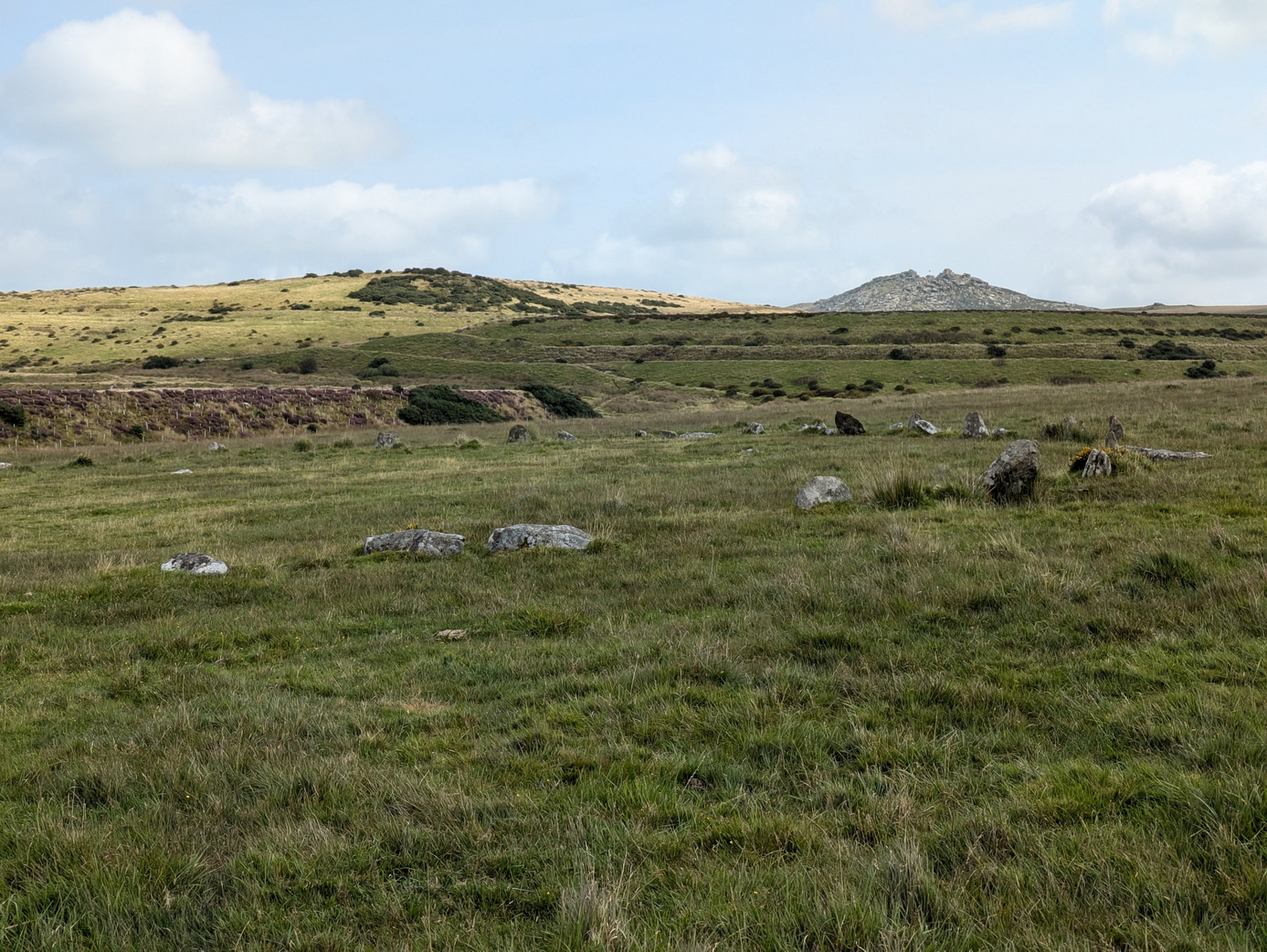
The first delight was Stannon stone circle which consists of 39 standing stones and about another 40 recumbent, according to Craig Weatherhill, out of a probable total of 82. There were various alignments with Rough Tor, Brown Willy and the gap between which we could not test on a sunny day.
The effect of its isolation is rather ruined by the large, obviously man-made hill alongside: the remains of former china clay mining which has resulted in the large Stannon reservoir.
On a bright Spring day at the end of April, we set off from Sancreed Beacon following an excellent route provided by iWalk Cornwall. This had it all: ancient monuments, a splendid church, a holy well, and a fogou (than which there is nothing better).
The route took us off to look at the end of the Drift reservoir before returning us to Sancreed itself, passing through some lovely green lanes, resplendent with bluebells, white leek and that soft green of spring, eventually emerging by Sancreed church.
Castle an Dinas seen from St Dennis church, with Goss Moor in the valley below
We have often driven down the A30, and wondered what is on the hill to the north of us, as we pass Goss Moor, haunted with memories of its horrendous traffic jams.
The answer is Castle an Dinas, one of the largest Iron Age hillforts in Cornwall. It is a superb site, with stunning views ranging from Rough Tor and Brown Willy in the east, Hensbarrow to the south, St Agnes beacon to the west, and glimpses of the sea to the north. This is one of the few places where the term ‘360 degree view’ is completely valid.
A brilliantly hot and sunny July day tempted us out to walk to Brown Willy and Rough Tor. We used the excellent iWalk Cornwall advice.
They promised us 5.2 miles of moderate-strenuous walking ‘marshy even in summer’. The ground was bone dry but we could certainly see that much of the ground could be marshy with frequent appearance of marsh grasses.
Rough Tor well
It was glorious. Starting from the end of Roughtor road by Charlotte Dymond’s memorial, one is literally tripping over ancient monuments the whole way up the slope to the top.
We headed for the main patch of reeds where some young horses were eating and drinking, and found the ‘holy well’. This was ‘discovered’ in 1970 and then lost again until 1994. One wonders how one loses a well and whether ‘discovered’ is similar to Speke’s ‘discovery’ of the source of the Nile: it was always there and known by local people.
The Piskie bath
For some reason the Wessex Division has decided to plant a memorial on top of Rough Tor. Our ancient ancestors would have understood the respect for the place but it seemed oddly incongruous and faintly invasive in such a landscape.
Our helpful notes did not mention that there was an excellent Piskie bath by the logan rock at the summit. This even has carefully crafted soap dishes.
Crossing to Showery Tor, we met a group of young lads who were doing their DoE Bronze Award, rather slowly, allowing time for the usual youthful banter. We encountered them again on top of Brown Willy where a cry went up ‘There’s a Pokemon up here’. ‘The government has spent £millions trying to get us to take exercise and all it needed was a fun app like this’, as one of them wisely remarked.
View towards Hensbarrow and the Alps
Another couple of walkers turned up thinking they were on Rough Tor, with no map or equipment, having arrived from Bolventor. Happy as anything, they set off for Rough Tor. It was just as well that it was not a ‘typical’ moorland day.
The views around us were magnificent, reaching as far as Hensbarrow, St Breock Down, Dartmoor and was that St Agnes Beacon we could espy?
From Brown Willy we re-crossed the bridge back to the foot of Rough Tor and made our way along the base of the tor towards the settlements, enjoying the remoteness of a small farmhouse with its own field system which must have been in occupation for many centuries.
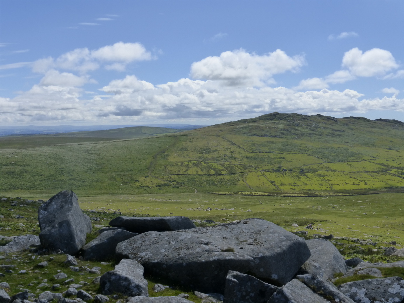
Fernacre stone circle towards Brown Willy
There was no discernible path here and we could imagine it being pretty boggy in winter.
Fernacre stone circle was a short step away and we paid it a visit. We counted 50 stones either erect or hidden in the grass and walked the obligatory circuit without any ill or beneficial affects.
The way back around the tor was once again littered with meaningful stones which deserve more careful and detailed study: small hut circles, curb stones and alignments. They are probably all Bronze Age.
It had taken us three hours and we had covered 6.4 miles according to our tracker. It had been more moderate than strenuous but that was on a lovely hot day when the ground was rock hard. Boggy or in Winter would be a different matter.
Bronze Age hut
Rough Tor well
Piskie bath
Towards Hensbarrow
Brown Willy
Fernacre stone circle and Rough Tor
Fernacre stone circle and Brown Willy
Charlotte Dymond’s memorial
A journey through the landscape and history of Cornwall