All posts by allgriffs

Bossiney to Crackington Haven

P1050725
Rocky Valley

Unlike the previous day, this proved to be very overcast: more grey cloud than the promised black cloud but with a biting east wind which kept us well-wrapped up when not walking.

We left Bossiney after a full breakfast which was designed to sustain us over a stretch that was known to be high, lonely and severe. People had asked us in cautious tones ‘have you done the Crackington stretch yet?’ Well, here we were.

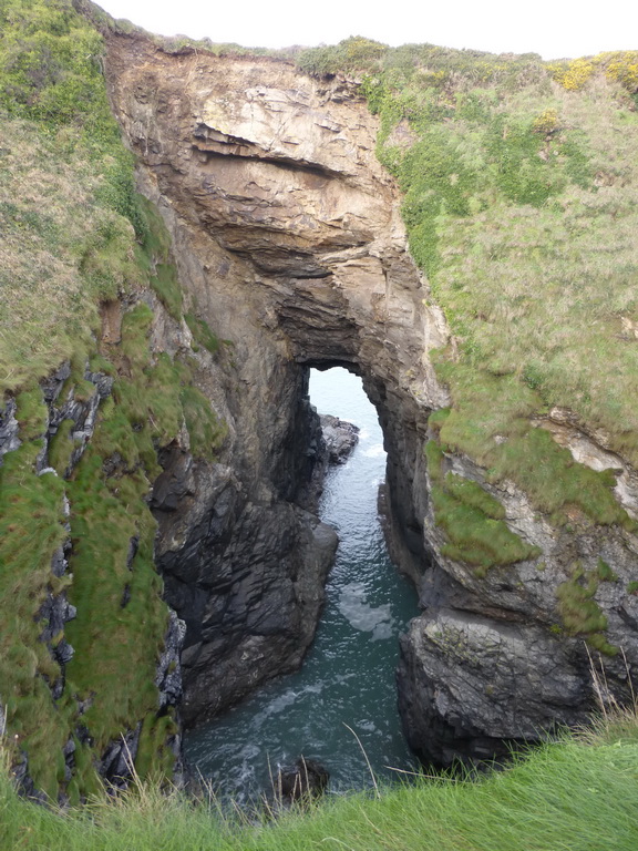
Rocky Valley was our first descent and it lived up to its name in the grey day with little green to relieve the textures. This was going to be a day of towering slate cliffs, the black-eyed caves sucking and blowing at the sea as the gentle rollers struck their base.

P1050727
Boscastle harbour with the blow-hole in operation

The going was relatively easy all the way to Boscastle with a white coastguard lookout beckoning us onwards. The water table had dropped sufficiently that the paths were not running streams and the patches of mud were not actually ankle-deep.

The Boscastle blow-hole was puffing its steam at the base of the cliff as the rollers ricocheted around the narrow twisting harbour.

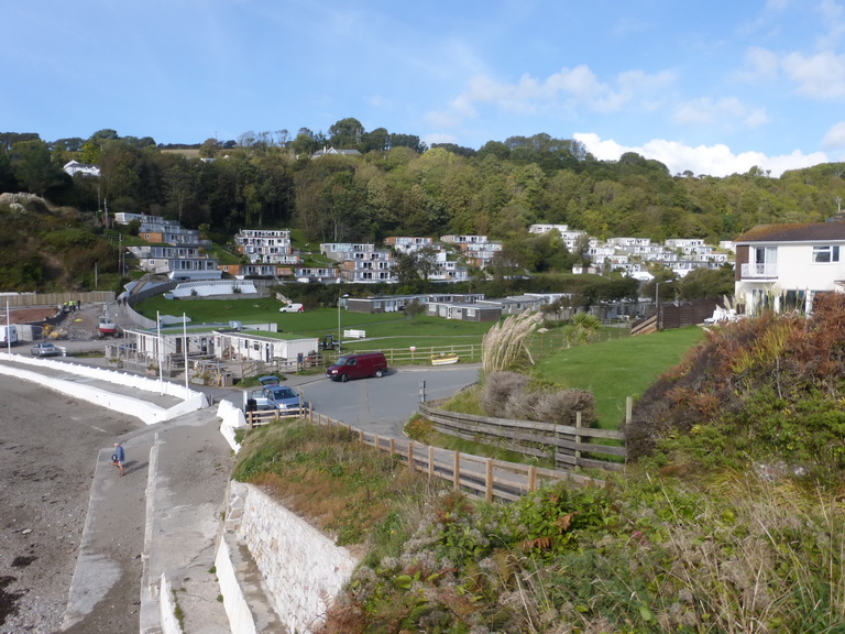
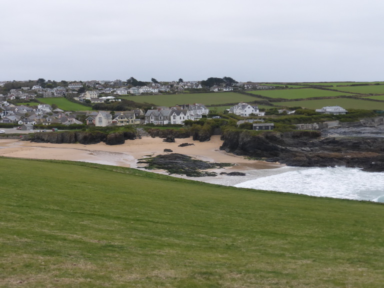
As we had found the night before, all signs of the great flood of 2004 seemed to have disappeared and the haven was as charming and well-kempt as any other Cornish fishing village. The main village is tucked higher up, on a north-facing slope.

P1050733
The descent to Pentargon

Walking onwards, we came to the first of the ‘challenging’ sections which was thankfully a steep descent and gentle ascent at Pentargon. Passing walkers said that we were definitely going the ‘wrong way’ today. We felt that we had been going the ‘right way’ the day before as the descents had been steep and the ascents largely gentle, much as we found at Pentargon.

Beeny cliff was the next objective and it soon corrected any optimism we might have had. The ascent to fire beacon point was up steep steps to what turned out to be a false summit with yet more twisting, turning and climbing in store. Lung-bursting indeed and time for a cup of coffee.

Beeny cliff is famous in poetry and we had brought a copy so that a recitation could take place.

P1050741O the opal and the sapphire of that wandering western sea,
And the woman riding high above with bright hair flapping free –
The woman whom I loved so, and who loyally loved me.

The pale mews plained below us, and the waves seemed far away
In a nether sky, engrossed in saying their ceaseless babbling say,
As we laughed light-heartedly aloft on that clear-sunned March day.

A little cloud then cloaked us, and there flew an irised rain,
And the Atlantic dyed its levels with a dull misfeatured stain,
And then the sun burst out again, and purples prinked the main.

Still in all its chasmal beauty bulks old Beeny to the sky,
And shall she and I not go there once again now March is nigh,
And the sweet things said in that March say anew there by and by?

What if still in chasmal beauty looms that wild weird western shore,
The woman now is – elsewhere – whom the ambling pony bore,
And nor knows nor cares for Beeny, and will laugh there nevermore.

Thomas Hardy at his best, remembering his dead, estranged wife, Emma whom he first met at neighbouring St Juliot church where she was the Rector’s daughter. And it was March.

P1050745
Looking south west from High Cliff

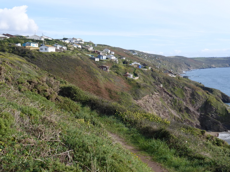
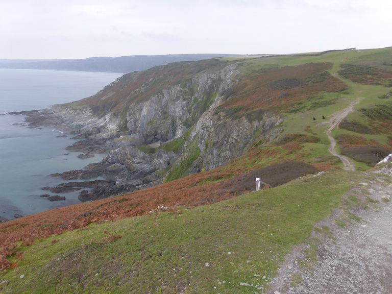
We knew there was more in store: not only did people tell us but we could see High Cliff in front of us, aptly named as it is the highest in Cornwall. What we did not expect was that the path would drop us down some way to make sure that we experienced the full delight of the climb. Step after torturous step took us up, and up until we emerged on the grassy top, definitely in need of a lie-down but constrained by the cold wind.

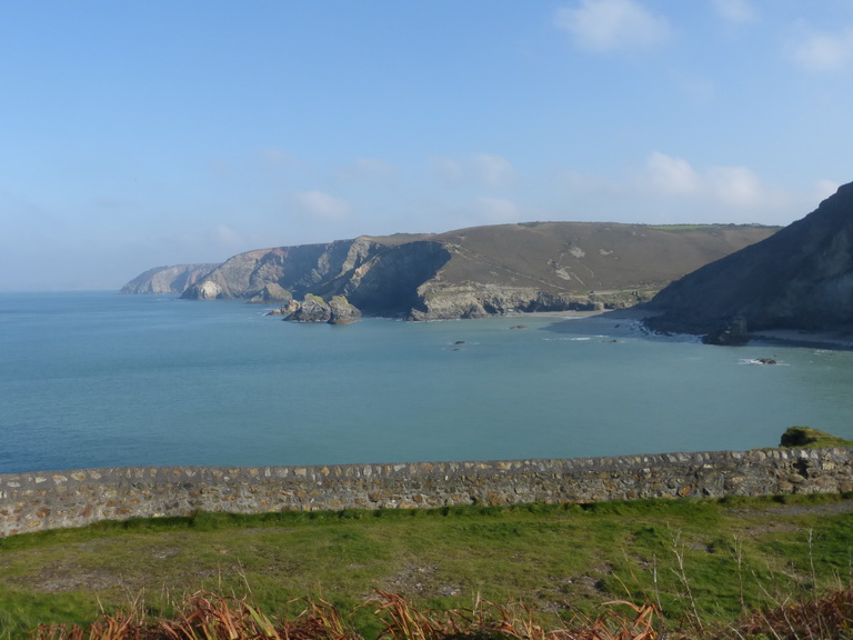
The views from its peak were spectacular stretching from Trevose Head, via Pentire and Tintagel, the whole flanked by the three major rocks which had been offshore: Meachard off Boscastle, Short Island and the Sisters off Tintagel. Ahead of us we could see beyond Cambeak to Hartland Point. On the hazy horizon, the bulk of Lundy was just discernible.

P1050743
Cambeak dragon: can you spot his eye and mouth behind his dodo nose?

Below us, the cliff tumbled down, dark and impressive, to the sea far below. These were not the vertical cliffs of Port Isaac, nor the gorse-laden cliffs of Zennor. No sandy beach fringed their feet, just rough black and grey stones.

We could not linger and headed onwards, leaving our copy of the poem to some passing friends, enjoining them to pass it on again in an endless chain that it may be enjoyed on Beeny cliff for generations.

The path to Cambeak seemed straightforward after this and we felt that we were within easy reach of our goal. ‘Beware of goats’ said the guidebook and they were right for one small dip contained some black-coated goats with wonderful horns.

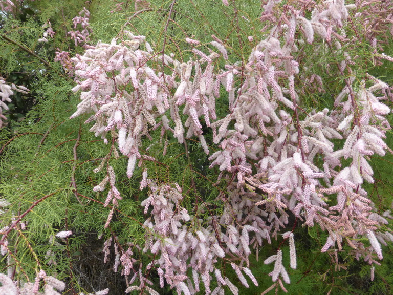
We had been struck by the lack of colour in the landscape, partially because of the grey day but the green of the fields and the yellow of the gorse were the only relieving colours to the mix of blacks and browns. No green shoots yet covered the blackthorn or sprouted from the bracken. In one sheltered corner, the primroses were bold enough to emerge.

P1050754
Lunch in the ‘warm spring weather’: we would not have had it a degree warmer

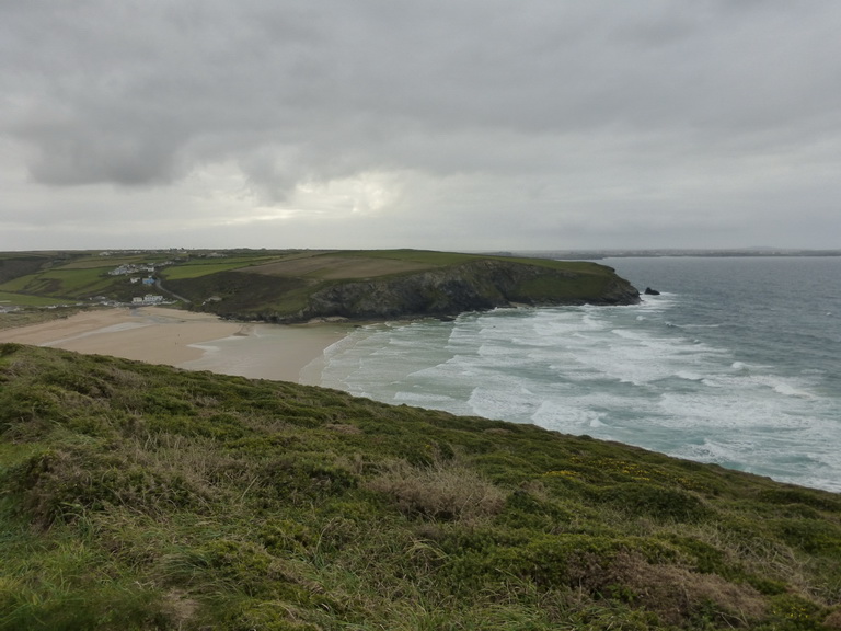
Rounding Cambeak and patting the head of the dragon, we dropped down into Crackington Haven and a welcoming hot cup of coffee and late lunch. We were joined by a very bold grey wagtail who must have felt that sandwiches were easier pickings than anything to be found in the stream.

We had covered about 9.7 miles in 4.25 hours and gained 1478ft. More importantly, we felt that we had laid the ghost of ‘Crackington Haven’ and could tackle ‘severe’ and survive to tell the tale. The end was literally in sight.

As light relief on the way home, we visited St Gennys and Forrabury (Boscastle) churches. A headstone in Forrabury seemed apt: You will find me on the cliffs and moors, on the rocks and on the mountains. Thank you Ron Hart d. 2008.

Port Isaac to Bossiney

P1050694
Only the lonely sea and sky for company

It has been a long winter of storms, rain and wind when conditions have been far from ideal for walking the coast path. Eventually a high pressure settled over the country, the sun came out and the earth began to dry. We leaped at the chance to blow the dust off our walking boots and head out into the open air.

We left off at Port Isaac, having walked from Rock. Ahead of us was the last stretch to the Cornish border, known to be wildest, loneliest and steepest section of the path.

It was a bright day. There had been a frost on the ground as we left home but it soon cleared and by the time we reached the north coast the sun was shining strongly with little breeze. It did not take us long to remove our fleeces.

P1050690
Back on the trail

Passing through Port Gaverne, we headed up to the cliff tops admiring the blue-green sea unsure what to expect as the books warned us that the section was to be ‘severe’, their most extreme category.

It was good to be back in the open and we were soon greeted by a little stonechat, as tame as a garden robin and about as perky, checking what we were doing approaching his tangled web of bare blackthorn and gorse.

There were some steep ascents and descents but we decided that the we had chosen the best direction for the descents were definitely the steeper. A couple of the ascents did not have steps but were more scrambles on slatey shale, requiring a good grip. Our device recorded about five valleys with some being little problem.

Bare, lonely valleys stretched inland, devoid of houses or animals. Along the relatively smooth shelf of Tregardock cliff we were reminded of the cliffs near Zennor. Inland of us lay acres of green fields with scattered farmsteads whose sites must have been in use for generations. These were backed by a gently rising escarpment.

P1050697
The steps down to Trebarwith Strand

After a long level stretch, we climbed out of Backways cove and found ourselves at the top of a flight of steps down into the interestingly-named Trebarwith Strand. There had been no beaches worthy of the name since we had started, certainly no sand. Despite its name, Trebarwith had no beach either, consisting of a rocky ledge with an attractive stream running between smooth slate walls.

This was the beginning of the slate-mining area and the final stretch into Tintagel was peppered with quarries, tips and the evidence of former extraction activities.

P1050717
Tintagel castle

In no time we were passing Tintagel church, perched on its wind-swept hilltop, and descending to the bulk of the headland, surely the best defended headland site of a promintory fort on this coast with its narrow neck of land connecting  the island to the mainland.

It was too early in the season for the island to be open and so we surveyed the castle ruins on the mainland, completely missing the ‘controversial’ sculpture of Merlin on the cliff face which featured on the local news later that evening, and headed onwards.

The site of the Camelot Hotel was another reminder of the way in which Tintagel has been developed for and by tourism over the years. The village of Tintagel is replete with references to the Arthurian legends, matched only by Rochester, with its Dickensian connections. ‘Arthur’s Garage’ vies with ‘Miss Havisham’s Bridal Gowns’.

Feeling fit, we walked onwards towards Bossiney Haven where we ended the day’s walk. We had covered 9.8 miles according to the map, in 4.5 hours. The height gain had been 1651 hard-earned ft.

We spent the night in Boscastle where we walked around the village which was so devastated, and made famous, by the flood in 2004. All seems to have returned to normal except all our electronic devices which seemed to have wills of their own, perhaps thanks to the presence of the Museum of Witchcraft and Magic.


Rock to Port Isaac

P1050120
The Camel estuary

Storms Abigail and Barney had passed through leaving some lovely late November weather, warm and still. We grabbed the opportunity to complete one last long stretch of the Coast Path before the end of the year, picking up where we had left off at the Camel estuary.

This time we were on the eastern side which meant starting with the delights of Rock and Polzeath. We were promised a walk which would start ‘easy’ and end ‘strenuous’.

St Enodoc 04
St Enodoc church

Almost immediately after leaving the ferry, we detoured around Brea hill to see St Enodoc church and to pay our respects to Sir John Betjeman. The little church which was almost literally dug out of the sand in the C19 was delightful, circled around by a sheltering hedge of tamarisk, its little spire sharp against the bright blue sky.

The church is set in the middle of a golf course which, even by golf course standards, was crisply prepared and empty of golfers. We suffered the usual warnings of golf balls driving to left of us, to right of us and ahead but with little indication of what we should do as a result.

P1050138The avid notice-writers really struggled with one word however, mangling their grammar to avoid any mention of the c*,  s* words: or even ‘poo’. Dog owners were warned to ‘clear up after their dogs and remove it to be disposed of’ (sic). How wonderfully British. It is ‘it’ you know, … ‘it’.

The same person had obviously been at work in Polzeath where it seemed the dog itself was to be removed.

Having rocked on a rock in Rock – see previous postings – we made our way past the white houses of Polzeath, each set in its dull garden staring northwards towards the sea. They did look very cared for with extra signs, railings and trim new paths, rather as though some minister or other was likely to be coming on holiday there. They were clearly doing more for less.

P1050148
Looking back towards the Rumps

Eventually we started to leave buildings behind us. Looking back the sight of Stepper Point, Gulland Rock and Trevose Head reminded us from where we had come. The air was still, the sea flat and a delicate winter shade of greeny-blue.

Rounding Pentire point, we were at last out of sight of habitation and alone on a lovely meandering path set on a ledge above a long golden slope to the sea. The bracken had died back and carpeted the cliffs in the golden colours of autumn.

P1050145
The Rumps from Binyon’s plaque

The dominating sight of the Rumps, Iron Age fort, soon came into view and it was here that we stumbled on the small plaque to Laurence Binyon who composed his famous poem while wandering these cliffs. The trenches of WWI felt a very long way away from such still beauty.

They shall grow not old, as we that are left grow old:
Age shall not weary them, nor the years condemn.
At the going down of the sun and in the morning
We will remember them.

P1050146
The dragon of the Rumps

The profile of the Rumps set off other thoughts for it was clear that the fort was not only protected by a series of ramparts but also one of the best Cornish dragons that we have yet seen, a rival for Cudden Point. A series of pointed spines ran up his back, his nose just showing above the water level.

It is good to know that Cornwall is so stoutly defended, the dragons’ noses, waiting lest a hostile invader should attempt to approach the Duchy at which point they will no doubt rise, roaring and breathing fire once again.

P1050150
Lundy hole

When others are burning effigies of C16 Catholics on their bonfires, or setting off beacons, we plan to arrange a series of burning barrels so that the smoke can once again emerge from these dragons’ nostrils. They can live again.

We debated why Iron Age forts were needed and could only come back to testosterone-fuelled avarice and desire for power.

This was a glorious section of cliff: tall and remote with easy going, a series of small rocky coves and signs of natural arches and caves below us. One of these was the strangely-named Lundy Cove with the enormous Lundy hole collapsed cave where the water swilled gently over the rock platform.

As always, we were grateful for the lack of fussy notices telling us to keep back from the edge. It will happen one day. Polzeath will take over.

P1050157
Port Quin

Before long, Port Quin came into view, the shape of the Droyden castle folly emerging above the hill. Built as a banqueting house in the C19, this was a businessman’s conceit, now passed across to the NT as a holiday home.

Below was the wide and calm inlet of Port Quin with its pilchard cellars at the end. It looked like a wonderfully sheltered natural harbour but for a dangerous-looking rock at its entrance.

P1050156
Pilchard bar holes

The cellars had also been converted to holiday homes but the remnants of the pilchard activity could still be seen. A series of brick-protected openings were visible. These would have held the fixed ends of the compression bars used to press pilchards in their barrels.

These are probably the best examples to be seen anywhere in Cornwall.

One night the fishermen of Port Quin went out to sea. None returned. Binyon’s lines could as easily refer to them.

P1050160We were expecting the going to get tougher from here onwards – rising to ‘strenuous’ – and it did. A series of seemingly unnecessary steps along reedy cliff took us up and around: lung-bursting but not terminal.

The descent into Pine Haven was a long staircase but thankfully we were tackling it in the right direction with nothing but a long slope up the other side to Lobber point. The reverse would indeed have been ‘strenuous’.

Port Isaac emerged as we breasted the hill, and we prepared ourselves of Doc Martin spotting: each building scoring one point. It was an easy game but we had forgotten about the Fishermen’s Friends for every workman in the village seemed to be singing.

P1050162
Port Isaac

It is another lovely fishing village and natural harbour, helped by a stout breakwater which must keep out the worst of the northerly gales.

Eventually, we reached our parked car. We had walked about 12 miles in 4.5 hours.

The familiar shape of Tintagel had been haunting us for some time, its square headland hotel destroying the natural outlines. This would be our next destination but it would have to wait for the new year.  For now, our long distance boots are being hung up to dry.

Long walks in the short winter days are too risky but you never know: Cornwall can always surprise one with a burst of wonderful winter weather.


Trevaunance Cove and St Agnes Head

P1050061
Trevaunance Cove

Warnings of rain sent us out for a short walk to fill in one of the two little gaps in itinerary. This one involved a section of about half a mile crossing Trevaunance Cove (St Agnes) but as it was a lovely day with soft November sunshine and a calm sea, we decided to extend it to St Agnes Head (and back).

Parking at the bottom of Cross Coombe, a small sandy beach to the east of Trevaunance, close to the Blue Hills mine workings, we set off westward.

P1050069
Heather and spoil heaps: a typical north coast scene

The remnants of mining were very evident all around us: spoil heaps, capped shafts, chimneys and mysterious overgrown walls.

Trevaunance Cove is dominated by the stacks where the small harbour used to lie on the westward side, nothing but rubble remaining. On the cliff above the smarter-than-usual houses and a prepared road hinted at the former use of the area. granite steps up the hillside suggest a re-use of old materials.

Today surfers enjoy the gently rolling waves and such industry is in the past.

P1050066
St Agnes Head

The going was easy along a heather-girt path, past spoil heaps until we reached Newdowns Head where the natural landscape took over. The strong blues of the sky and sea had gone to be replaced by gentle watery colours that softened the landscape, the distant cliffs which we had already walked, gently fading into the mist.

St Agnes Head, with its NCI watch station, was a good coffee stop where we could admire a tiny shrine of assorted plastic fairies, flowerpots, flowers and lights.

P1050064
Stonechat

The light was sharper on our return and we were pleased to be joined by a little stonechat. These little fellows seem to enjoy any high spot as they survey the clifftops and, like the robin to the gardener, have a cheeky curiosity about passing walkers.

We wondered whether this was the same little fellow we had seen on the Beacon and many other stretches of the coast, keeping an eye on our progress and tweeting the occasional encouraging message.

P1050063
Towards Cross Coombe

We were soon back at Trevaunance and over the top to Cross Coombe, a distance of about 4.5 miles in total.

It had been good to stretch our legs and fill in one of the missing links on such a lovely day. The other stretch is much shorter at a mere half mile but it must be done.

Mawgan Porth to Padstow

151024 Mawgan Porth to Padstow 03
Mawgan Porth

Having reached Cremyll ferry on the south coast, we returned to our exploration of the north coast, picking up where we left off at Mawgan Porth.

It was an overcast and blustery day. Gone were the azure blue seas and bright blue sky we had experienced last time we were here. In had come the mean seas of October.

We made a good start and left Mawgan Porth by walking across the sandy beach, marvelling at the shallowness of the beach, even with the tide out, the rollers breaking well out to sea. The Scarlet’s gardener was adjusting the planting and encouraging each plant to stand to attention.

151024 Mawgan Porth to Padstow 06
Bedruthan Steps

It was wonderful to be back on the north coast, though. The high cliffs, sheep-cropped soft grass and the towering cliffs were a contrast to the softness and density of population of the landscape of the Rame peninsular.

Any view over the edge of the cliff produced feelings of vertigo and were conducted by crawling on tummies to peer down at inaccessible sandy coves.

The gorse and blackthorn lay low on the ground and in places we passed great meadows of heather which must be a wonderful sight in the spring.

Bedruthan Steps are justly famous, having been a convenient charabanc distance from Newquay. The giant would have been proud of his legacy. As the surf and sand pounded against the columns, we wondered that they still managed to survive and had not been ground down by time.

151024 Mawgan Porth to Padstow 11
Across Porthcothan to the Trescore islands

Below us, a series of steep-sided coves rumbled to the road of the breaking waves and we spotted the first of many natural arches.

Around Park Head, we approached the Trescore islands -which tempted us to wonder again what makes them an island rather than a rock – which formed a tranquil  pool in an otherwise fractious sea.

It is a surprise that no one ever attempted to close up the gaps to make a small natural harbour.

151024 Mawgan Porth to Padstow 13Porthcothan, a long thin beach, was disappointing in not being able to provide coffee and so we made our way onwards passed a series of maelstroms, one of which was throwing spume up high and covering the neighbouring cliffs with white blossom like a field of dandelion clocks. The entire cliff face was plastered with ‘shaving foam’.

A welcome break in a YHA cafe in Treyarnon – highly recommended – provided the necessary coffee before we descended into the touristic area around Trevose Head, our eyes looking seaward to avoid seeing the golf course.

151024 Mawgan Porth to Padstow 17
Looking westward from Dinas Head past Booby’s and Constantine bays to Treyarnon

Constantine Bay provided some enjoyable sand-dune crossing but we were soon back climbing the grassy slopes to the head. Here we met our first enormous, almost circular, sink hole. It does not do to wonder too hard whether the rock beneath one’s feet is as friable as the rock in the sink hole must have been to have been worn away from underneath.

A brief detour to Dinas Head was essential and we noted the Coastguard pole, set here no doubt, for training in breeches buoys and similar rescues, the pole standing in for the truncated mast of a ship.

151024 Mawgan Porth to Padstow 20Rounding Trevose Head, a whole new vista opened up, stretching far to the north, a view that would no doubt become familiar as we made our way towards far-distant Devon.

But close at hand was another less welcome vista: a quite ghastly mobile home camp right up close to the path at the back of Mother Ivy’s Bay. Why, we wondered, did the units have to be so close together; so close to the edge; so white when they could have been brown or green to blend into the landscape as we had seen at shack-land on the south coast near Freathy? What might have been a charming view was ruined by the proximity and massing of the camp.

151024 Mawgan Porth to Padstow 22
Harlyn bay and Cataclews point

Quite suddenly, the sun came out and great shafts of light shone like a powerful searchlight on sections of cliff and the sea. The familiar colours were back: a blue-green sea and watery blue sky.

We stopped to admire the tamarisk which was in flower – a lovely soft pinky purple –  and to watch two kestrels hovering effortlessly in the strong wind just above our heads.

151024 Mawgan Porth to Padstow 14
Tamarisk in flower

The going had been sufficiently easy that we were considering revising our plan and to walk the extra distance to Padstow but, as we walked, we spied our hosts for the night and diverted with them to the generous comfort of Trevone for some rest and recuperation.

We had covered 12 miles in almost exactly four hours of easy going.

Part II

151024 Mawgan Porth to Padstow 27
Trevone

We picked up where we had left off the following morning, walking out of Trevone and once more up onto the high cliffs, passing another sink hole called, like its predecessor, by the simple and descriptive name ‘the round hole’. It was overcast.

Once again, the cliffs were high, solid and sheer. Below us the waves pounded against the cliffs making the ground we walked on feel as though it was shaking from their power.

151024 Mawgan Porth to Padstow 29
Above Butter Hole

Rising to Stepper Point, we passed a herd of bullocks, one of whom seemed to be contemplating a swift exit as he peered over the edge to a sheer drop of several hundred feet to the base of Butter Hole.

As we passed the point, the view over the broad Camel estuary opened on our right, the waves breaking far across the inland bay.

It was a little way from the mouth of the Camel to Padstow itself for the town is hidden behind yet another small headland: St Saviour’s Point which bristles with hidden fortifications which have been re-captured by nature.

151024 Mawgan Porth to Padstow 31
The Camel estuary from Stepper Point

Across the river, the dunes of Rock, St Enodoc and Polzeath beckoned us onwards but they were for another day.

We entered Padstow through the Chapel Style Fields, counting over 60 benches in a single long row, each named for some dear departed. It was hard not to agree that the view is well worth stopping and admiring but there was something depressingly municipal in the arrangement.

We headed for the church and a welcoming cup of coffee with friends. We had walked 5.2 easy miles in just under two hours. This is a lovely and classic stretch of north coast (except for the holiday park).

The rest of the day was given over to visiting other churches: St Merryn, St Ervan, St Eval and St Enoder.

Trenethick Barton, another church and some crosses

Trenethick 01
Trenethick Barton

A few hours to kill in Helston led us to walk to Wendron to study the church and its crosses.

A delight on the way was the discovery of Trenethick Barton, a fine C16 squire’s house with ‘an unforgettable two-storey gatehouse’ (Pevsner). The tall walls prevent one seeing much of the house.

Pevsner decribes it as ‘an exceedingly attractive ensemble of medieval house, gatehouse and courtyard walls, one of the best in Cornwall.’ This sounds pretty credible.

Trenethick 02
Trenethick Barton – the gatehouse

It would not be surprising to see the Warleggans or Poldarks leaving on horseback.

Freathy to Cremyll ferry

151010 Freathy to Cremyll 02Being a two day walk, we stayed in the area. This allowed us to make an early start which was lovely. The cool morning mist was still clearing, the sun breaking through the clouds and the clear early morning area filled our lungs as we set off from Freathy on our last leg of the south Cornish coast.

Trying to get a meal in a pub the night before we had been turned away from several pubs because ‘the wedding’. We never did discover whose but it was good to know that business was still brisk in October.

151010 Freathy to Cremyll 03The shack-land continued as we walked along the cliff beyond Freathy, the military road our constant companion, following the contours.  The open-air nature of these, with their little patch of green seemed so much more appealing and genuinely ‘green’ than the rows of houses at Looe, Millendreath, or Downderry. It was as though the planners were refusing brick and stone; well done them.

151010 Freathy to Cremyll 07In the distance loomed Rame Head and, tucked underneath it Polhawn Fort, scene of the big wedding. In no time, we were crossing the Iron Age ramparts and climbing the slopes up to the little chapel of St Michael on the headland. Here, the remains of a very exposed WWII anti-aircraft battery sat alongside a possibly Norman chapel within an Iron Age fort.

In the distance, the shadowy shape of another place – we think it must be Devon – stretched into the distance. Somewhere out there were Start and Prawle points, scenes of childhood memories for some.

151010 Freathy to Cremyll 11Shortly after the Head, we turned inland for a brief detour to admire lonely Rame church with its little spire and restrained woodwork.

Onwards, around Penlee point and the twin villages of Cawsand/Kingsand hove into view. Cawsand is dominated by the mighty bulk of a former fort, now converted to flats, which hovers like a spaceship over the tiny harbour.

151010 Freathy to Cremyll 15On the harbourside we admired the institute building, a smaller twin of that at Porthleven, which was almost undermined in the great storms of February 2014. From here it was a step to the former boundary (until 1844) between Cornwall and Devon at Devon-Corn house.

By now, we were all too aware that the colour of the geology had changed again. The familiar red sandstone of Devon was everywhere and  it was understandable why Devon once thought that this areas should be theirs. Despite the close-packed houses and narrow lanes, this no longer felt like Cornwall and the view of bits of the city in the distance hinted at the real loyalties of the area.

151010 Freathy to Cremyll 27An easy walk along low cliffs brought us to the last large fort at Picklecombe, which has been converted into flats and apartments in a way which betrays its original shape and feel.

Around the corner was the first sight of the city across the water as we entered the enormous Mount Edgcumbe park. The contrast between the close-packed houses, tower blocks and defences of Plymouth and the rural nature of the landscape through which we were passing, was very marked.

151010 Freathy to Cremyll 29We passed a succession of small ruins and follies and made another brief detour around the back of the less-than attractive red stone house before descending though incongruous and distinctly un-Cornish formal gardens.

From here it was a step out of the park to the Cremyll ferry where we rewarded ourselves with some lunch and well-deserved refreshment at the Edgcumbe Arms. We had walked about 9.5 miles in 3.75 hours of easy walking.

151010 Freathy to Cremyll 35And so we had reached the end of the beginning, or was it the beginning of the end? We had completed the south coast of Cornwall – but for one tiny bit of about 500m which remained on our consciences. Our attention will now turn once more to the unwalked sections of north coast which is said to be rather more in the ‘challenging’ category.

Looe to Freathy

151009 Looe 01
Looe from the east

Another series of social engagements and guests prevented us from making the most of some lovely September weather but we managed to get out for two consecutive days to complete the south coast.

We had left off our story looking at a loo in Looe and this is where we re-started our journey. It was October and we were not expecting scalding heat, a suntan or azure blue seas.

We had not altogether  taken to West Looe which appeared to straggle with little character. East Looe had a heart clustered around some narrow streets worthy of Mevagissey or Mousehole.

151009 Looe 05
Millendreath holiday village

Once we found our way out of town, we followed another straggly ribbon of houses along the cliff to Millendreath. This small beach was not an architectural gem having been colonised by a soulless holiday village of cheap houses.

A diversion – an unsafe cliff – took us through a narrow shelter belt of trees cunningly disguised to be woodland path and a short bit of road before we were once more on the cliff top, passing the monkey sanctuary.

151009 Looe 04
Looe island from Millendreath

The vegetation had changed since we had last walked. Now the dry brown leaves of oak, sycamore and beech were beneath our feet. The blackberries which had not been eaten by passing walkers, were coming to an end. The sloes were ripe on the bare wood of the blackthorn. Near houses, Michaelmas daisies were in full flower but the hydrangeas were coming to an end.

There was a distinct feeling that autumn was approaching. A weak sun shone all day: perfect conditions for walking.

151009 Looe 13
Rame Head

The sweep of Whitsand Bay to Rame Head would be our companion all day. It was one of those walks where you can see your start and finish points throughout the day. The underlying rock was slate which had created black and grey beaches rather than the golden sand we expected.

Our next stop was Seaton where we took the opportunity to sit on a seat and have our late morning coffee. Like Millendreath, it was not going to win many prizes for architecture.

151009 Looe 16
Portwrinkle

A long and glorious stretch took us to Portwrinkle. We had heard that it did not live up to its charming name but we found otherwise. The houses clustered around the tiny harbour seemed thoroughly traditional and well-cared for and good enough to excuse the straggle beyond. The hotel and golf course … well, there has to be a hotel somewhere.

Cresting a rise, we had our first view of distant Plymouth, a complete contrast to the rural landscape through which we were walking.

Before long we were being warned that we were entering a danger area. Approaching the Rame peninsular proper, one is constantly reminded how this area has been in the vanguard of defending Plymouth with a string of fortifications, batteries and forts from Palmerston’s time (1850s and 1860s) to World War II.

151009 Looe 21
Tregantle fort

The first and largest of these on this walk would be Tregantle. The cliff edge below this has been converted into a series of firing ranges. Thankfully, we were able to walk in front of the fort for there was to be no firing today.

Only a few mysterious and very much C21 semi-camouflaged objects suggested that this was a military site. They were gone by the following day.

151009 Looe 23
Freathy

It was only a step from here to our car, parked free at Freathy despite Cornwall Council’s conviction that we might want to spend vast sums in their car park.

Here there was a complete contrast to the straggle of Looe: a series of sheds or shacks clung to the cliffside at the top of a steep cliff, with some gentle waves breaking on golden beach below.

There was something simple and appropriate about these shacks which were almost universally in wood or look-alike wood. They felt like holiday cottages should, where life could be lived inside and outside with gorse and bracken as the garden wall.

We had walked 11 miles in 4.5 hours and felt good. Described as ‘strenuous, moderate in places’ in the guide we had felt it nearer ‘moderate’.

We headed off to find some churches: Hessenford and St Martin by Looe.