Another rain-free day took us out for the next leg of the Copper Trail. When I say rain-free, this does not mean that it did not rain heavily the day before, a fact that worried us as the guidebook was full of helpful remarks such as ‘after heavy rain it may provide you with a wet foot‘, ‘… this takes you into a very muddy field …’ We had a sweepstake on how soon we would have a boot full of water.
We set out on a cold dry, windy January day with the objective of shaking off the effects of Christmas and to find some fresh air after a series of heavy storms and gales had passed through. It was sunny and cold with a stiffish wind blowing.
This stretch of the Copper Trail took us on a wide sweep westwards from Callywith, close to Bodmin, to meet the upper reaches of the Camel Trail before breaking away to head back up to the moor ending at St Breward.
Leaving the road near Racecourse Farm, we followed a series of tracks towards Copshorn. The mud was thick in places and we were grateful for the sharp frost which had stiffened the surface of the surrounding grass.
The trail often passed small settlements at the bottom of valleys, close to bridges. The first of these was at Clerkenwater where there used to be a woollen mill. A charming Old Laundry Cottage gave a hint of its original purpose.
The Camel Trail ensured there was always light at the end of the tunnel
At Copshorn, on the hill above, we encountered a large solar farm which was not mentioned in the guidebook and the paths had been altered. From here, the path descended by forestry roads through a wood where, after a momentary hesitation, we managed to join up with the Camel Trail.
The Trail was one of the two highlights of this walk. This section of the familiar was much less busy than the Padstow to Bodmin section and followed the Camel river at a slight distance, through some lovely woodland. We were glad to be out of the wind and walking on firm level ground for about 4 miles, passing Hellandbridge and eventually reaching Tresarrett.
We saw only a few cyclists, runners and walkers as we chuffed our way along the old railway track. Despite one’s childhood dreams, a career driving a steam train must have been a relatively repetitive process with cold mornings, rain, and constant smoke and coal dust. Yet some lines must have been a joy and this is surely one of them, watching the changing seasons in the trees and river as the line winds upwards between the outpost of Wenford and the busy metropolis of Bodmin.
The granite bridge which only crosses part of the river
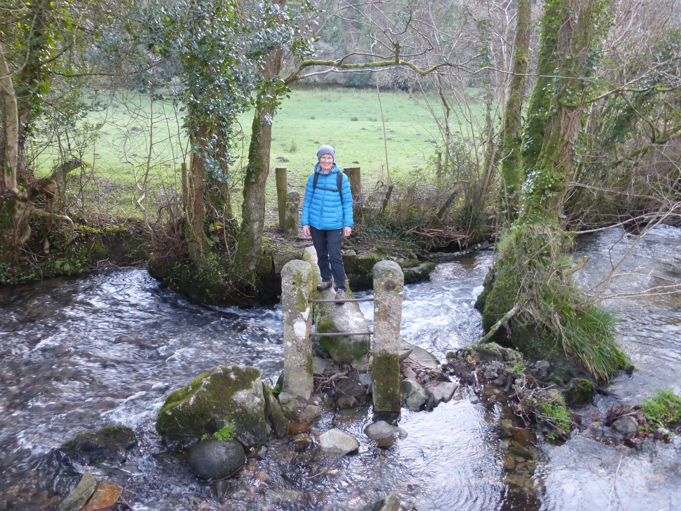
From a road junction at Tresarrett a short uphill section led to some more muddy tracks which dropped down into another valley, across a narrow granite bridge, and up a steep slope emerging right beside the lovely Blisland church. Here we settled down to a lunch which included some warming and welcome soup.
Tearing ourselves away from the delights of the village green, we headed north through Pendrift.
Our next objective was the area around the de Lank quarries, the second highlight of the walk. The evidence of the quarry’s work had been very evident as all the houses and cottages we had seen had been built of solid granite.
Pendrift moor. Spot the ‘solitary hawthorn tree’
We soon found ourselves back on waterlogged and very muddy ground, especially as we emerged onto the wide-open spaces of Pendrift Downs.
Somewhere here, amongst the dead and brown bracken, we were told to turn off at a ‘solitary hawthorn tree’. It is a mistake to use trees as waypoints, certainly in an area which was covered in hawthorns. We chose one and found something of a path which led in much the right direction and continued, hopping from tussock to tussock. ‘In winter this path can get wet underfoot’ said the guidebook. I should say it can.
The de Lank river
It was worth the effort however as we soon found ourselves crossing the de Lank river which gushed and tumbled over the boulders, heading for Wenford. The guidebook likens this to the Golitha falls.
Crossing the old quarry road, the path went through the muddiest possible field inhabited by some cold-looking cows. Thankfully, the hard surface was not far below the surface but our boots were now thoroughly caked with the resulting mud (as were some socks).
Eventually, we emerged on a road and were able to follow a path into the beginnings of the long string of hamlets that makes up St Breward. A final muddy path past the school and we had reached our destination: the Old Inn next to St Breward church.
The temperature was beginning to drop and we were pleased to be able to visit the church.
We had covered 10 miles (according to the guide), 11 miles (according to the map) or 15 miles according to our gps, in 5 hours. The heating in the car was very welcome.
It was good to get out and stretch our legs
The Camel Trail
The Camel Trail
Hellandbridge
A granite cottage
The Camel at Tresarrett
A granite signpost
The granite bridge
Pendrift moor
The solitary hawthorn?
The de Lank river
A journey through the landscape and history of Cornwall